

UPDATE: High surf advisory extended until Thursday morning for eastern shorelines of Big Island
Update at 4:47 p.m. Feb. 11, 2026: Strong trade winds continue to produce high surf for east-facing shores of the Big Island, extending the high surf advisory until 6 a.m. on Thursday, Feb. 12.
Winds will be on the decrease tonight with surf heights falling below advisory levels by Thursday. Advisory level surf will likely return over the weekend as trades restrengthen, according to the National Weather Service.
Update at 3:33 a.m. Feb. 11, 2026: A high surf advisory for east-facing shores of the Big Island will remain in effect until 6 p.m. today (Feb. 11) after National Weather Service forecasters in Honolulu extended the advisory early this morning.
Strong trade winds continue to produce high surf along eastern shorelines from North Hawai’i to Kaʻū.
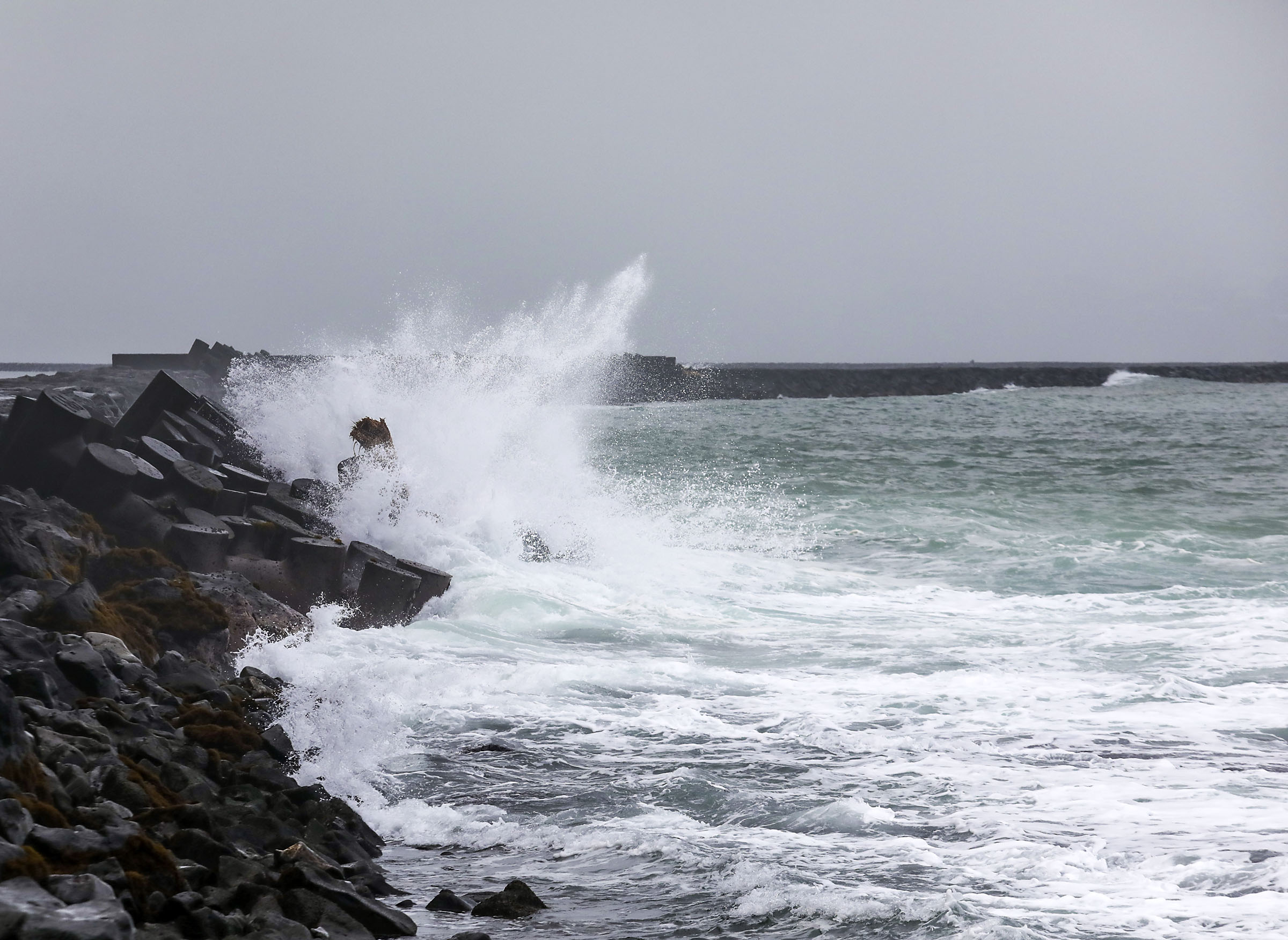
Large breaking waves of 7 to 10 feet are still expected along those Big Island shores.
Winds will be on the decrease today, however, with surf heights expected to be just below advisory levels by later today.
The public should continue to heed all advice from ocean safety officials. Again: when in doubt, don’t go out.
Story originally posted at 4:07 a.m. Feb. 10, 2026: National Weather Service forecasters in Honolulu issued a high surf advisory for eastern shorelines of the Big Island until 6 a.m. Wednesday (Feb. 11). It replaces a previously issued high surf warning.
Strong to near gale force easterly trade winds will produce continued high surf along exposed east-facing shores.
Surf of 8 to 12 feet is expected, producing strong, breaking waves and strong currents that will make swimming and other ocean activities dangerous along the shores in advisory areas.
The public is advised to heed all advice from ocean safety officials.
When in doubt, don’t go out.
Wind speeds are forecast to slowly decrease through Wednesday, with surf heights falling just below advisory thresholds along eastern shores by Wednesday morning.
Sponsored Content


