

UPDATE 2: High surf warning downgraded to advisory for West Hawaiʻi
Update at 4:14 a.m. Thursday, Feb. 5, 2026: A northwest swell moving through the state now is on the downward trend, forecast to continue that trend slowly through today (Feb. 5); however, surf along north- and west-facing shores of most islands should remain at advisory levels through much of the day.
National Weather Service forecasters at the Honolulu office — in response — canceled the high surf advisory that was previously in place for north shorelines of the Big Island. They also canceled the high surf warning for western shores of the island, replacing it with a high surf advisory now in effect through 6 p.m. today.
West Hawai’i coasts can still expect surf of 7 to 10 feet heading into today, lowering to 6 to 8 feet this afternoon.
Strong breaking waves and strong currents also continue to make swimming and other ocean activities in the advisory areas dangerous.
The public is advised to heed all advice from ocean safety officials — when in doubt, don’t go out.
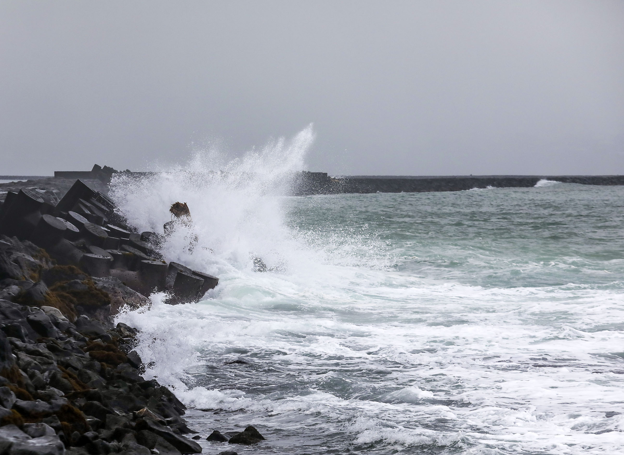
3:33 p.m. Feb. 4 update: Although the extra large northwest swell is now declining, surf along exposed on west-facing shores of the Big Island will remain at warning levels this evening and tonight.
Surf along the west-facing shores is expected to reach 8 to 12 feet before lowering to advisory levels Thursday, according to forecasters at the National Weather Service in Honolulu.
Honaunau Boat Ramp, Kahalu`u Beach Park, La`aloa (Magic Sands) Beach Park, and Mahukona Wharf remain closed due to large breaking surf, significant shore break, and dangerous currents, according to the Hawaiʻi County Civil Defense Agency.
Advisory level surf will remain possible along north facing shores of the Big Island through tonight.
9:26 a.m. Feb. 4 update: Hōnaunau Boat Ramp, Kahalu‘u Beach Park, La‘aloa (Magic Sands) Beach Park, and Mahukona Wharf are closed due to high surf.
The National Weather Service in Honolulu issued a high surf warning for west-facing shores and a high surf advisory for north-facing shores of Hawai‘i Island through today.
Large breaking surf, significant shore break, and dangerous currents are expected and could cause injury or death.
Original post: A high surf warning for north- and west-facing shores of Big Island is in effect through 6 p.m. Wednesday, as a powerful northwest swell moves into the islands, according to forecasters at the National Weather Service in Honolulu.
Kahalu‘u and La‘aloa (Magic Sands) Beach Parks, and Mahukona Wharf are closed.
Forecasters said surf is expected to rise rapidly along exposed coastlines Monday evening, with wave heights peaking Tuesday, Feb. 3, well above warning thresholds.
An unusually large northwest swell, combined with overlapping wave pulses, is expected to keep surf elevated through Wednesday, after which conditions will gradually improve along north-facing shores. Wave heights are forecast to reach 8 to 14 feet by Tuesday afternoon, according to the weather service.
On the west-facing shores of the smaller islands, surf of 15 to 20 feet is building to 20 to 30 feet on Tuesday. On the west-facing shores of the Big Island, surf is building to 8 to 14 feet on Tuesday.
Officials warned that ocean conditions during the advisory period will be extremely dangerous.
Entering the water could result in serious injury or death, and beachgoers were urged to remain cautious, as large breaking waves may also pose hazards along the shoreline.
The warning may be extended, modified, or canceled depending on changing conditions. Residents and visitors are encouraged to monitor updates from the National Weather Service and consult county lifeguards for the latest information on ocean safety and beach conditions.
For updated information on ocean and weather alerts, click here.
Sponsored Content


