

High surf advisory, flood advisory, coastal flood statement in effect for East Hawai’i
The National Weather Service forecast office in Honolulu has issued a high surf advisory for east-facing shores of the Big Island and throughout the state that will go into effect from 6 a.m. Monday, Jan. 5, through 6 a.m. Wednesday, Jan. 7.
A flood advisory also is in effect until 8 a.m. due to excessive rainfall over East Hawaiʻi districts.
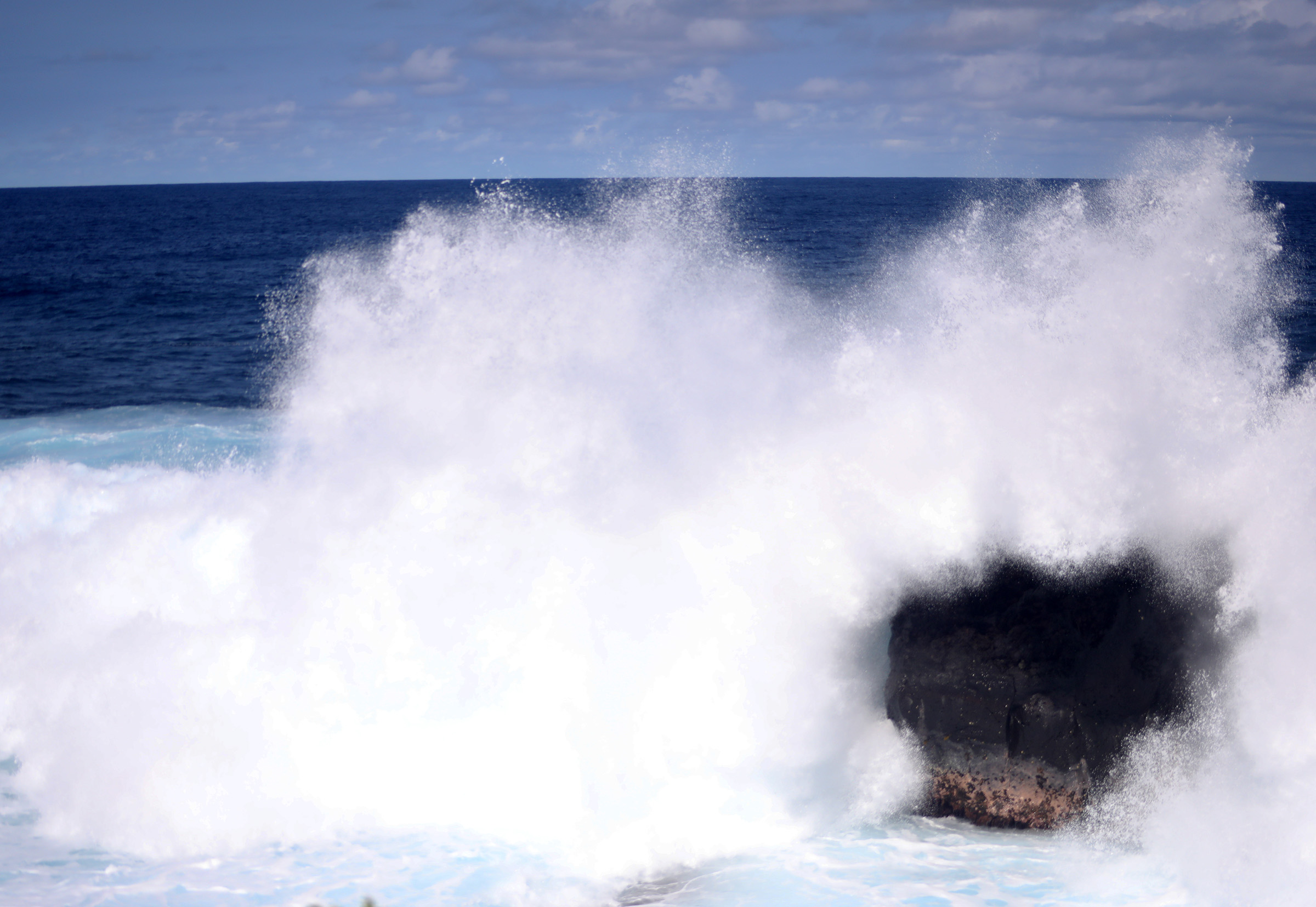
For the high surf advisory, an easterly wind fetch generated by lowering pressures south and west of the islands will significantly increase easterly wind wave swell.
The building east swell will impact most eastern shorelines throughout the islands through early Wednesday, with this smaller-period chop reaching advisory heights early Monday.
Surf heights of between 10 and 12 feet can be expected in the advisory locations, causing strong breaking waves and strong currents that will make swimming dangerous.
The public should heed all advice from ocean safety officials along the coastlines under the advisory. Remember: when in doubt, don’t go out.
Flood advisory
Minor flooding is expected on roads, poor drainage areas, and in streams with the heaviest rain, 1 to 2 inches per hour, falling from Laupahoehoe southward to Volcano as of 4:51 a.m.
Some locations that will experience flooding include, Hilo, Hawaiian Paradise Park, Honokaa, Volcano, Glenwood, Hawaii Volcanoes National Park, Mountain View, Hawaiian Acres, Wood Valley, Keaau, Orchidlands Estates, Pahala, Pahoa, Papaikou, Pepeekeo, Punaluu Beach, Honomu, Kawa Flats and Hakalau.
Coastal flood statement
To make conditions along eastern shores of the island even more hazardous, a coastal flood statement has also been extended through early Tuesday.
Peak monthly high tides combined with higher-than-predicted water levels will continue to lead to minor flooding along shorelines and in low-lying coastal areas.
Minor flooding can still be expected around the daily peak high tides, which happen in the early morning hours, along shorelines and in low-lying coastal areas.
Flooding is especially possible along northern low-lying coastal areas exposed to a northerly swell.
There is a potential for flooding of beaches that are normally dry, minor coastal erosion and saltwater inundation.
The public is advised to:
- Avoid driving through flooded roadways. If you are forced to drive through salt water, be sure to rinse your vehicle with fresh water as soon as possible.
- Move electronics, vehicles and other valuables to higher ground.
- Monitor vessels to ensure mooring lines don’t get too tight and watch out for overwash around boat ramps.
- Secure canoes or other watercraft stowed on beaches.
Coastal flooding photos can also be submitted to Hawaiʻi and Pacific Islands King Tides Project.
Flood watch
A flood watch continues for east Hawaiʻi districts – Hāmākua, North Hilo, South Hilo, Puna, and Kāʻu – through Monday, according to the National Weather Service.
While flooding may not occur, it is possible. The public is advised:
- Prepare for heavy rains and potential flooding in flood prone areas;
- Be aware that road closures may occur without notice;
- Do not attempt to cross flowing water in a vehicle or on foot; turn around don’t drown;
- If lightning threatens the area, the safest place to be is indoors.
Sponsored Content


