

East Hawai’i finally sees the sun, after 10 days of rain — and snow on the summits
Man! The weather outside was frightful — not at all delightful. Rain, rain and more rain took more than a week to slow, and even the Big Island’s summits got a ton of snow.
Meteorologist Guy Hagi was right: the eastern half of the island was taken for a rough and soggy ride for 10 days. Actually, is there something worse than soggy?
Back-to-back Kona Lows were followed by persistent — and sometimes seemingly perpetual — showers ushered in by returning trade winds. They drenched places from Honomū to Pāhala, beginning on Feb. 16 and lasting until Saturday, when the rain finally stopped long enough in Hilo to give the saturated ground a chance to dry out a little.
A Facebook friend said the days of relentless rounds of rainfall was “like Bible stuff.” Many people probably were ready to build an ark.
One person in the Hilo Happenings Facebook group said they had received more than 30 inches at their home on North Kulani Road in Mountain View between Feb. 16 and 21.
Numbers from automated rain gauges monitored by the National Weather Service forecast office in Honolulu from the morning of Feb. 16 to Saturday morning also showed totals ranging between 10.51 inches in Pāhoa to 23.6 inches at the Waiākea Experimental Station.
The Pāhala rain gauge saw 15.31 inches in the same time frame, and the gauge at the Hilo International Airport recorded 21.81 inches.
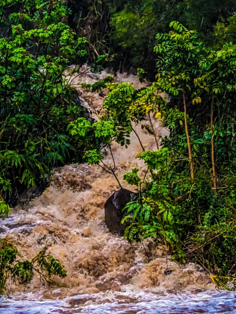
 Waiʻōhinu Stream in Kaʻū gushes Friday, Feb. 17, because of heavy rainfall from a Kona Low storm. Photo by Bob Martin.
- A stream in Hakalau was full to the brim during the recent Kona Low storms. Photo by Paiton Yaw
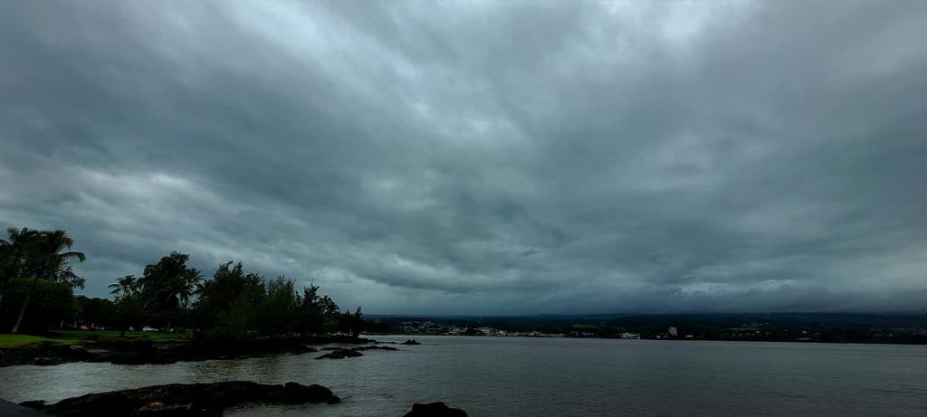
- A Kona Low passes over Hilo early last week. Photo by Stephanie Pakani.
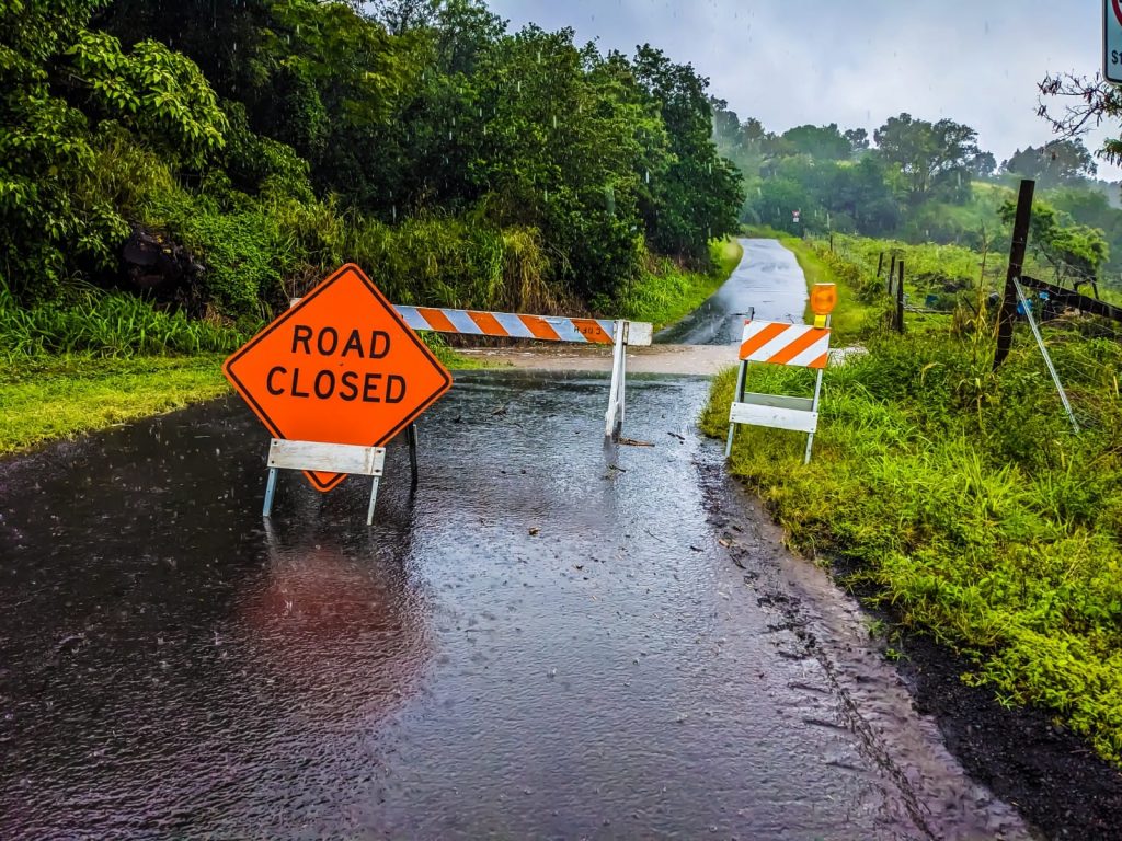
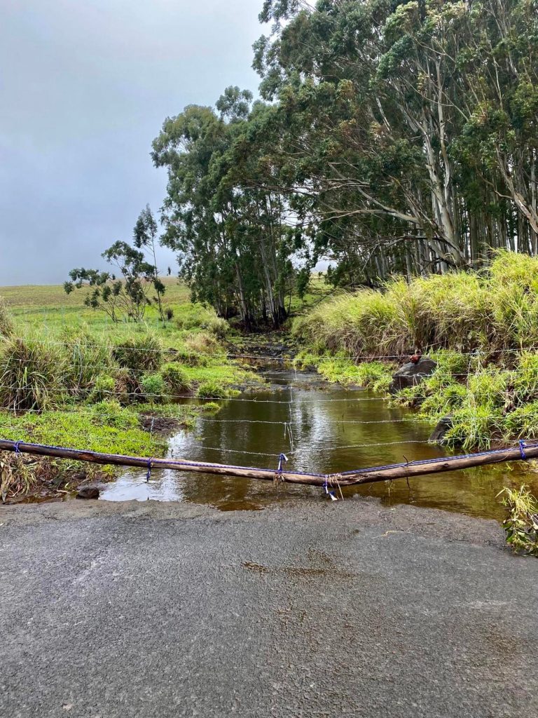
- A road in Kaʻū is closed Feb. 17 because of flooding caused by a Kona Low storm. Photo by Bob Martin
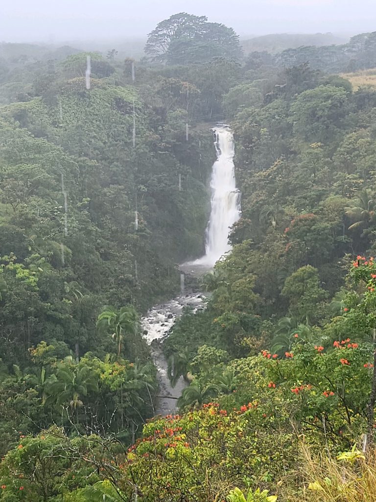
- Kama’e’e Falls in Hakalau on Feb. 18. Photo by Paiton Yaw
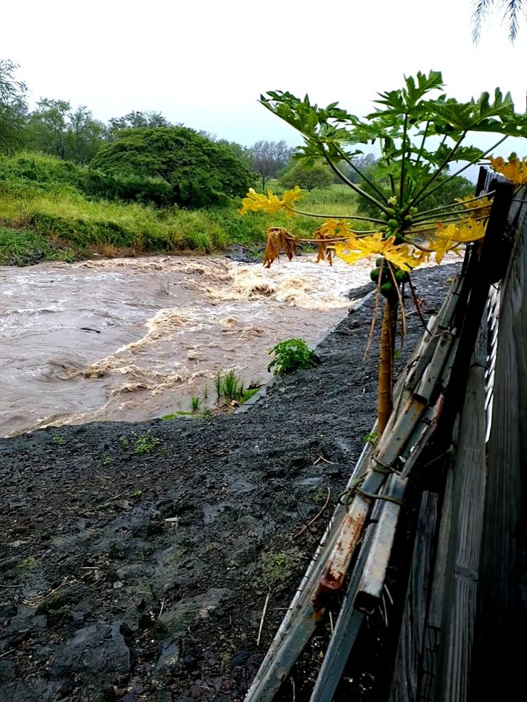
- A Kaʻū stream runs full on Feb. 17 thanks to rains from a Kona Low storm. Photo by Bob Martin
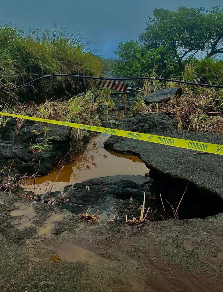
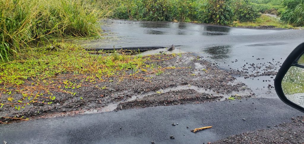
- Road damage in Kaʻū from flooding caused by a Kona Low storm last week. Photo by Christine Rolon-Inserra
- Flooding in Kaʻū caused by the recent Kona Low storms. Photo by Christine Rolon-Inserra
- Damage in Kaʻū caused by flooding from Kona Low storms. Photo by Christine Rolon-Inserra
- A Kaʻū stream flows fast thanks to heavy rain from recent Kona Low storms. Photo by Christine Rolon-Inserra
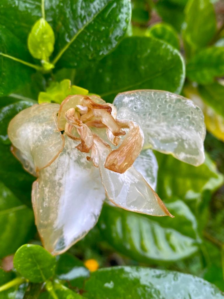
- A Tahitian gardenia in Kaʻū that was trying to bloom wilts thanks to the chilly temperatures and deluge from recent Kona Low storms. Photo by Christine Rolon-Inserra
- Flood waters rush over a road in Kaʻū during recent Kona Low storms. Photo by Joe Ahsley
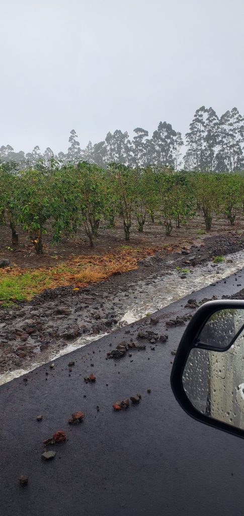
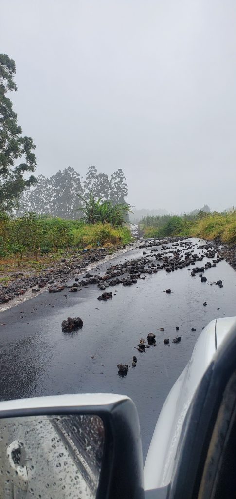
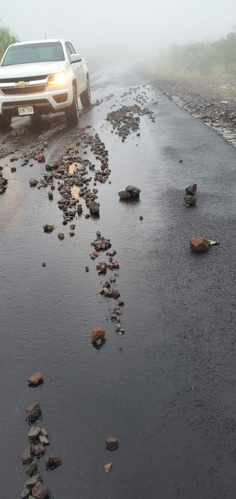
- Rocks that were washed onto a Kaʻū road during recent Kona Low storms because of flooding. Photo by Joe Ashley
- A roadway in Kaʻū is littered with large rocks washed onto it because of flooding from recent Kona Low storms. Photo by Joe Ashley
- Flooding caused by recent Kona Low storms moved tons of rocks onto roadways and other locations in Kaʻū. Photo by Joe Ashley
- Flooding in Kaʻū caused by recent Kona Low storms. Photo by Joe Ashley
- Large rocks were washed into this Kaʻū roadway because of flooding caused by recent Kona Low storms. Photo by Joe Ashley
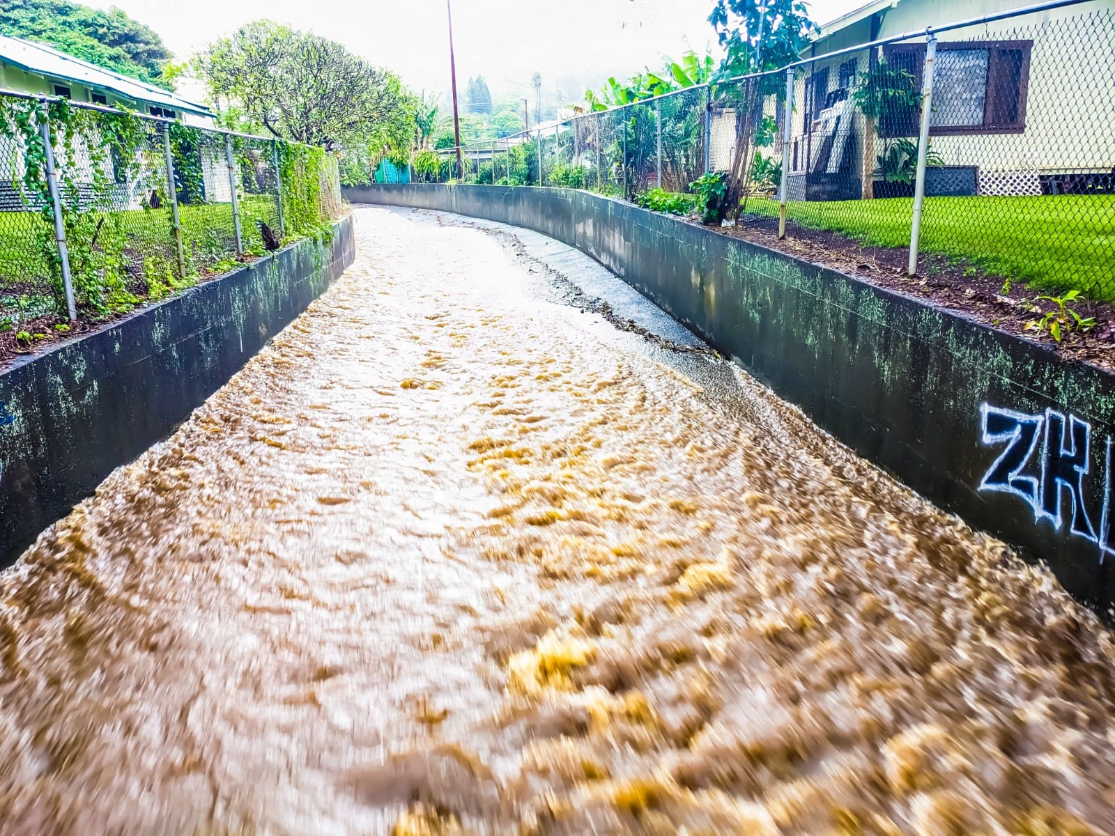
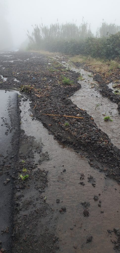
- A drainage ditch overflows with rain water and runoff Feb. 17 thanks to flooding caused by a Kona Low storm. Photo by B. Bruce Bare


Most of the rain fell during the Kona Low storms that moved over the Big Island and Maui from the southwest last weekend and into the beginning of the week. While much of the rain started to taper off after the second storm moved out of the area, those persistent trade wind showers kept some places soggy for several more days. The rain gauge at Honoli‘i Stream north of Hilo measured 16.02 inches just from Feb. 20 to Saturday morning.
The deluge from the Kona Lows produced days of dangerous flash flooding, mostly in Puna and Kaʻū. Several people on social media asked where to get sandbags.
One person was trapped and had to be rescued shortly after 5 a.m. on Feb. 18 after the sedan they were driving became stuck and half-submerged in fast-moving flood waters in the Wood Valley area of Kaʻū.
Another vehicle was reportedly swept downstream Feb. 17 after its driver attempted to travel through heavy runoff crossing over Wood Valley Road. According to the Hawai‘i Island Radio Scanner Community Facebook group, Hawai‘i Fire Department crews searched the area after arriving and located the vehicle and its operator, who was fortunately able to get out of the vehicle.
Some areas received so much rain from the Kona Lows that roadways became impassible lakes. Several were closed for hours or longer. The storms also caused power outages; downed trees, including an ʻōhiʻa; tossed rocks onto roadways and landslides; damaged bridges and washed away asphalt; canceled bus routes for several days; and the closure of some schools and businesses.
The owners of Crusty Buns food truck posted the morning of Feb. 17 on Facebook while they were parked at Kai Store in Hilo: “Hilo thought we were funny … wanting to reopen today. Looks like the joke’s on us! We will re-open next week as we will be spending today repairing the flooding that’s trapped our truck in it’s spot. Everyone stay safe!”
The storms also took out the internet functionality at the Hawai‘i Pacific Parks Association’s Kīlauea Visitor Center store at Hawai‘i Volcanoes National Park, forcing it to close on Feb. 17.
“It is raining, folks! A good day to stay in with some hot cocoa and a book!” the association’s Facebook post said. Another person on social media said it was “Call in sick day.”
It was still flooding intermittently by Feb. 24 in Kaʻū Mauka. Big Island Now asked Hawai‘i County for damage reports or information but received no response.
The level of headache experienced during the severe weather and heavy rainfall just depended on where you were in its path. There likely were many socks hung inside to dry out after misjudging the depth of a puddle. One family’s washing machine broke because of the rain.
- A lenticular cloud hovers over a snowcapped Maunakea on Feb. 19. Photo by Keith Kefford.
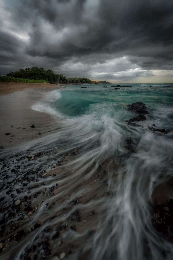
- Clouds create dark skies over South Point during recent Kona Low storms. Photo by Christine Rolon-Inserra
- “Hawaiian Winter Storm” by Beau Jack Key.
- A sunset from Ocean View on Feb. 18 as a Kona Low storm passes over the Big Island. “Looked more like a lava flow,” said Stone Love, who took the photo.
- This photo of sunset was taken at Kāʻanapali beach on Maui during the recent Kona Low storms that socked the Big Island and Maui. Photo by Lou Carter


Even the coqui frogs seemed to hunker down.
The deep tropical moisture the Kona Lows drew in also helped blanket the summits of Maunakea and Mauna Loa with several inches of fresh powder. More than a foot of new snow fell atop Maunakea, affirming the 13,803-foot volcano’s “White Mountain” moniker.
The weather has definitely been wild, but despite the obvious pains, nature’s beauty was also on display.

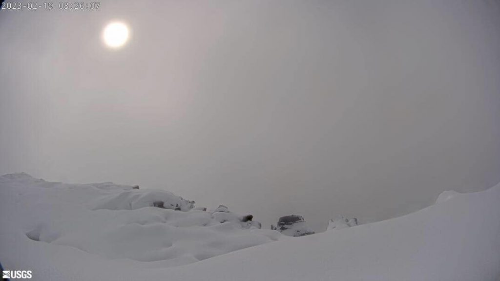
“Looks like something from a dream,” Tyson Caporrimo wrote in a post in the Hawai‘i Tracker Facebook group after sharing a U.S. Geological Survey photo from the summit of Mauna Loa. “Beautiful Moku’āweoweo layered with a large amount of snowfall.”
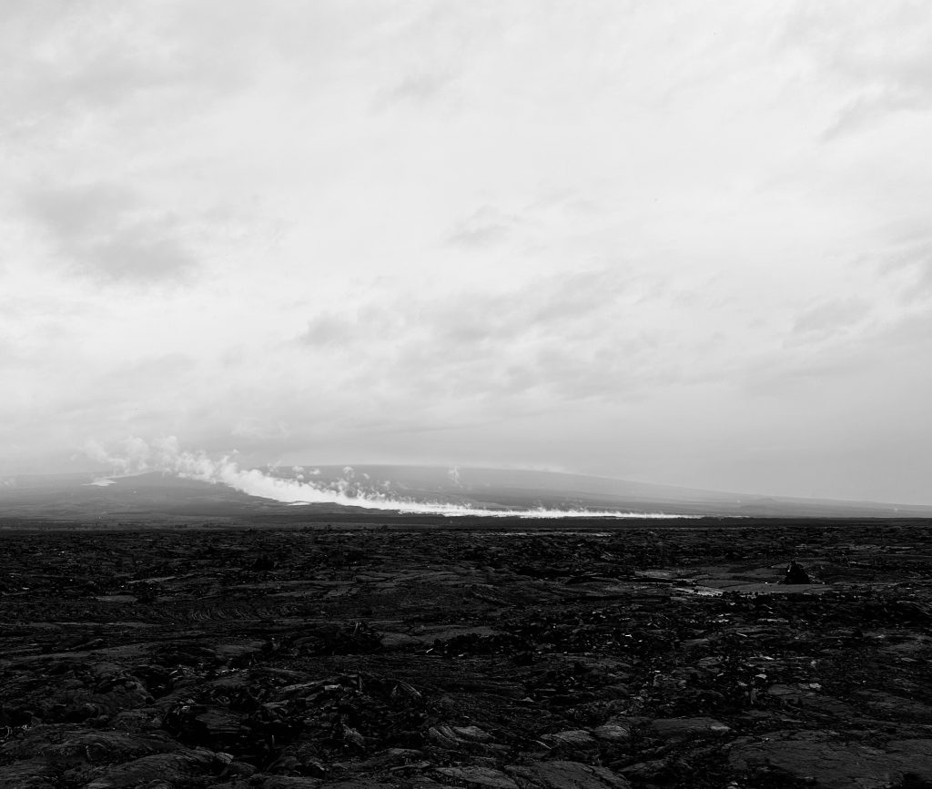
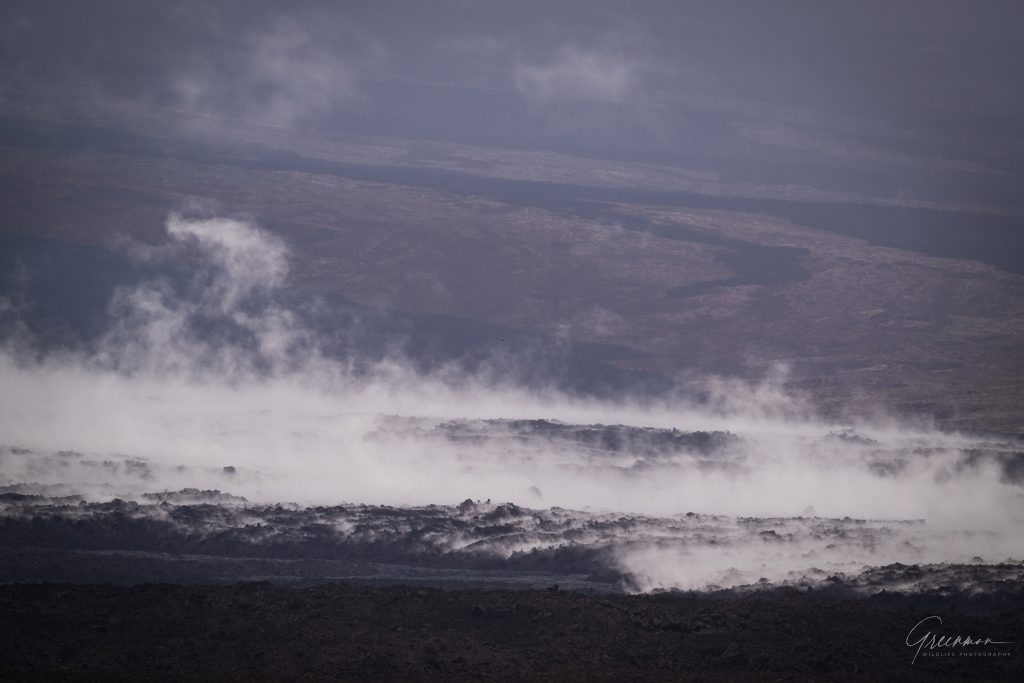
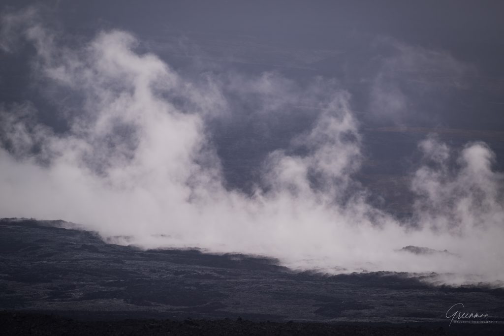
Snowboarders have been reported to be taking advantage of the snowcapped summit. Other photos posted on social media showed the chilly rain causing steam to roll off of the still cooling lava flows on Mauna Loa’s northeast flank.
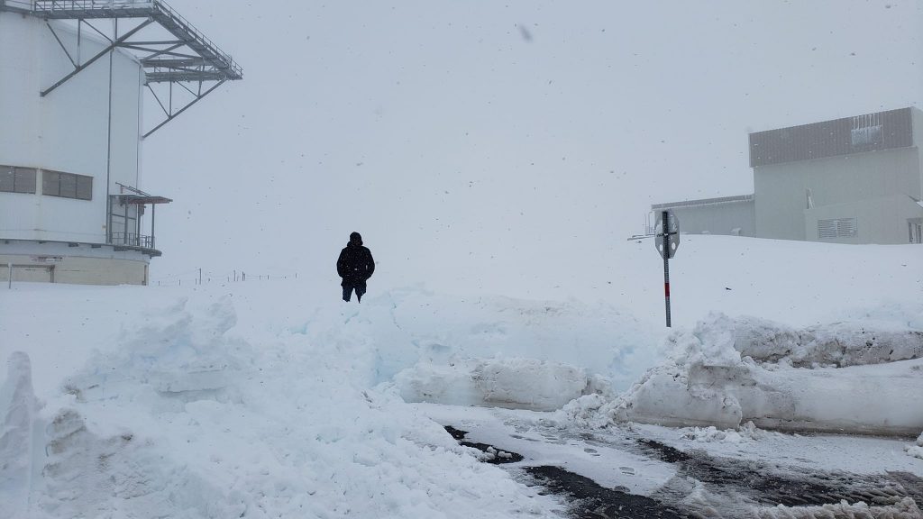
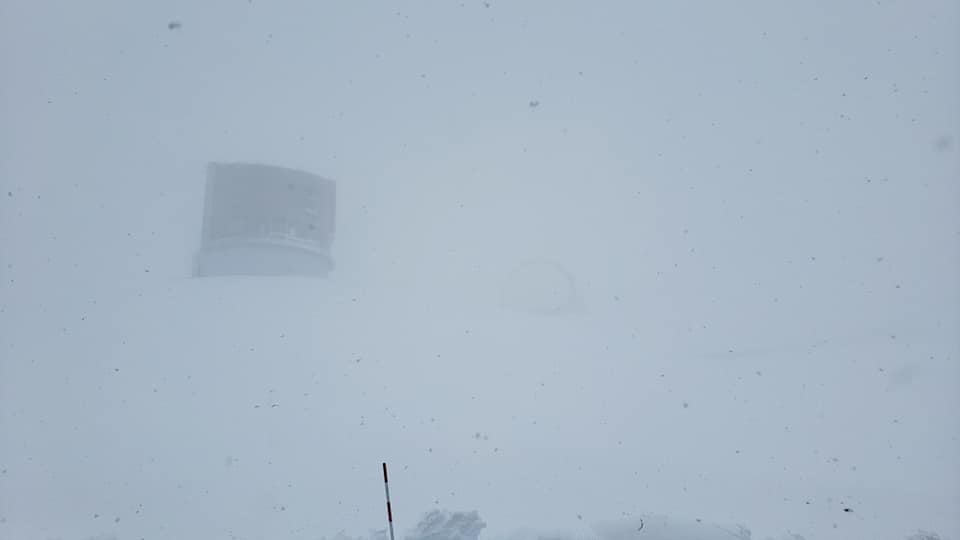
- A photo atop Maunakea from Feb. 19. Photo by Dennis Patterson
- A photo atop Maunakea from Feb. 19. Photo by Dennis Patterson
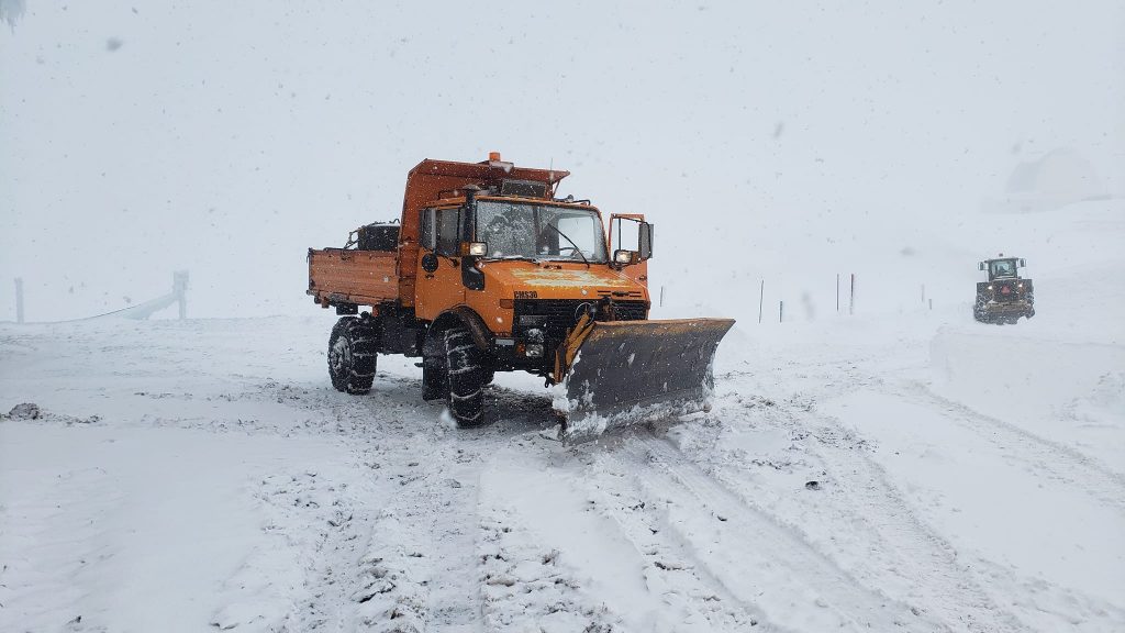
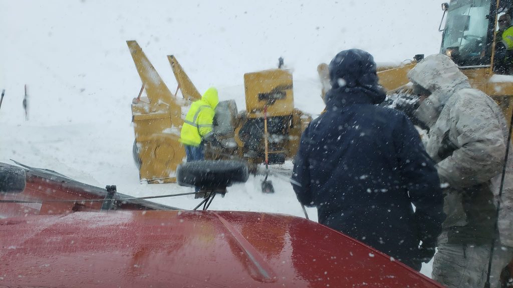
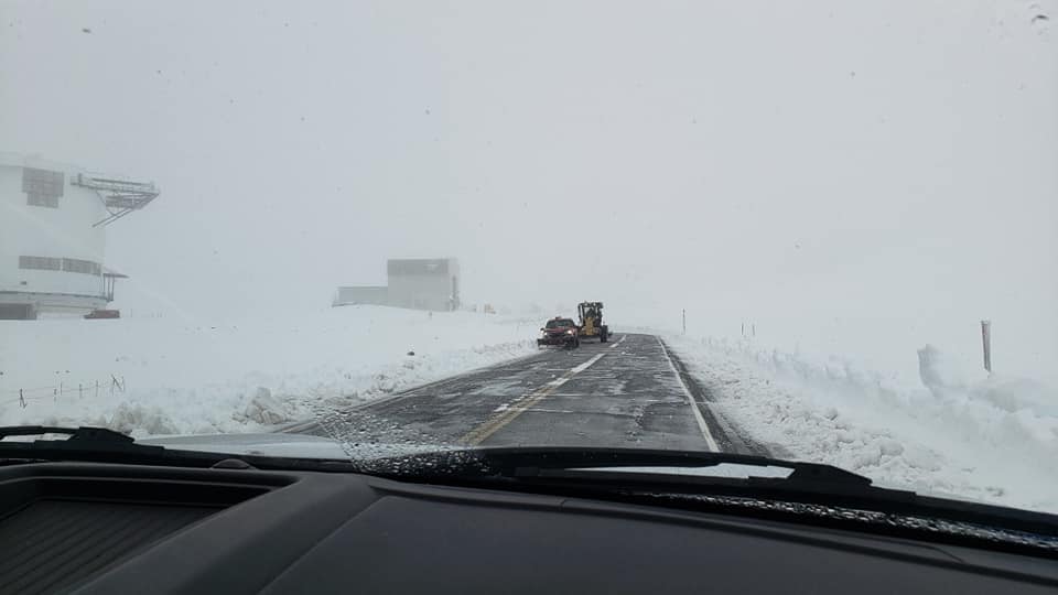
- A snowplow moves fresh snow atop Maunakea on Feb. 19. Photo by Dennis Patterson.
- Snow falls as crews work to move it Feb. 19 atop Maunakea. Photo by Dennis Patterson
- A photo atop Maunakea from Feb. 19. Photo by Dennis Patterson
- A photo atop Maunakea from Feb. 19. Photo by Dennis Patterson
- A photo atop Maunakea from Feb. 19. Photo by Dennis Patterson
- Mauna Loa’s summit crater Moku’āweoweo after the Kona Low storms dumped several inches on the mountain last week. Photo from the U.S. Geological Survey
- Steam rises from the still cooling lava flows on Mauna Loa as chilly rain falls during the recent Kona Low storms. Photo by Raymond Naeyaert (follow him on Instragram: Greenman_Wildlife_Photography)
- Steam rises from the still cooling lava flows on Mauna Loa as chilly rain falls during the recent Kona Low storms. Photo by Raymond Naeyaert (follow him on Instragram: Greenman_Wildlife_Photography)
- Steam rises from the still cooling lava flows on Mauna Loa as chilly rain falls during the recent Kona Low storms. Photo by Raymond Naeyaert (follow him on Instragram: Greenman_Wildlife_Photography)


On Saturday, It was nice to again feel the warmth on your skin as the sun made an appearance late Saturday morning into the afternoon in Hilo, even if it wasn’t for the entire day.
The sun has been such a rare commodity in East Hawai‘i that by Thursday some people wondered if it would ever return and others posted photos of blue sky on social media when there were brief breaks in the clouds. During one of the sun’s brief appearances, Lopaka Palani-Lono Milliora joked in the Puna Weather Facebook group that China was at it again.
“I think they sent another balloon,” she said about her post of a photo of a rare appearance by the sun. To which Kathleen Frontino replied: “I really don’t quite recognize that orb thing.”
While it dried out for a good chunk of Saturday, long enough to hear the familiar droning of lawn mowers as people took advantage of the lull, the gray and dark clouds rolled back in later in the afternoon.
The smell of a fresh round of rain bombarded your nose just before it started to fall again, a sign of, you guessed it, what is likely to be a forecast feature in East Hawai‘i for several more days.

The National Weather Service said shortly before 4 p.m. Saturday that strong high pressure north of the state will keep breezy to locally strong trade winds in place through late this week. Scattered to numerous showers can be expected over windward slopes and coasts, with a few showers reaching leeward communities as well because of the strength of the trades.
So be sure to enjoy the breaks — and the sun — when you can. Unless you’re on the west side of the island, where it was a balmy 76 degrees under partly cloudy skies just after 5 p.m. on Saturday, with sunny conditions and just a slight chance of rain forecast through at least Wednesday.
Sponsored Content


