

Kona Low storm approaches Big Island; weatherman Guy Hagi says ‘Buckle up’
A chilly southerly breeze blew in a thick voggy blanket under gray overcast skies late Wednesday afternoon in Hilo. At just 71 degrees by 4:19 p.m., it was stark — and dark.
A few sprinkles fell here and there; the rain hadn’t started just yet. But signs were there: wicked weather is on its way.
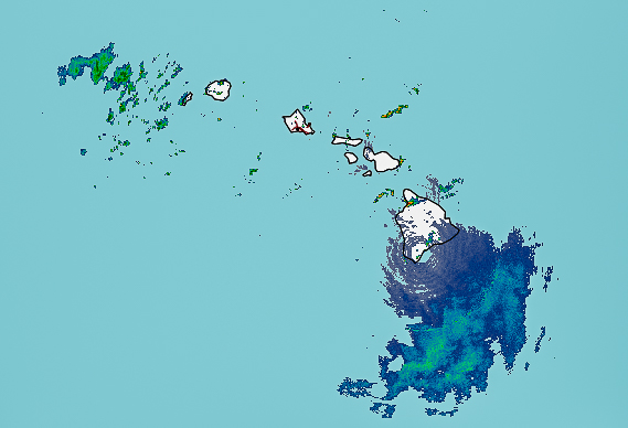
The National Weather Service in Honolulu says a Kona Low is expected to bring widespread heavy rainfall to the Hawaiian Islands and possibly some thunderstorms, gusty winds and lightning from Thursday morning through Saturday. It all starts on the Big Island.
There is a potential for very heavy rainfall totals throughout the three days and beyond, particularly across east and southeast portions of the Big Island and windward Maui.
“It doesn’t look good for you guys,” said Guy Hagi, weather anchor for Hawai‘i News Now who took time on a day off to talk with Big Island Now about the impending severe weather.
He added that various forecast models have come much more into alignment during the past couple of days, showing significant rainfall moving in from the south and southeast will likely drench the Big Island from South Point through Hilo all the way up to Kohala before heading to Maui and O‘ahu.
“We’re pretty confident that we’re in for a rough round of weather, especially for Hawai‘i Island,” Hagi said.
John Bravender, warning coordination meteorologist with the National Weather Service Honolulu office, said the storm looks to be a “significant rain event.”
Rainfall rates in excess of 1 inch per hour are possible beginning Thursday morning, which could result in dangerous flooding. A flood watch is in effect for the entire state from 6 a.m. Thursday through 6 p.m. Saturday, meaning conditions will be favorable for life-threatening flash flooding.
Hawai‘i County is expecting rainfall of up to 20 inches throughout the 72-hour period and it anticipates road closures, particularly in flood-prone areas.

Hawai’i County Civil Defense already announced that Waipiʻo Valley Road will be closed from this evening through Sunday to everyone except valley residents and farmers. The Hele-On park-and-ride location in Hilo also was relocated from Kamehameha Avenue to Kuawa Street through Monday morning.
The County has not asked that outdoor events or activities be canceled but reminded the public that closures and cancellations could be necessary with little to no notice, depending on the severity of the weather.
The areas expected to see the most severe impacts are the Kaʻū, Puna and Hilo districts, including areas along the Hāmākua Coast to Waipiʻo Valley. Road crews, utilities, fire and police personnel are standing by to ensure public safety.
Areas of particular concern include east and southeast portions of the Big Island, where washed out roads could isolate communities.
“We’re expecting a lot of rain over a condensed period and are asking residents to prepare for that,” Hawai‘i County Mayor Mitch Roth said on Wednesday afternoon in a news release. “Rainfall is nothing new to us, but as we look at the impacts we’ve had from similar events over the past couple of years, it’s better to be safe than sorry. We’ve seen the benefits of community preparedness and trust that the community will always do what is in the best interest of each other and our collective safety.”
Civil Defense says residents in flood prone areas especially should prepare for flooding and remain alert. The National Weather Service advises to monitor the forecast and be prepared to take action should flash flood warnings be issued.
Damage from wind also could be enhanced Friday beyond what would normally be expected for 20 to 30 mph winds because of the ground already being saturated from previous storms, making it easier for trees to be uprooted and other debris to be washed away.
The Hawai‘i Department of Transportation is preparing for the storm, notifying contractors and working with crews to check drains and bridges, rockslide areas and low-lying spots along roadways. The agency is also making sure all vessels and aircraft are secure at the state’s airports and harbors. It also is topping off the gas tanks of generators at facilities.

The severe weather also brings the potential for landslides in areas with steep terrain. The Department of Transportation has listed the top 10 sites throughout the state that are susceptible to rockfalls and four are on the Big Island. Of those four, all are on the Hawai‘i Belt Road (Highway 19).
The department urges everyone to follow directions from emergency management officials. If you come across a flooded roadway, notify police and do not attempt to cross. Travelers also should check with their airlines or cruise lines about possible delays.
Hawaiian Electric crews are also prepared to respond to storm-related power outages, but warned that restoring electricity in some areas could be delayed because of fallen trees, debris or flooding. If you see a downed power line, assume it is energized and dangerous and stay at least 30 feet or more away.
To keep updated about outages, follow Hawaiian Electric on Twitter @HIElectricLight and download the utility’s mobile app on your smartphone.
Click here to see additional preparation tips from Hawaiian Electric.
The National Weather Service also issued a winter storm warning for the summits of Maunakea and Mauna Loa from 6 a.m. Thursday to 6 p.m. Saturday. There is the potential with temperatures near or below freezing to produce heavy snow up to 10 feet, with strong and gusty winds leading to periods of near-zero visibility.
Admittedly, while the science behind meteorology is improving, there’s no such thing as a 100% accurate forecast, Hagi said. There’s always the chance a storm won’t live up to the hype, but forecasters offer a sort of time machine with their predictions to give people a chance to look back at what they said and prepare.
“I’m telling you right now it’s going to rain,” he said, adding people can doubt the forecast if they want to, but then who is really to blame if what was predicted comes to pass and they weren’t prepared?
Hagi said the main goal should always be staying alive — that’s the bar. Everything else can come after you and your loved ones are safe. Based on all of the forecast models, this storm looks pretty eminent, so now is the time to batten down the hatches.
“Buckle up,” Hagi said. “You guys are in for a rough ride.”
Sponsored Content


