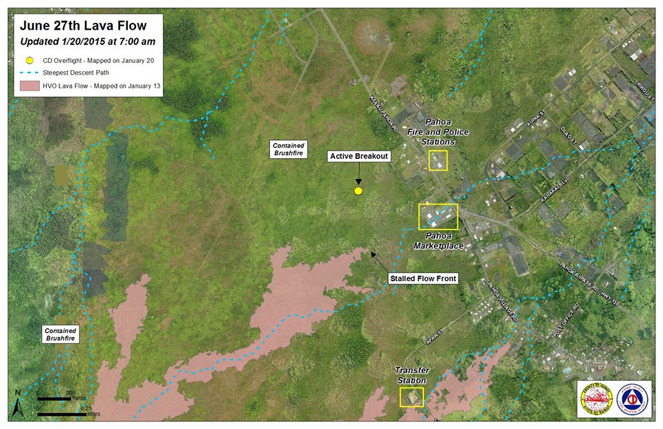
The active and advancing north breakout of the June 27 lava flow front that experienced a stall in movement Monday is back on the move, although sluggishly.
Hawai’i County Civil Defense’s Tuesday morning overflight showed that the north breakout flow front advanced by about 15 yards in the past 24 hours. The tip of the advancing flow is about 0.4 miles from Highway 130, west of the Pahoa Police and Fire Stations.
The original flow front that was heading towards Pahoa Marketplace just weeks ago continues to remain stalled, as does the south margin breakout that was active and advancing.
Two additional breakouts 1-1.5 miles upslope from the original flow front along the north margin continue to be watched after advancement and activity in past weeks. Officials say that these breakouts remain active, but are sluggish and show very little signs of advancement.
ARTICLE CONTINUES BELOW AD
ARTICLE CONTINUES BELOW AD
During its overflight, Civil Defense observed a number of breakouts along both margins of the flow.
None of the lava activity poses an immediate threat to communities in the area. Civil Defense, along with Hawaiian Volcano Observatory personnel, will continue to monitor activity and keep the public informed.
There is no current brush fire threat to residents or properties in the area. Hawai’i Fire Department personnel have remained on scene, monitoring fire conditions since the early part of last week. Fires that have occurred have been contained within the fire break perimeters. Burning in the areas are limited to hot spots and flare ups.
ARTICLE CONTINUES BELOW AD
Smoke conditions continue to improve, as Civil Defense reported light to moderate conditions Tuesday morning. A light northeast wind was blowing smoke in a southwest direction. As usual, these smoke conditions may change and officials advise individuals who are sensitive or have respiratory issues to be aware, taking necessary precautions and staying inside.
+
SWIPE LEFT OR RIGHT
Hawai’i County Civil Defense lava flow map, as of Jan. 20 at 7 a.m. Civil Defense photo.
Hawai’i County Civil Defense lava flow map, as of Jan. 20 at 7 a.m. Civil Defense photo.
This comments section is a public community forum for the purpose of free expression. Although Big Island Now encourages respectful communication only, some content may be considered offensive. Please view at your own discretion. View Comments