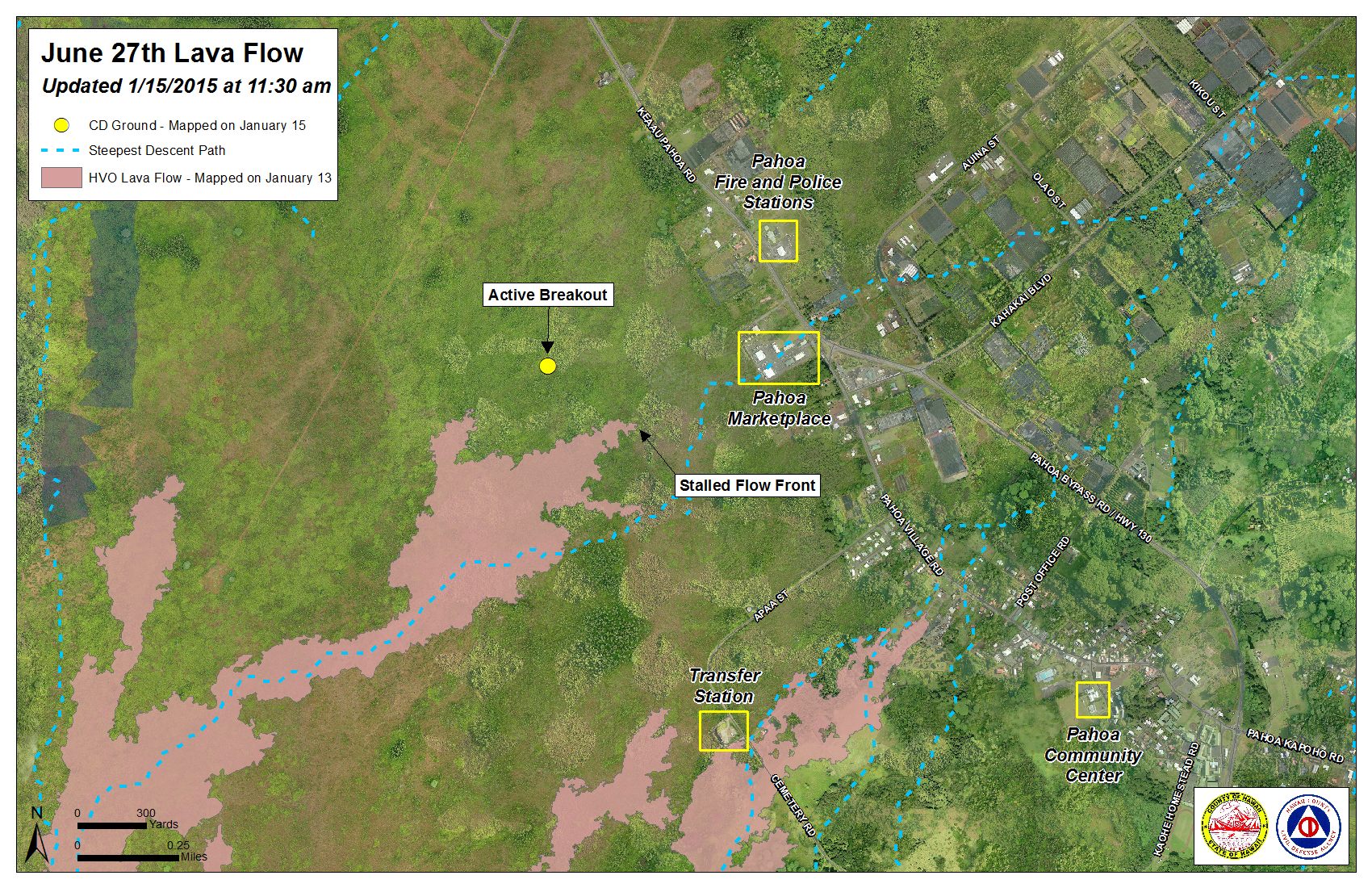
Hawai’i County Civil Defense’s morning helicopter overflight of the June 27 lava flow has been delayed. A preliminary on-ground assessment of the area shows the leading flow front and south margin breakout that have been stalled for nearly two weeks continues to remain stalled.
Additionally, the breakout along the north margin of the flow has advanced and continues to remain active. That flow has traveled towards an area near the stalled flow front. Until Civil Defense takes its overflight later in the day, measurement of the advancement is not available.
The two breakouts along the north margin of the flow about 1-1.5 miles upslope from the stalled flow front continue to remain active. Civil Defense hopes to conduct a more thorough assessment of the breakouts later in the day during a helicopter assessment.
A brush fire that began on Tuesday as a result of the lava flow has been contained within the fire breaks, according to Civil Defense. Fire activity in the area is limited to hot spots and smoldering. The Hawai’i Fire Department has been on the scene continuously, monitoring the conditions. No fire threat poses danger to residents or property in the area.
ARTICLE CONTINUES BELOW AD
ARTICLE CONTINUES BELOW AD
Continued heavy smoke and vog conditions were reported Thursday morning, as a southwest wind continues to blow smoke in a northeast direction toward lower Puna and into Hilo. These smoke conditions, as usual, have the possibility of increasing. Officials advise that individuals who are sensitive or have a history of respiratory issues take necessary precautions and remain indoors.
+
SWIPE LEFT OR RIGHT
Hawai’i County Civil Defense lava flow map, as of Jan. 15 at 11:30 a.m. Civil Defense photo.
Hawai’i County Civil Defense lava flow map, as of Jan. 15 at 11:30 a.m. Civil Defense photo.
This comments section is a public community forum for the purpose of free expression. Although Big Island Now encourages respectful communication only, some content may be considered offensive. Please view at your own discretion. View Comments