


Coastal Highway a ‘Visitors’ Paradise’ — Then and Now
Editor’s Note: See related story, “‘Red Road’ Losing its Namesake Hue.”
Highway 137, also known as the “Red Road,” has a history strewn with vistas and volcanism.
Motorists wending their way through lush vegetation can suddenly find themselves just a few yards from the palm-lined shoreline and crashing waves
It’s the kind of scenery that inspires painters and poets. And that has long been the case, according to newspaper articles of the past.

Highway 137 offers lush landscapes in sections that stray from the coast …
“Truly a visitors’ paradise” was how a Honolulu Star-Bulletin editorial described Puna in 1951, although it noted that most tourists don’t visit because of the “poor highways through it.”
The editorial, which discussed plans for a 20-mile version of Highway 137 called the “Puna Parkway,” concluded with a rueful look back: “Even more than Kona, in some respects Puna reflects the slow moving life which is fast disappearing.”
A few years later, government officials began pushing for an extension of the coastal highway south into Hawaii Volcanoes National Park. The idea was to use park roadways to link Lower Puna with the mauka part of the district to create a route called the “Magic Triangle.”

… and breathtaking vistas where it passes close to the shore. Photo by Dave Smith.
But the project would be a challenge, noted a 1954 article in the Honolulu Star-Bulletin, as even the existing portion of Highway 137 was mostly unpaved, including the 10-mile stretch from Pohoiki to Kalapana.
“Completion of the triangle will mean big business to all of the Big Island and the tourist industry at large – because it will create an attraction in the Puna District that will practically mandate an additional overnight stay on the Big Island for tourists who visit that place,” the article said.
That appeal isn’t lost on modern-day visitors.
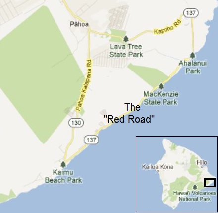
Modified Google Maps image.
“I’m really grateful there are still places like this,” said Mary Laurence, a Massachusetts resident sightseeing along Highway 137 with her husband, Matt. “It feels like Hawaii in an undeveloped sense.”
The interview was interrupted by a chorus of oohs and ahs when a whale spouted a short distance away.
Jesse Warren, a visiting English teacher in China who was taking photos further down the road, was also enamored with the scenery.
“It’s beautiful,” he said. “It’s very photogenic.”
———
The Magic Triangle was finally completed in the 1940s, providing a spectacular drive down the coast from lower Puna all the way up to Volcano. But it would be severed by lava from the eruption of Mauna Ulu in the 1970s, and, after being rebuilt, cut again in 1986 by flows from the current eruption.
More lava flows from Kilauea volcano reached Highway 137 and the coast at Kalapana in 1990, destroying numerous homes and burying Harry K. Brown Park under 50 feet of rock.
Not only was Puna’s busiest coastal park lost, but lava also buried nearly a mile and a half of shoreline, including the famed Kaimu black sand beach. It also covered Drainpipe Beach, a treasure among Puna’s predominately rocky beaches in that it had enough tan-colored sand to actually form dunes.

The relocated Kalapana Painted Church.
Also buried were a church, drive-in restaurant and Walter Yamaguchi’s store, a regular destination for parched swimmers and sunbathers. A second church was hauled away — just ahead of a lava flow — to a new home on nearby Highway 130.
Lava is currently again flowing into the ocean south of Kalapana, providing yet more incentive for visitors to take the 45-minute drive from Hilo to Puna’s coast.
Ironically, eventual repaving of the coastal road over the flows of the last 30 years toward the national park has again been discussed over the past decade, this time to provide an alternate route out of lower Puna should Highway 130 be cut by a new round of volcanic activity.
Sponsored Content


