

Island forecast
Hilo, Big Island Weather
Clear daily guidance, radar access and the latest regional weather reporting in one place.
- Change Towns
- Hilo
- Kona
- Ocean View
- Pahala
- Waimea
Multi-day outlook
Forecast timeline
Scroll for the full forecast
Overnight
Saturday
Saturday Night
Sunday
Sunday Night
Monday
Monday Night
Tuesday
Tuesday Night
Wednesday
Wednesday Night
Thursday
Thursday Night
Friday
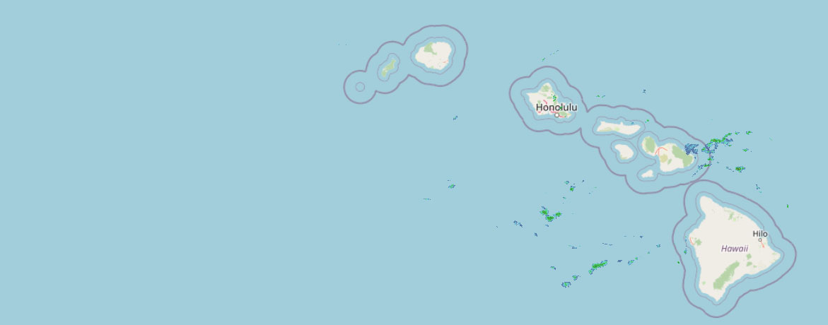 Weather Radar
Regional forecast
Regional Big Island Weather Forecast Hawaii County Weather Forecast for July 11, 2026

Hilo
Tonight: Cloudy. Occasional showers in the evening, then numerous showers after midnight. Lows 67 to 74 near the shore to around 61 at 4000 feet. North winds up to 15 mph. Chance of rain 90 percent.
Saturday: Mostly cloudy. Occasional showers in the morning, then numerous showers in the afternoon. Highs 80 to 86 near the shore to around 68 at 4000 feet. Northeast winds up to 15 mph. Chance of rain 90 percent.
Saturday Night: Occasional showers. Lows 67 to 73 near the shore to around 60 at 4000 feet. North winds up to 15 mph. Chance of rain near 100 percent.
Kona
Tonight: Mostly cloudy. Isolated showers in the evening. Lows 68 to 76 near the shore to around 56 near 5000 feet. Light winds. Chance of rain 20 percent.
Saturday: Mostly cloudy. Scattered showers in the afternoon. Highs 86 to 91 near the shore to around 70 near 5000 feet. Light winds. Chance of rain 30 percent.
Saturday Night: Mostly cloudy. Lows 68 to 76 near the shore to around 56 near 5000 feet. Light winds.
Waimea
Tonight: Breezy. Mostly cloudy with numerous showers. Lows 67 to 74 near the shore to 61 to 67 near 3000 feet. East winds 10 to 25 mph. Chance of rain 70 percent.
Saturday: Breezy. Mostly cloudy with scattered showers. Highs around 82 near the shore to 70 to 81 near 3000 feet. East winds 10 to 25 mph with gusts to 45 mph. Chance of rain 50 percent.
Saturday Night: Mostly cloudy. Breezy. Scattered showers in the evening, then numerous showers after midnight. Lows 66 to 74 near the shore to 61 to 67 near 3000 feet. East winds 10 to 20 mph. Chance of rain 70 percent.
Kohala
Tonight: Breezy. Mostly cloudy with numerous showers. Lows 67 to 74 near the shore to 61 to 67 near 3000 feet. East winds 10 to 25 mph. Chance of rain 70 percent.
Saturday: Breezy. Mostly cloudy with scattered showers. Highs around 82 near the shore to 70 to 81 near 3000 feet. East winds 10 to 25 mph with gusts to 45 mph. Chance of rain 50 percent.
Saturday Night: Mostly cloudy. Breezy. Scattered showers in the evening, then numerous showers after midnight. Lows 66 to 74 near the shore to 61 to 67 near 3000 feet. East winds 10 to 20 mph. Chance of rain 70 percent.
South Big Island
Tonight: Breezy. Partly cloudy with isolated showers in the evening, then mostly cloudy after midnight. Lows around 77 near the shore to around 59 near 5000 feet. Northeast winds up to 25 mph. Chance of rain 20 percent.
Saturday: Breezy. Partly sunny with isolated showers. Highs around 88 near the shore to around 69 near 5000 feet. East winds up to 25 mph increasing to 10 to 25 mph in the afternoon. Chance of rain 20 percent.
Saturday Night: Mostly cloudy. Breezy. Isolated showers in the evening. Lows around 77 near the shore to around 58 near 5000 feet. Northeast winds 10 to 20 mph. Chance of rain 20 percent.
Puna
Tonight: Cloudy. Occasional showers in the evening, then numerous showers after midnight. Lows 67 to 74 near the shore to around 61 at 4000 feet. North winds up to 15 mph. Chance of rain 90 percent.
Saturday: Mostly cloudy. Occasional showers in the morning, then numerous showers in the afternoon. Highs 80 to 86 near the shore to around 68 at 4000 feet. Northeast winds up to 15 mph. Chance of rain 90 percent.
Saturday Night: Occasional showers. Lows 67 to 73 near the shore to around 60 at 4000 feet. North winds up to 15 mph. Chance of rain near 100 percent.
Waikoloa
Tonight: Mostly cloudy. Breezy. Lows 70 to 76 near the shore to 55 to 60 above 4000 feet. East winds up to 20 mph.
Saturday: Partly sunny. Breezy. Highs 86 to 92 near the shore to 68 to 75 above 4000 feet. Northeast winds up to 25 mph with gusts to 45 mph.
Saturday Night: Mostly cloudy. Lows 70 to 76 near the shore to 55 to 60 above 4000 feet. East winds up to 15 mph.
Detailed Forecast
Synopsis
Strong high pressure far north of the state will continue to produce breezy trades through the weekend and well into next week. An increase in moisture will bring enhanced showers to windward and mauka locations Saturday night into Sunday morning. The next plume of moisture could then arrive by the middle of next week, otherwise a typical summertime trade wind shower distribution is expected.
Short term update
Radar data this evening shows the bulk of the shower activity over the windward slopes of the Big Island and a usual shower distribution for the rest of the islands. Overall the forecast remains on track.
Prev discussion
Issued at 309 PM HST Fri Jul 10 2026 Radar and satellite show partly to mostly cloudy skies with showers focused mainly windward and mauka. The highest concentration of showers early this afternoon has been over Kauai and the Big Island. Winds were breezy, averaging 10-20 mph sustained with gusts 25 to 35 mph.
A strong upper level ridge will remain anchored to our north over the next week, helping to keep a surface high in place. Winds rotating clockwise around this surface high will then keep the trades blowing, bringing a rather typical summer pattern. Showers will continue, mainly windward and mauka, and most numerous at night. One noticeable increase in low level moisture will arrive Sunday, resulting in an increase in both the coverage and strength of showers. This should also increase the number that make it over to leeward areas. There may be additional periods of increased moisture next week, but details are not available yet.
The tropics are showing signs of life not too far away, but at this time no systems are forecast to impact the state. Longer range ensembles indicate that the last two weeks of the month may bring an environment supportive of further development, but it is way too early to have any details. However, now would be a good time to make sure you are prepared for what could prove to be an active El Nino tropical storm season.
Aviation
Moderate to breezy trades continue across the state, with pockets of embedded light to moderate shower activity expected to impact windward sites at times, occasionally spilling over into leeward areas. Expect VFR conditions to prevail across most locations, with occasional localized MVFR conditions in association with low clouds and shower activity.
AIRMET Tango remains in effect for moderate low-level turbulence over and downwind of terrain for all islands. This AIRMET will likely continue as this ongoing trade wind pattern persists.
Marine
Issued at 309 PM HST Fri Jul 10 2026 Strong high pressure centered north of the state will remain nearly stationary through the forecast period. Fresh to strong trade winds are expected through Saturday afternoon. The Small Craft Advisory (SCA) has been extended through Saturday for all Hawaiian waters. Trades will remain fresh to strong through the weekend so the SCA may need to be extended through Sunday before getting scaled back to the windier waters and channels around Maui County and the Big Island.
The current small medium-period south-southwest (190-200 degrees) swell will plateau through Saturday just below the summer average. A small to moderate, long- period southwest swell (220 degrees) is expected to fill in late Saturday through Monday, which can elevate surf through early next week.
Surf along east-facing shores will remain rough and choppy through the forecast period as fresh to strong trades hold. A series of small, moderate period west (270 to 280 degrees) swells are expected to arrive this evening and hold into early next week, sourced from Typhoon Bavi in the far western Pacific. Surf along north- facing shores is expected to remain flat to tiny with no significant swells forecast from the north or northwest.
Looking ahead, higher than normal high tides will be possible beginning during the latter half of this weekend. Interests immediately along the coasts in low-lying or vulnerable areas should continue to monitor forecasts for possible coastal flooding due to the King Tides from Sunday through the first half of next week.
HFO Watches/Warnings/Advisories
Small Craft Advisory until 6 PM HST Saturday for Alenuihaha Channel, Big Island Leeward Waters, Big Island Southeast Waters, Big Island Windward Waters, Kaiwi Channel, Kauai Channel, Kauai Leeward Waters, Kauai Northwest Waters, Kauai Windward Waters, Maalaea Bay, Maui County Leeward Waters, Maui County Windward Waters, Oahu Leeward Waters, Oahu Windward Waters, Pailolo Channel.
Big Island Now Weather is brought to you by Blue Hawaiian Helicopters.
Check out their Big Island Helicopter Tours today!
Data Courtesy of NOAA.gov