


Lowell moves away from Hawaiian Islands; heavy rainfall to linger over portions of Big Island
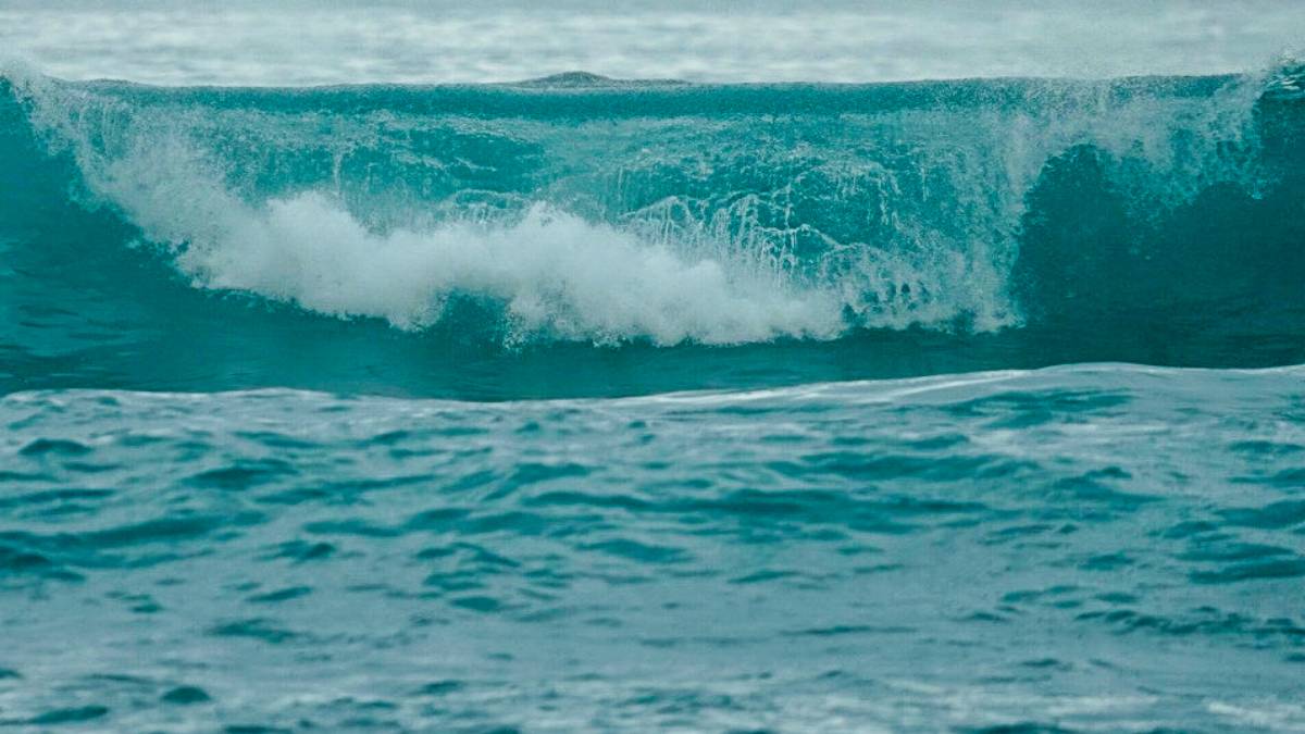
As of Tuesday morning, it is 230 miles north-northwest of Līhu‘e.
Updated at 11 a.m. Sept. 8
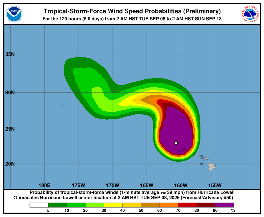
Hurricane Lowell continues to move away from Kaua‘i and Ni‘ihau and is forecast to gradually weaken over the next few days, according to the 11 a.m. advisory from the National Hurricane Center.
The fast-moving storm reached its closest point to the main Hawaiian Islands on Monday night. As of Tuesday morning, it is 230 miles north-northwest of Līhu‘e.
Flash flooding remains a threat to all Hawaiian Islands as periods of heavy rainfall associated with Lowell will linger over the eastern Hawaiian Islands through Wednesday. This may produce areas of flooding for urban and low-lying regions, with significant flash flooding and mudslides possible across portions of the Big Island.
Hurricane Lowell’s sustained maximum winds have decreased to 75 mph, with higher gusts. The storm is traveling north at 15 mph. Lowell is then forecast to turn toward the northwest
and west and slow down on Wednesday and Thursday after passing the main Hawaiian Islands.
The National Weather Service has canceled the tornado watch for Kauaʻi County. It also has canceled the flash flood warning for the county.
Hurricane and tropical storm warnings have been canceled.
For the Big Island, the storm has generated extremely high surf and heavy rain in places.
High surf warning
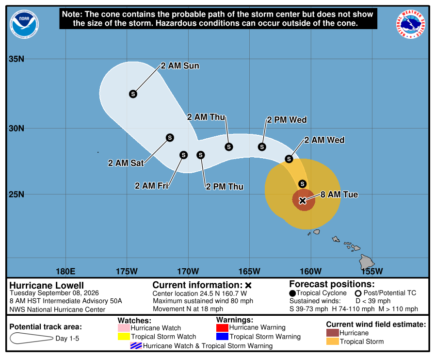
A high surf warning is in effect for south and west-facing shores of the Big Island until 6 p.m. Tuesday, according to the National Weather Service.
Surf of 12 to 16 feet is forecast for south-facing shores of the Big Island.
For west facing shores, surf of 6 to 8 feet is forecast for Monday morning and rapidly will build Monday afternoon and evening to 12 to 16 feet.
Expect ocean water surging and sweeping across beaches, coastal benches and lava flows, creating the potential for impacts to coastal properties and infrastructure, including roadways.
Powerful longshore and rip currents will be present at most beaches. Large breaking waves and strong currents may impact harbor entrances and channels causing challenging boat handling.
Flood watch
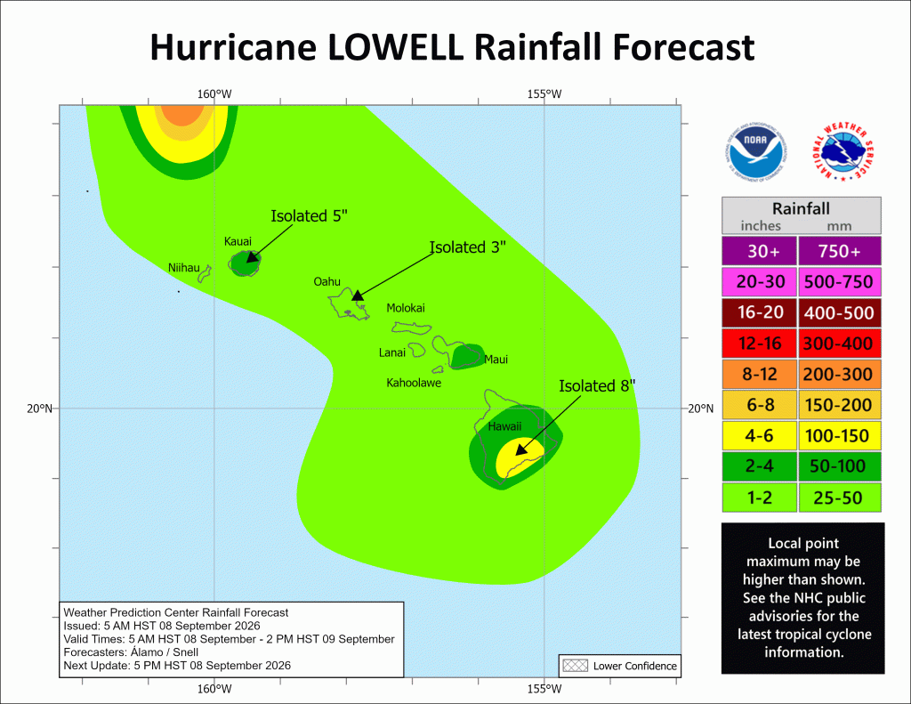
A flood watch is in effect for the entire state, with the Big Island forecast to receive 3 to 8 inches of rainfall, with isolated totals up to 12 inches possible.
Kauaʻi County is expected to receive additional rainfall totals of 4 to 8 inches, with maximum totals possibly exceeding 24 inches in some locations. Maui and Oʻahu are expected to get 2 to 5 inches of rain, with isolated maximum totals of 10 inches possible.
Rainfall could produce significant flash flooding and mudslides, especially on Kauaʻi and portions of the Big Island.
After the storm
Visitors should confirm flights, accommodations and activities directly with airlines, hotels and other providers. Visitor information is available online and by calling 1-800-GOHAWAII.
Contact Civil Defense at 808-935-0031 or visit the Civil Defense website if you have any questions or require assistance.
Check the Hawai‘i County Hazard Impact Map for even more information.







