


Thursday weather update: Hurricane warning issued for Big Island as Lala continues march toward state
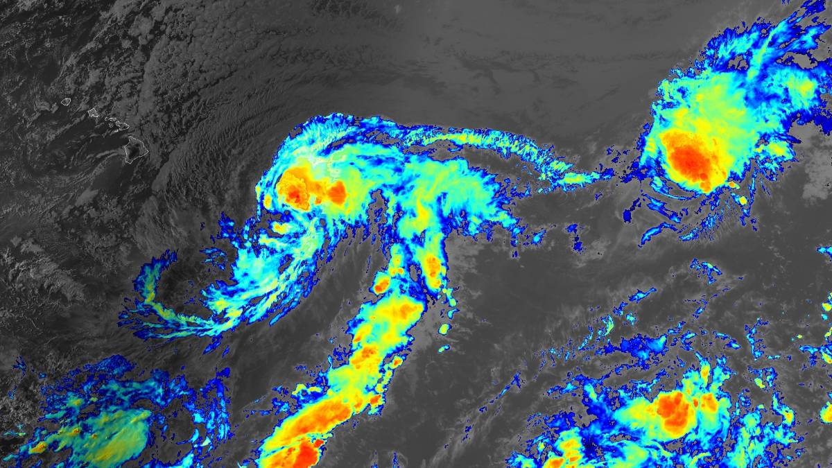
The tropical storm was about 550 miles east-southeast of Hilo by 5 p.m. today (Aug. 13), with maximum sustained winds of 60 mph and moving west-northwest at 12 mph; National Weather Service forecasters in Honolulu also issued a tropical storm warning for Maui County.
Editor’s note: This story was updated at 6:31 p.m. Aug. 13, 2026.
National Weather Service forecasters in Honolulu issued a hurricane warning in effect until further notice for the Big Island because of the threat for dangerous and damaging winds as well as heavy, flooding rainfall within the next 36 hours because of Tropical Storm Lala.
The warning replaces a hurricane watch that was previously in effect for the island.
Forecasters also issued a tropical storm watch for Maui County as the storm continues to move toward the state.
Lala was about 550 miles east-southeast of Hilo, or about 770 miles east-southeast of Honolulu, by 5 p.m. today. It had maximum winds of 60 mph and was moving west-northwest at 12 mph.
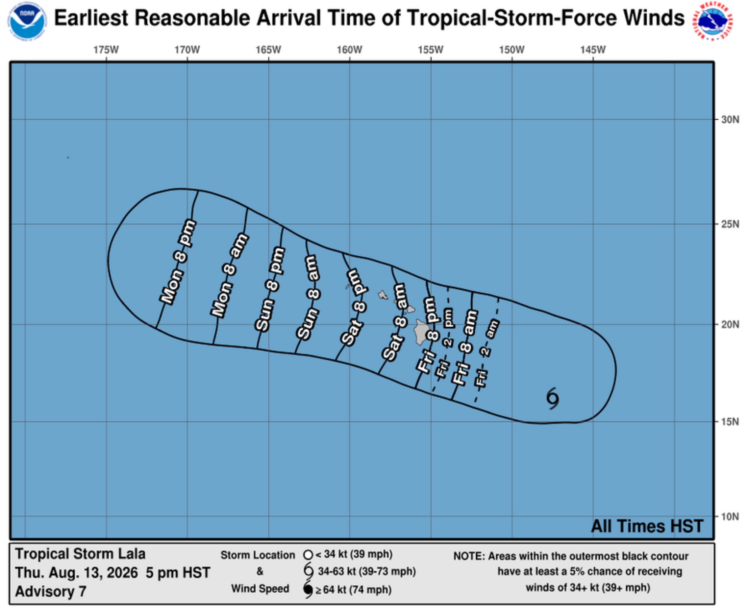
Central Pacific Hurricane Center reports a faster west-northwestward motion is expected during the next several days, with the storm forecast to be near the Big Island by Saturday and pass by to the south of the rest of the state later during the weekend.
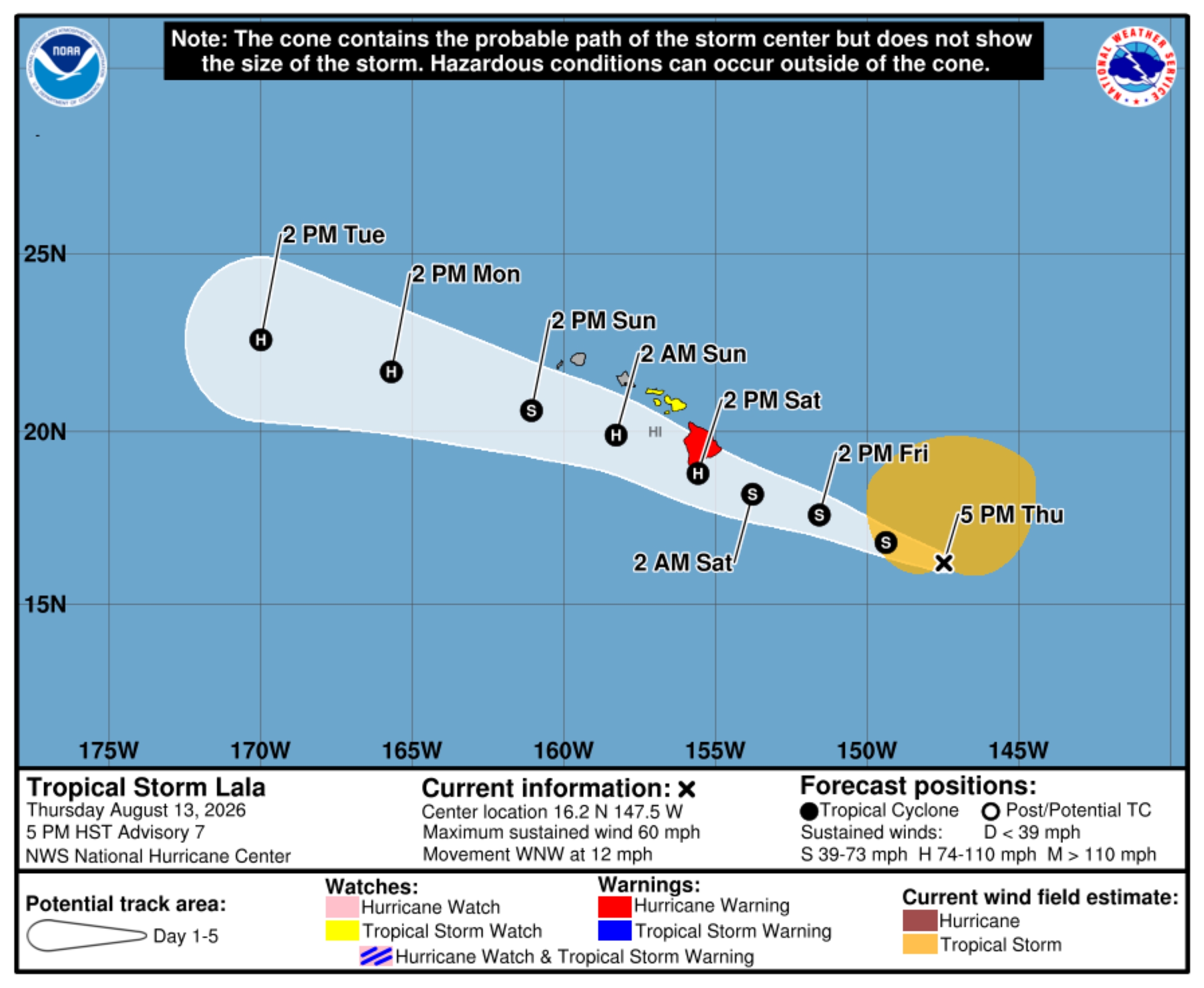
Lala also will steadily strengthen and is expected to become a hurricane as it approaches Hawai’i County.
Tropical storm force winds extended outward from the storm’s center up to 275 miles by the hurricane center’s 5 p.m. update.
Hazards on the Big Island and Maui will include:
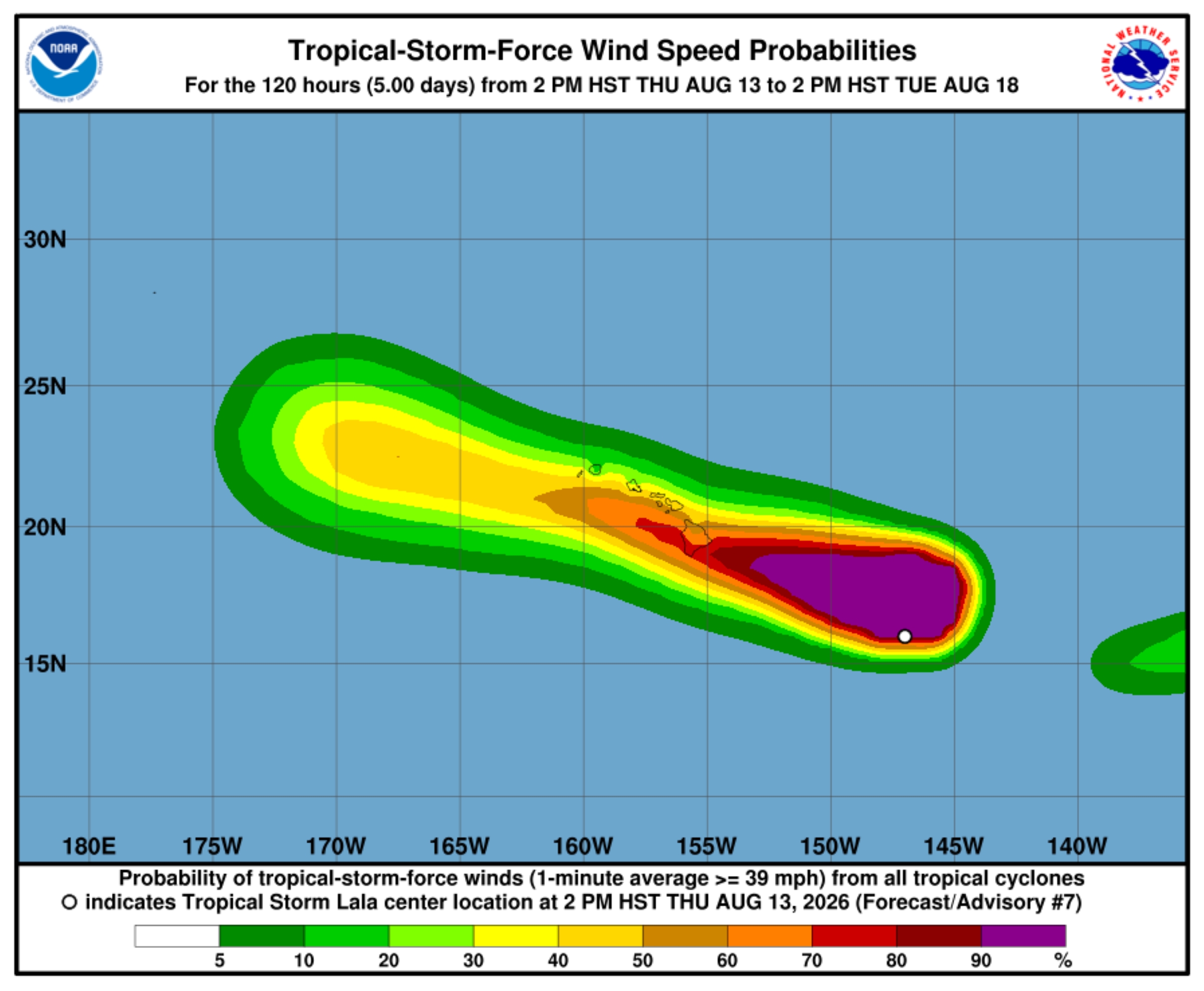
- WIND: Hurricane conditions are expected by early Saturday, with tropical storm conditions possible by late Saturday in Maui County by late Saturday. Wind speeds atop and on windward slopes and mountains are often up to 30% stronger than the near-surface winds indicated in this advisory, and in some elevated locations could be even greater. Some locations on the Big Island have the potential to see winds of up to 110 mph.
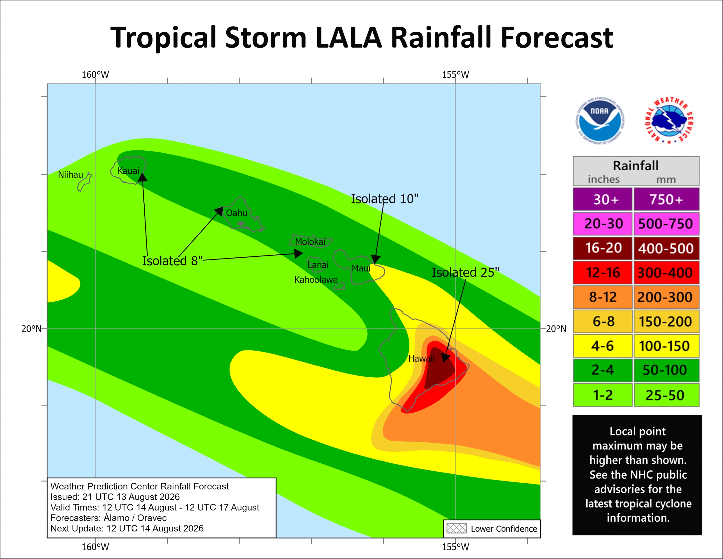
- RAINFALL: Tropical Storm Lala is expected to produce rainfall totals generally of 8 to 12 inches across Maui County and the Big Island, with maximum totals of 25 inches possible on the Big Island. Rainfall totals of 4 to 6 inches, with maximum amounts of 8 inches, are forecast for the remainder of the island chain. This rainfall can produce life-threatening flooding and mudslides, especially in areas of steep terrain.
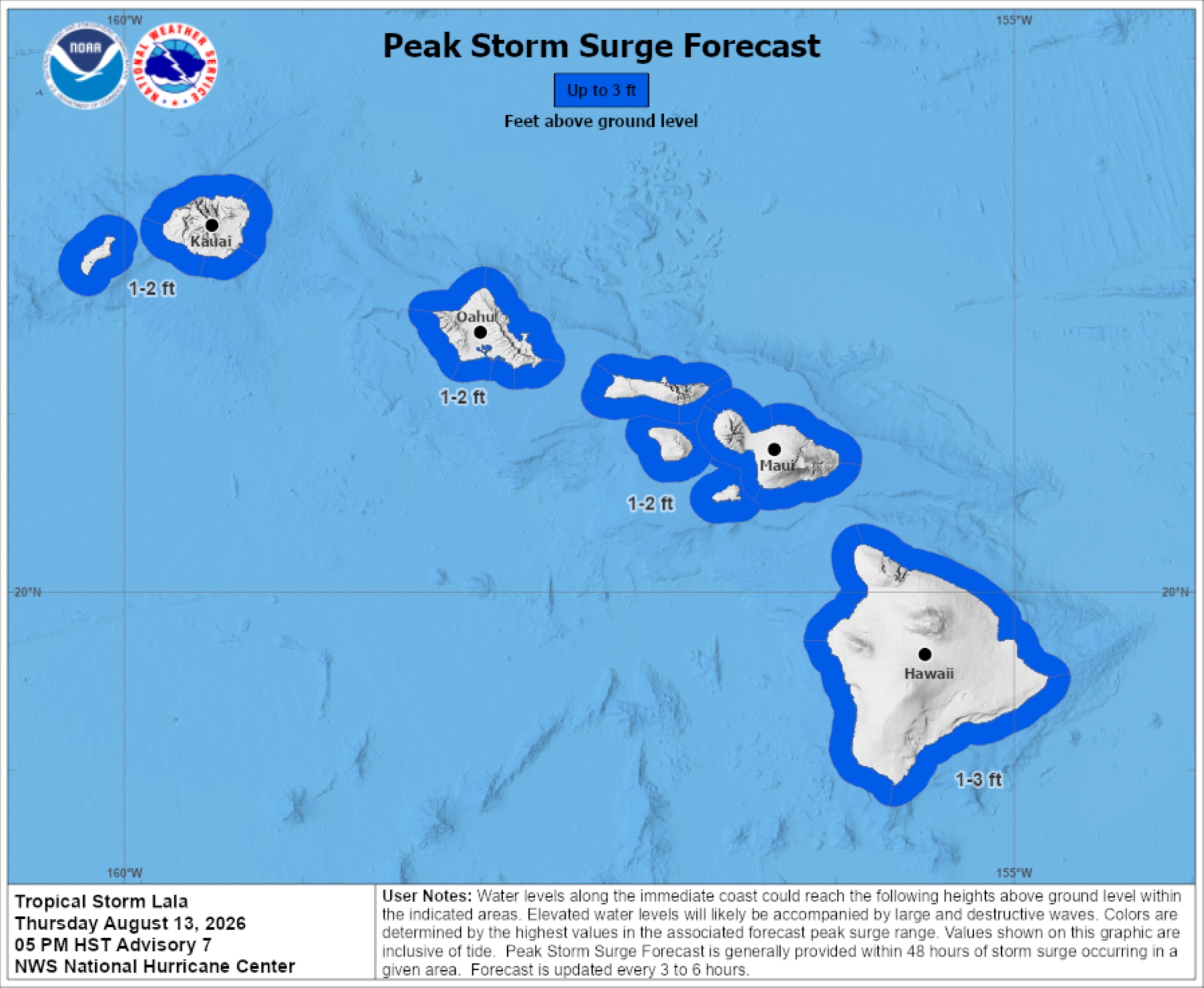
- STORM SURGE: The combination of dangerous storm surge and tide will cause normally dry areas near the coast to be flooded by rising waters moving inland from the shoreline. The water could reach from 1 to 3 feet above ground in some locations if peak surge happens at the same time as high tide. The deepest water will be along the immediate coast, where surge will be accompanied by large and dangerous waves.
- SURF: Swells generated by Lala are expected to reach east-facing shores of the state Friday, spreading west and building through the weekend. These swells are likely to cause life-threatening surf and rip current conditions.
There also is a chance for tornadoes spawning from Lala, with limited impacts around the Big Island.
A flood watch also is now in effect through late Saturday night for portions of the Big Island and Maui County as flash flooding from excessive rainfall is possible.
Flood prone roads and other low lying areas could be closed because of elevated runoff and overflowing streams. Urban areas also could receive more significant flooding and property damage because of rapid runoff.
Lala will bring heavy rainfall to the state, especially the Big Island and Maui, beginning Friday evening and likely extending through Saturday night.
Rainfall amounts generally of 10 to 15 inches are possible over upslope/windward areas of the Big Island, with generally 8 to 12 inches over the same areas of Maui. Higher localized
amounts are possible, with up to 25 inches on the Big Island and up to 15 inches on Maui.
The public is advised to monitor later forecasts issued by the National Weather Service Honolulu forecast office and be prepared to take action if flash flood warnings are issued. National Weather Service also will have storm information online for specific locations, including possible inland watches and warnings.
National Weather Service also issued earlier Thursday the following advisories:
- Tropical storm warning for offshore waters of the Hawaiian Islands, extending out to 240 nautical miles, including the portion of the Papahanaumokuakea Marine National Monument east of French Frigate Shoals.
- High surf advisory through 6 a.m. Friday for south-facing shores. A new long-period south swell should peak today at advisory thresholds, with large breaking waves of 8 to 12 feet forecast, before beginning to diminish tonight. It could linger, however, at advisory thresholds through Friday.
U.S. Coast Guard port captain in Honolulu also is increasing port heavy weather conditions for commercial ports of Maui and Hawai‘i counties as of 8 p.m. today and 8 a.m. Friday because of Lala.
Current conditions and changes are as follows:
- Hawai‘i County: Commercial ports will increase at 8 p.m. today from X-ray to Yankee. The ports at 8 a.m. Friday then increase to Zulu.
- Maui County: Commercial ports will increase at 8 a.m. Friday from X-ray to Yankee.
- City and County of Honolulu: Remains at X-ray.
- Kaua‘i County: Remains at Whiskey.
During heavy weather condition Yankee, sustained tropical storm force winds of 39 mph are expected within 24 hours. Incoming traffic is prohibited without specific approval, cargo operations must cease within 12 hours and lightering and bunkering must also cease.
All cargo operations within an affected port are prohibited during Zulu condition and the port is closed.
Condition Whiskey is set when National Weather Service advisories indicate sustained gale force winds of 39 to 54 mph within 72 hours.
Condition X-ray is set when weather advisories indicate sustained gale force winds within 48 hours.
Click here for additional information about port conditions. Follow the Coast Guard on Facebook, X and Instagram for updates.
Hawai‘i County Department of Water Supply advises customers and the public to prepare for drinking water needs as severe weather and high winds can disrupt the electrical power grid, which can cause interruptions to water service.
Customers and those who depend on a continuous supply of county water should review their personal situation and prepare accordingly.
Ways to safely store drinking water are listed in the Water Emergency Preparedness Guide available online.
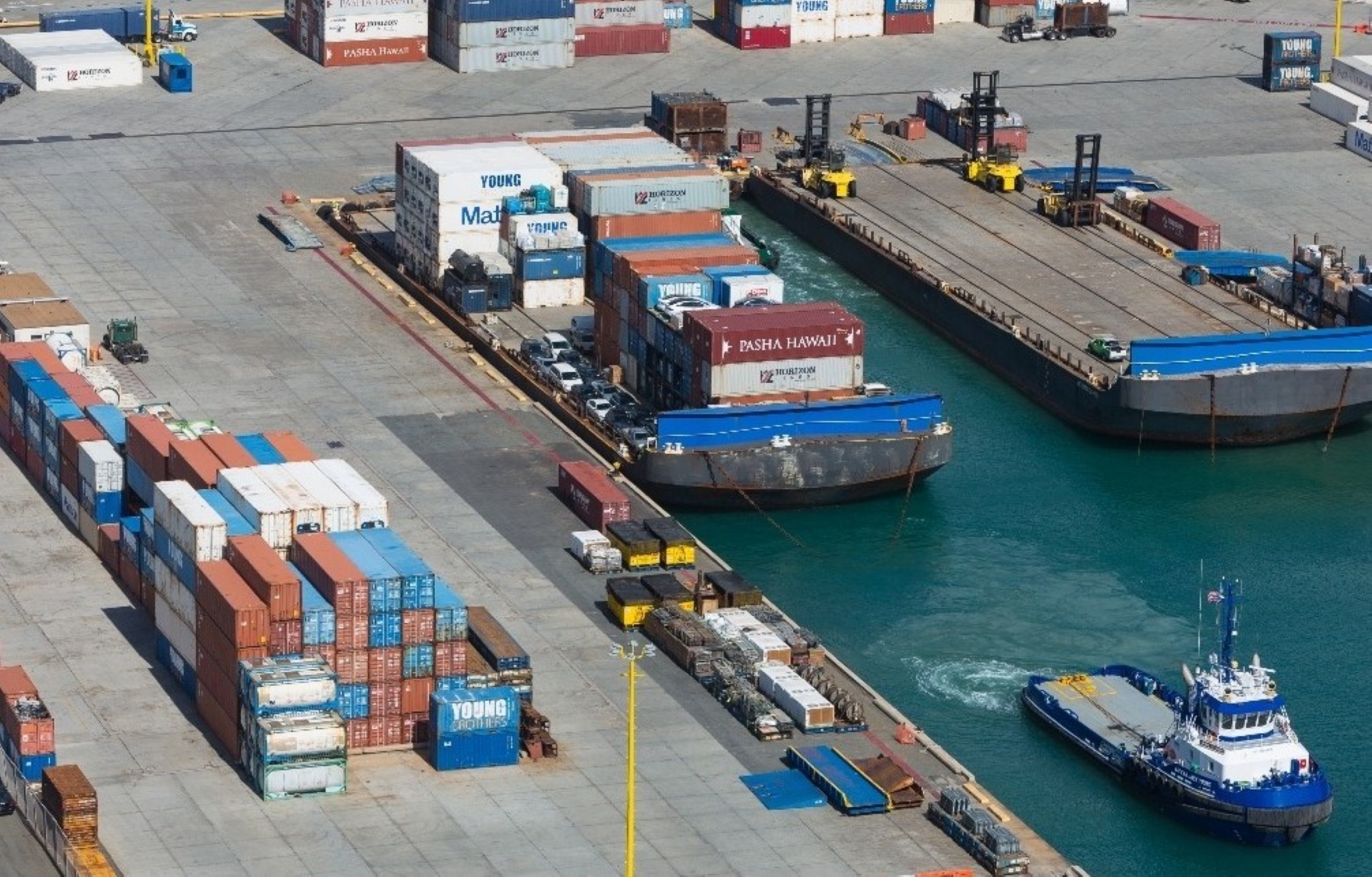
Shipping company Young Brothers is working closely with U.S. Coast Guard and state departments to monitor Lala. The firm made several moves Thursday.
Sailing schedule updates
Thursday: Honolulu to Nāwiliwili, Kaua‘i, and Kahului, Maui
- There are no changes. Port of Honolulu will accept refrigerated and hazardous straight-load cargo.
Thursday: Honolulu to Kawaihae on the Big Island
- Canceled. Coast Guard officials will close the Kawaihae port at 8 p.m. today for all inbound traffic and at 8 a.m. Friday to all outbound traffic. The port will be preparing to keep cargo safe.
- The port will be open 7:30 a.m. to 11:30 a.m. Friday for pickup of all dry straighload and palletized cargo.
- NO acceptance for refrigerated cargo, hazardous cargo or livestock.
- The next sailing to Kawaihae will be the regularly scheduled Aug. 17 departure and Aug. 18 arrival.
Hawaiian Electric advises its customers to review their emergency plans and ensure they have necessary supplies on hand. Preparation and safety tips can be found at the electric utility’s website.
Hawai‘i County Civil Defense also urges residents to prepare for high surf, flooding rains and damaging winds, making sure they have food, water and fuel as well as signing up for alert messages.






