


Hurricane Fausto Friday Update: Risk of some impacts from wind, rainfall increasing, high surf advisory extended
While the storm is expected to weaken and there are no current coastal watches or warnings in effect for Hawaiʻi, the risk of wind and rainfall impacts to the state is increasing.
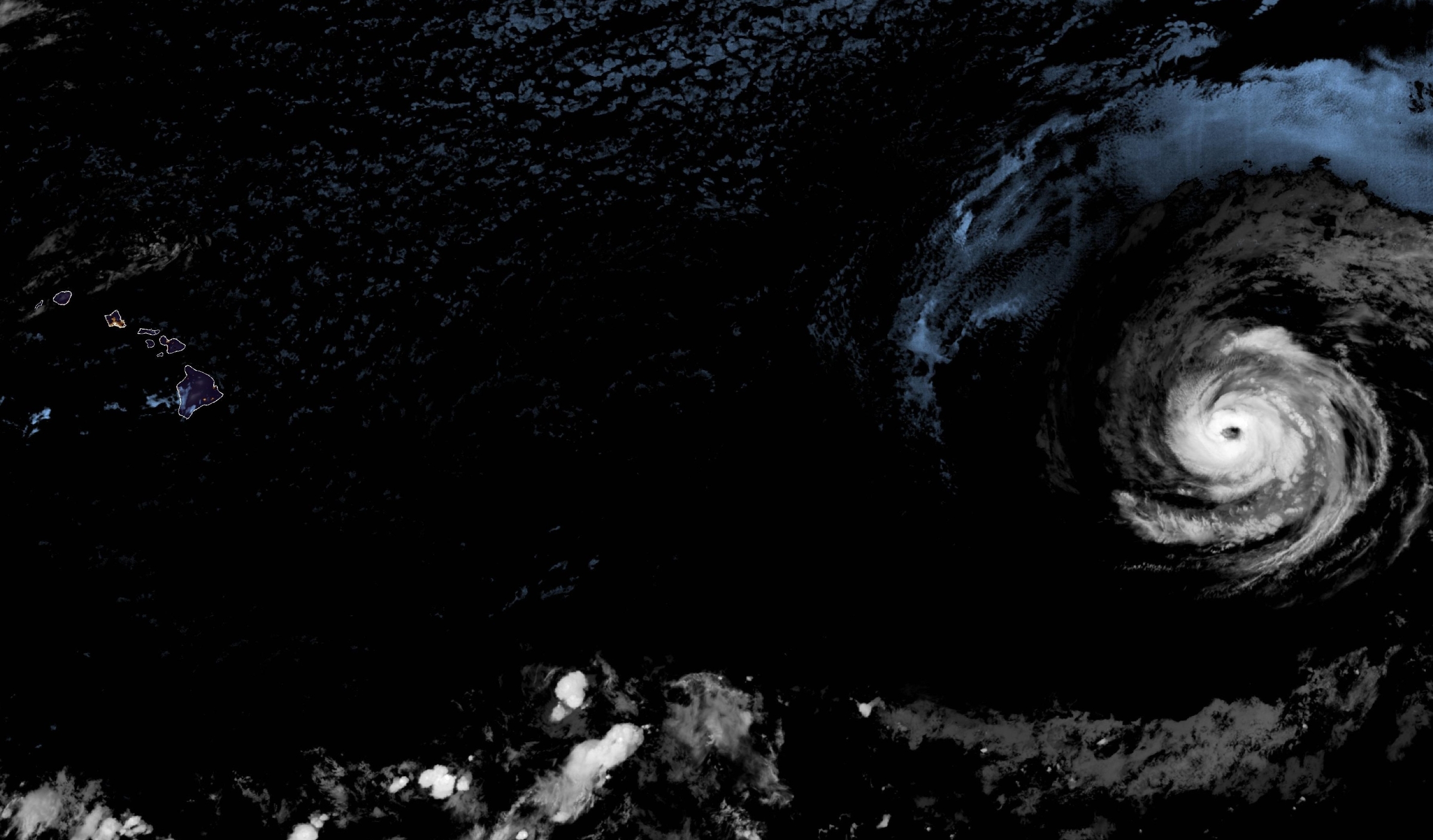
Updated 4:00 p.m. July 24:
Hurricane Fausto, the first hurricane of 2026 to move into the Central Pacific Basin, strengthened overnight to a Category 2 and now has maximum sustained winds of 105 mph as of the 11 a.m. Friday advisory by the National Weather Service.
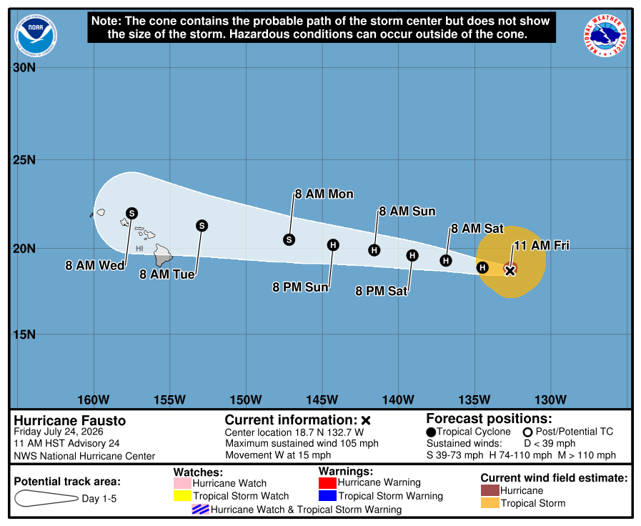
The storm was centered approximately 1,460 miles east of Hilo on the Big Island and moving west at approximately 15 mph. The storm is expected to continue along this general track for the next several days.
Forecasters believe Fausto is at or near its peak intensity and they expect gradual weakening to begin as the system moves over cooler waters and encounters drier air and increasing wind shear.
The National Weather Service has expressed relatively high confidence that Fausto will have weakened to a tropical storm by the time it reaches the vicinity of Hawaiʻi, according to Kauaʻi Emergency Management Agency.
But while the storm is expected to weaken and there are no current coastal watches or warnings in effect for Hawaiʻi, the risk of wind and rainfall impacts to the state is increasing. It remains too early to determine the exact location or magnitude of those impacts.
If Fausto stays on its expected course, it could bring high winds, hazardous surf and rain to parts of Hawai‘i as early as Monday night.
“We’re keeping an eye on the system and will provide updates as we learn more about its track,” said Mayor Kimo Alameda. “The storm is also a good reminder to make sure that you and your family are prepared this hurricane season.”
The County of Hawaiʻi is reminding residents to take the following steps to limit damage from storms and keep themselves safe:
- Make a plan for how to shelter at home, or move to safe shelter before a storm arrives;
- Trim vegetation that could be downed by wind and cause damage to the home;
- Clear any debris that may block water from flowing around drainage areas;
- Food, water and medication is stocked for everyone in your household (including pets);
- Prepare for power outages
- Sign up for Civil Defense emergency alerts online.
“The forecast this season is for more tropical cyclone activity than a normal year, and the wet spring caused heavy vegetation growth, which resulted in more fuel and higher wildfire risk as the summer proceeds,” said Civil Defense Administrator Talmadge Magno. “Now is a good time to make sure you are prepared for a hurricane, and if you live in a fire-prone area, assure you have taken steps to reduce your risk.”
Elevated surf is expected along east-facing shores late this weekend into early next week.
The swells are likely to cause life-threatening surf and rip current conditions, the National Weather Service advisory said. A depiction of rip current risk for the United States can be found here.
Hurricane force winds extended up to 45 miles out from the hurricanes center with tropical storm force winds extending up to 185 miles.
Hawai‘i County Department of Water Supply urges customers to get storm ready as the first hurricane of the 2026 Central Pacific Basin 2026 hurricane season moves toward the state. The department also provided tips to prepare.
A high surf advisory for south-facing shores of the entire state was extended until 6 p.m. Saturday as a long-period south-southwest swell continues to produce advisory level surf along south-facing shores this afternoon.
Forecasters at National Weather Service in Honolulu said the swell is expected to decline tonight, but a reinforcing pulse of long-period south-southwest energy high surf is expected to bring surf back to advisory level by Saturday afternoon and possibly continuing through the weekend.
Additional updates will be provided as Fausto continues to spin toward Hawai‘i.







