


UPDATE: High surf advisory extended for south-facing shorelines of Hawaiʻi
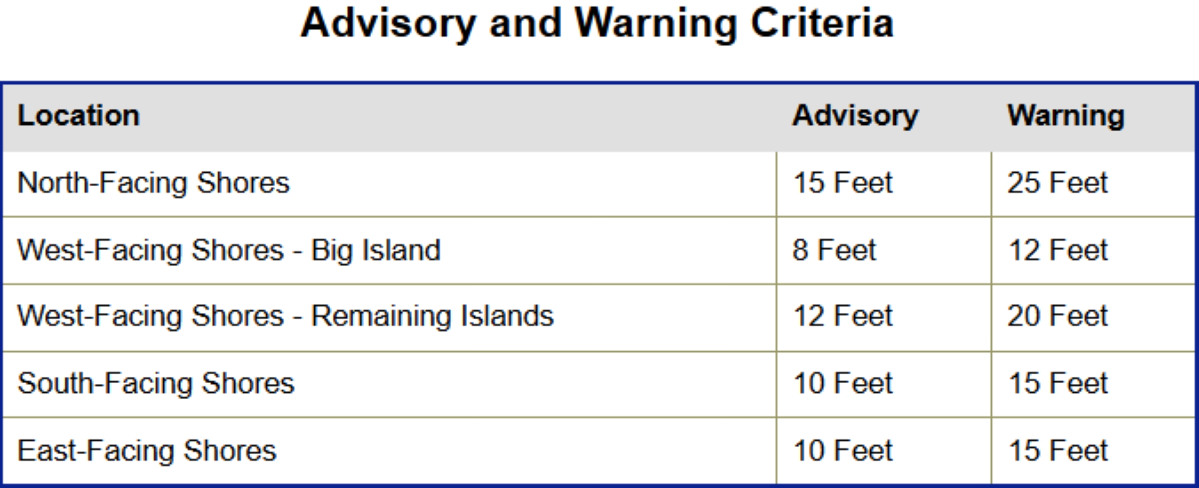
National Weather Service forecasters in Honolulu issued a high surf advisory that goes into effect at 6 a.m. July 23 and will continue until 6 p.m. on Friday, July 24, for all south-facing shorelines throughout the state.
Surf of 8 to 12 feet is forecast, causing strong breaking waves and strong currents that will cause dangerous conditions for swimming and other water activities along south shores.
“Forerunners from a moderate, long-period south swell are already reaching Hawai’i this afternoon,” said National Weather Service in the advisory the afternoon of July 22. “The swell builds tonight into Thursday, with surf increasing to advisory level along south-facing shores sometime on Thursday.”
The swell could peak near warning level overnight Thursday into Friday, and long-period south swell energy also will keep surf elevated beyond Friday.
“Which may require the advisory to be extended through the weekend,” the advisory said.
The public is reminded to heed all advice from ocean safety officials — when in doubt, don’t go out.







