

UPDATE: Flood watch canceled for Big Island
Update at 2 a.m. March 25, 2026: The flood watch issued by National Weather Service forecasters in Honolulu, which was originally in effect until 6 a.m. Wednesday, March 25, for the Big Island was canceled just after 1:30 a.m. Wednesday.
Forecasters said flooding is no longer expected to pose a threat.
Hawaiʻi County was the only place in the state still under a flood watch as of Tuesday. There were no watches or warnings in effect anywhere in the state as of 2 a.m. Wednesday.
The only advisory that remained in effect — until 6 a.m. Wednesday — was a small craft advisory around all islands.
Update: 4:25 p.m. March 24, 2026: The National Weather Service has extended the flood watch on portions of the Big Island until 7:45 p.m. Tuesday.
At 4:11 p.m., radar and automated rain gauges indicated heavy rain showers over Kohala and Hilo districts, along with Puna and Kaʻū. Rain was falling at a rate of 1 to 2 inches per hour. The heaviest rainfall is occurring near Pahala. Additional heavy showers are expected.
Story originally posted 11:50 a.m. March 24, 2026: The sun shined in Hilo and Kona on Tuesday morning, March 24, but National Weather Service in Honolulu said a flood watch remains in place for Hawaiʻi County through 6 a.m. Wednesday, March 25, as the forecast continued to predict the possibility of heavy showers and thunderstorms.
“We could get some additional heavy rain in some areas, so I’d say we’re not out of the woods yet,” said National Weather Service meteorologist Thomas Vaughan.
The northeastern areas of the island are most favored for rainfall.
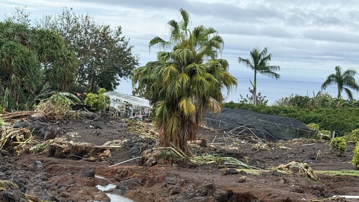
The county already received more than 400 reports from residents and commercial properties for damage suffered during the two kona low systems that hit the Big Island during the past 2 weeks.
The kona lows that struck the Big Island were about a week apart. The first occurred March 14, when properties in Ka‘ū and South Kona were flooded and damaged.
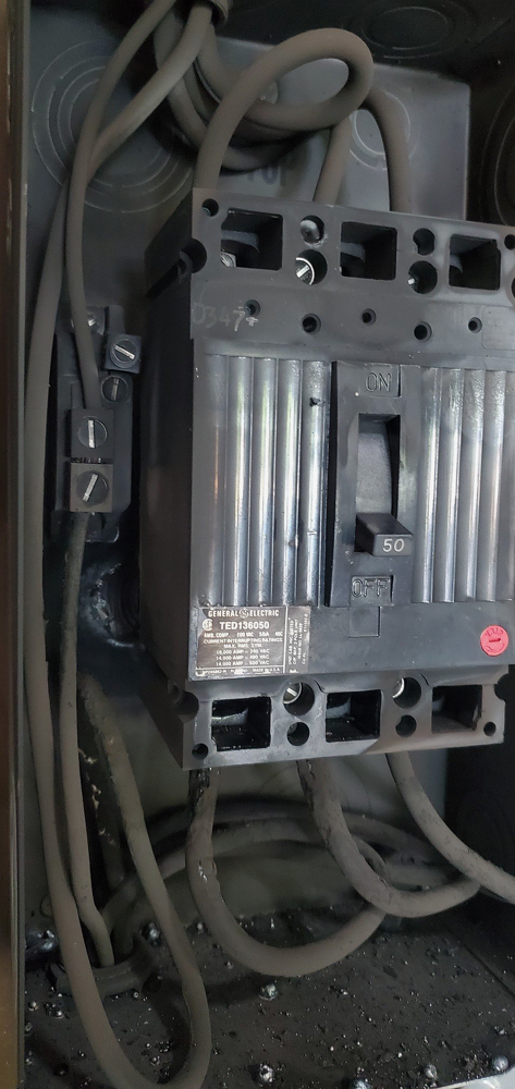
The second system hit Monday, March 23, and brought thunderstorms that forced airplanes to ground at Ellison Onizuka Kona International Airport and knocked out power for nearly 1,400 Hawaiian Electric customers in the Kealakehe and Hōlualoa areas, before moving to the eastside of the island.
Hawaiʻi County Mayor Kimo Alameda estimates the storms caused tens of millions of dollars in damage, especially with Monday’s lightning strikes.
Alameda said he is working with Hawai‘i Emergency Management Agency and Federal Emergency Management Agency on damage assessments in hopes of getting funding to help residents, farmers and ranchers recover from the losses.
Greenwell Coffee Farms was hit particularly hard March 14. Tom Greenwell, owner of the coffee farm, estimates millions of dollars in damage to one of his three farms.
Konawaena High School, Konawaena Middle School and Ke Kula ʻO ʻEhunuikaimalino also were damaged by the first kona low and remain closed for the rest of the week for cleanup and repair.
Also on Monday, lightning struck a power box at Pana‘ewa Rainforest Zoo and Gardens in Hilo, knocking out its power in the front gift shop, Alameda said. The zoo will reopen, but running on a generator.
Lightning also hit Charles “Sparky” Kawamoto Swim Stadium in Hilo, causing the pump to go out, which since was fixed. Lightning also struck at Carvalho Park, where damage is still being assessed.
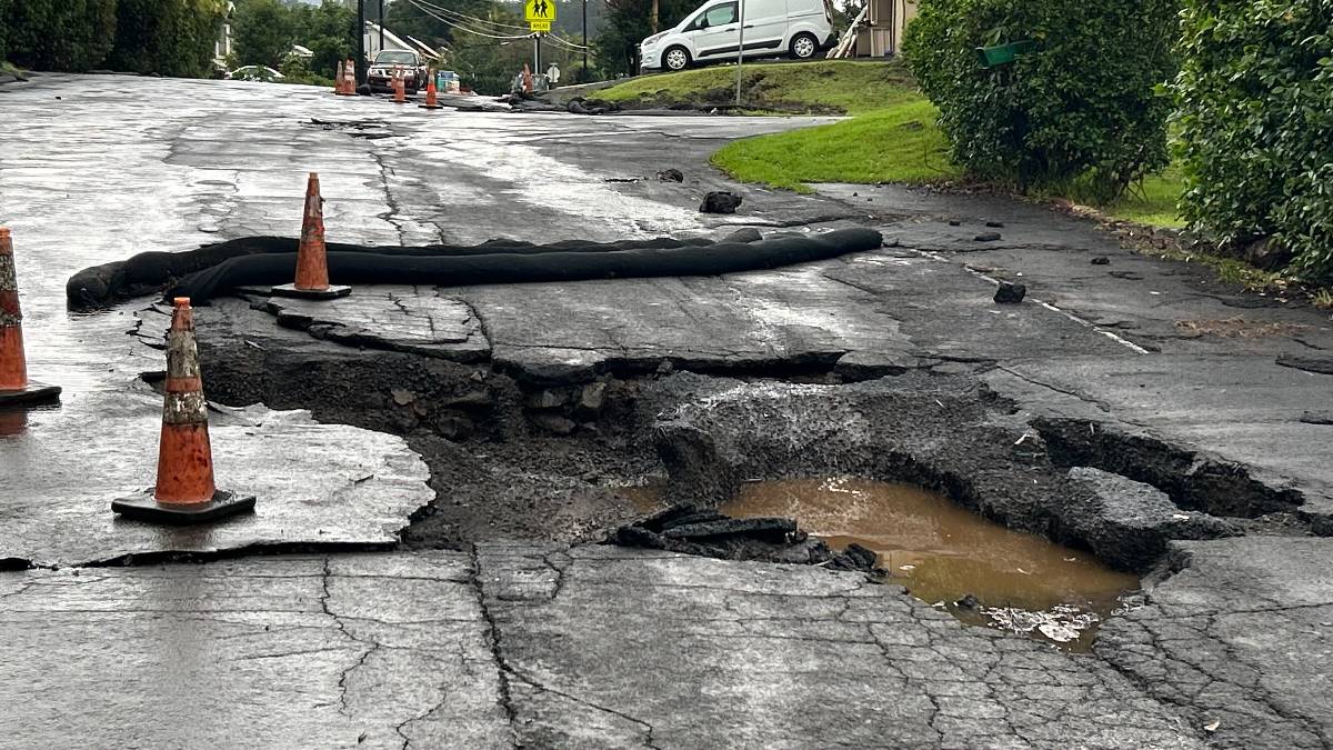
Alameda added heavy rain fell off Pikake Street in Pāhala in Ka‘ū, where it washed out pavement. Contractors will make repairs Wednesday.
The county continues to accept damage reports at the Hawai‘i County Civil Defense Agency website.
Farmers seeking aid are also encouraged to participate in a damage survey.
Hawai‘i Volcanoes National Park partially reopened, with access restored to the Kīlauea summit area and Chain of Craters Road. Work continues to clear and repair remaining areas impacted by last week’s storm and the recent episode of the ongoing episodic eruption at the summit.
Sponsored Content


