

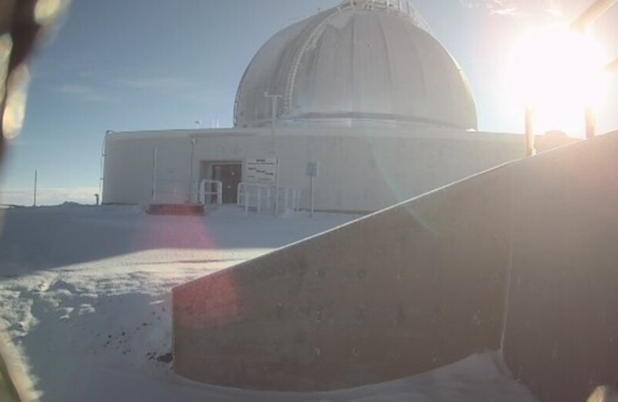
UPDATE: High wind advisory in effect for Big Island summits until noon
Update at 4 a.m. Feb. 23, 2026: A high wind warning has been canceled, and a high wind advisory is in effect on the summits of Mauna Kea and Mauna Loa on the Big Island until noon today.
The National Weather Service expects sustained winds from 40 to 50 mph, with gusts up to 60 mph. Winds of this strength can make driving and walking dangerous.
The winds can forcefully open doors, damage hinges, or slam doors shut, possibly causing injuries.
Forecasters advise the public to consider postponing travel to the summits until conditions improve. If travel is required, use extra caution while walking, opening or closing doors, and when driving, especially if operating a high-profile vehicle.
Update at 9:54 a.m. Feb. 22, 2026: The high wind warning in effect for the summits of Mauna Kea and Mauna Loa on the Big Island was extended until 6 a.m. Monday (Feb. 23) as blustery conditions are expected to persist atop both mountains.

West winds of 50 to 60 mph, with gusts up to 70 mph, continue to be expected to whip across the mountaintops through today and into the beginning of the work week.
National Weather Service forecasters in Honolulu remind the public that winds this strong can make driving and walking dangerous. Doors also can be forcefully opened, damaging hinges, or slammed shut, causing injuries, with winds that strong.
Necessary precautions should be taken to protect property at the summits, and forecasters say travel to the summit areas should just be delayed until winds subside, if possible.
Update at 7:57 a.m. Feb. 22, 2026: A winter weather advisory that had been extended until noon today (Feb. 22) for the summits of Mauna Kea and Mauna Loa on the Big Island, above 12,000 feet, was lifted only a few hours later.
Forecasters with the National Weather Service office in Honolulu canceled the advisory just after 7:15 a.m. today, about 4 hours and 45 minutes early.
They report that the threat for impactful winter weather atop the mountains has ended.
However, while the wintry mix of additional snow and ice accumulations at both summits is no more, a high wind warning remains in effect until 6 p.m. today for both summits.
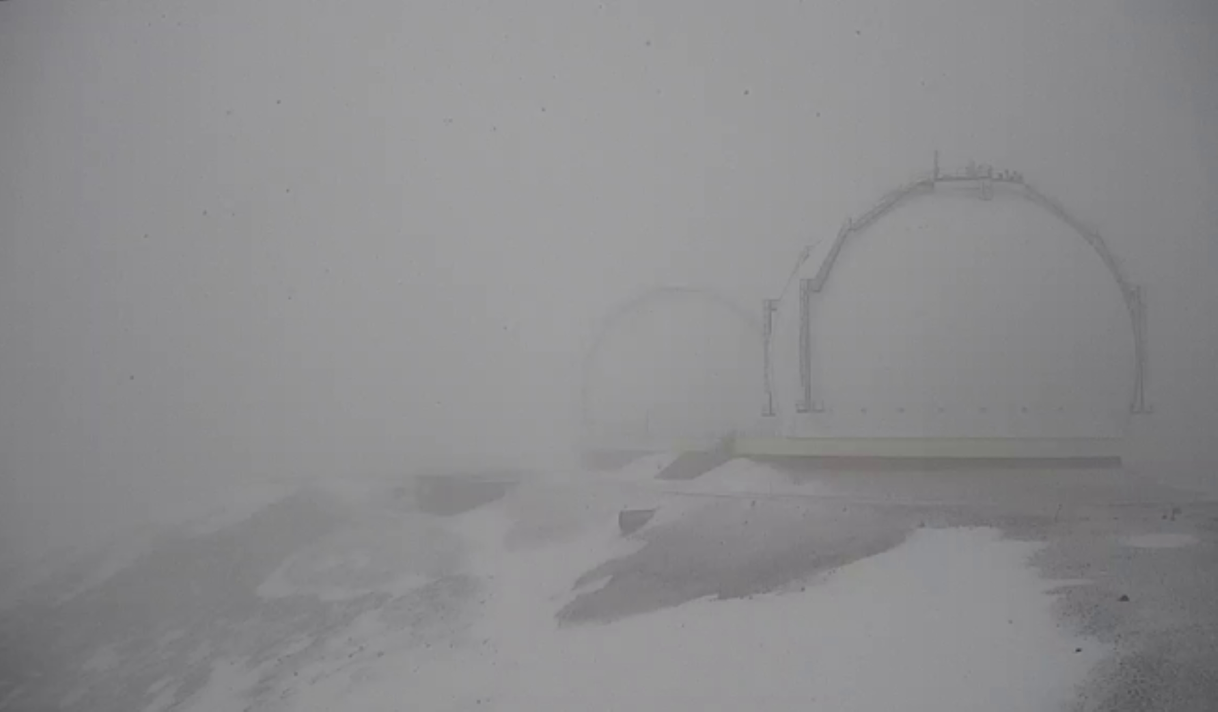
Blustery conditions with sustained west winds of 50 to 60 mph, and gusts of up 70 mph, are forecast to scream over the mountaintops.
Precautions should be taken to protect property at the summits because winds this strong can forcefully open doors and damage hinges or slam doors shut, possibly causing injuries
Travel to summit areas also should be postponed until winds subside.
Update at 5:59 a.m. Feb. 22, 2026: National Weather Service forecasters in Honolulu extended until noon today (Feb. 22) a winter weather advisory in effect for the summits of Mauna Kea and Mauna Loa above 12,000 feet.
An upper level trough and associated cold air will introduce freezing drizzle and light snowfall to the summits this morning.
Additional snow accumulations up to 1 inch mixed with less than a quarter of an inch of ice accumulations are forecast for the summits, with winds gusting as high as 70 mph.
Hazardous wintry weather could make travel at the summits very difficult. Blowing snow also will significantly reduce visibility at times, including periods of zero visibility.
The two summits also are under a high wind warning in effect until 6 p.m. today, with blustery, sustained west winds of 50 to 60 mph and gusts of up 70 mph in the forecast.
Precautions should be taken to protect property at the summits because winds this strong can forcefully open doors and damage hinges or slam doors shut, possibly causing injuries
Strong winds such as those forecast make driving and walking dangerous.
Travel to summit areas should be postponed until winds subside.
Update at 4:01 p.m. Feb. 21, 2026: The winter weather advisory issued earlier today (Feb. 21) for the summits of Mauna Kea and Mauna Loa on the Big Island was extended until 6 a.m. Sunday (Feb. 22) as additional snow, freezing fog and freezing drizzle continue to impact both summits above 12,000 feet.
An upper level disturbance will continue to produce periods of the hazardous wintry mix through tonight to the summits. Up to 2 inches of new snowfall is possible along with the icing mix.
Travel at the summits will continue to be very difficult, especially with freezing fog significantly reducing visibility at times, even causing periods of zero visibility.
Snow showers should generally be on the decrease overnight, but slick conditions could continue through the morning hours.
Story originally posted at 5:23 a.m. Feb. 21, 2026: An upper-level disturbance and cold air aloft is expected to bring freezing drizzle and light snowfall today (Feb. 21) to areas above 12,000 feet on the summits of Mauna Kea and Mauna Loa on the Big Island.
That wintry weather could make travel very difficult, and blowing snow will significantly reduce visibility at times, with periods of zero visibility.

Because of the possibility of hazardous winter conditions, National Weather Service forecasters in Honolulu issued a winter weather advisory now in effect until 6 p.m. today for the summits above the 12,000-foot level.
A winter weather advisory means periods of snow, sleet or freezing rain will cause travel difficulties.
Forecasters in Honolulu say snow and freezing drizzle, with up to 2 inches of new snowfall along with a wintry mix of icing possible today.
Combined with times of blowing snow — significantly reducing visibility at times, including likely periods of zero visibility — the winter weather conditions will make travel very difficult.
The public should be prepared for slippery roads and limited visibilities, using extreme caution if they must travel to either summit.
Sponsored Content


