

UPDATE: High wind warning canceled for much of Big Island, replaced with high wind advisory
Update at 3:16 p.m. Monday, Feb. 9, 2026: National Weather Service forecasters in Honolulu canceled a high wind warning previously in place for much of the Big Island, replacing it with a high wind advisory until 6 p.m. Tuesday (Feb. 10).
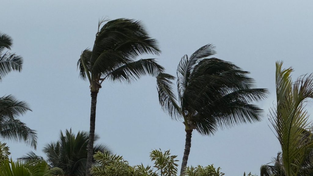
East winds of 20 to 30 mph, with gusts up to 50 mph, are still expected in the Kohala, interior, southern, southeastern and northern portions of the island.
Winds this strong can still tear off shingles, knock down tree branches, blow away tents and awnings and make it difficult to steer, especially for drivers of high-profile vehicles.
The public is advised to watch out for falling tree branches when walking or driving. Make
sure tents and awnings are secure or taken down, and continue to be prepared for additional power outages.
Update 7:17 a.m. Feb. 9: Several weather alerts remain in place till 6 p.m.
This includes the flood watch for all districts and the high wind warning for the Kohala and Ka‘ū Districts and the Island interior.
The flood advisory for the Kohala and Hāmākua Districts remains in effect through this morning, and the high surf warning for north- and east-facing shores of Hawai‘i Island remains in effect through Tuesday morning.
You are encouraged to limit driving to essential travel only. If you do drive today, please drive with caution and be prepared for road closures which can happen at any time.
All non-essential Hawai‘i County services and operations, including all parks and solid waste facilities, will be closed today. All public schools and the University of Hawai‘i will also be closed today.
Hele-on bus riders should check the Hele-on bus website for any modified or canceled routes.
Update: 9:50 p.m. Feb. 8: The flood advisory for the Big Island has been extended until midnight Sunday.
At 8:43 p.m., radar indicated heavy rain over portions of the coastal and upslope areas of the Hamakua and Hilo districts.
The heaviest rain was falling at a rate of 1 to 2 inches per hour, mainly between Hawi and Laupahoehoe, particularly over the Pu’u O Umi Natural Area Reserve. This could result in flooding in stream channels and along portions of Highway 19.
A statewide Flood Watch also is in effect until 6 p.m. Monday.
3:15 p.m. Feb. 8 update: A flood advisory is in effect for Big Island until 9 p.m. Sunday evening.
Excessive rainfall is causing flooding on roads, poor drainage areas and in steams. Some low-water crossings may become impassable, according to the National Weather Service.
At 2:57 p.m., radar indicated heavy rain over portions of the coastal and upslope areas of the Hāmākua and Hilo districts. The heaviest rain was falling at a rate of 1 to 2 inches per hour, mainly between Hawī and Laupāhoehoe, which could result in flooding in stream channels and along portions of Highway 19.
Some locations that will experience flooding include: Kapaau, Honokaa, Paauilo, Kukuihaele, Waipio Valley, Kamuela, Waimanu Valley, Ookala, Laupahoehoe, Pololu Valley, Ninole,
Kohala Ranch, Halaula, Hakalau, Honomu, Hawi, Pepeekeo, Papaikou, Mahukona and Paukaa.
The Hawaiʻi County Civil Defense Agency reminds residents in flood prone areas to remain alert as flooding can be life-threatening and to not attempt to cross flowing water in a vehicle or on foot.
The National Weather Service has also issued a high surf warning for east facing shores of Hawaiʻi Island, from ʻUpolu Point in North Kohala to South Point in Ka`ū through Tuesday.
Surf this large is dangerous and can cause injury or death. All beach parks are closed until further notice.
A flood watch is still in effect across the state until 6 p.m. Monday.
12:13 a.m. Feb. 8 update: A flood advisory has been extended until 3 a.m. today (Feb. 8) for the Big Island.
At 11:41 p.m., radar indicated moderate to locally heavy rain over windward Big Island, with the heaviest rain over the Hāmākua Coast between ʻUpolu Point and Hakalau, as well as near Hawaiian Beaches and Pāhoa.
8:52 p.m. Feb. 7 update: A flash flood warning is in effect for the North Kohala and Hāmākua districts on the Big Island through tonight.
The National Weather Service issues a flash flood warning when flooding is imminent or occurring.
Residents in flood-prone areas are advised to remain alert for potential flooding and to move to higher ground as needed.
Flooding is life-threatening, and the public is urged not to attempt to cross flowing water in a vehicle or on foot and to drive with caution. Stay vigilant for runoff, ponding water, debris, and low visibility.
Heavy rain has caused a landslide in Hāmākua on Highway 19 near mile marker 36, and motorists are advised to avoid the area for the next four hours.
A flood advisory has also been issued for windward areas of the Big Island until midnight.
Radar indicated moderate to heavy rain over Big Island, with the heaviest rain in and around
Hilo, as well as along the Hamakua Coast between Upolu Point and Laupāhoehoe.
Some locations that will experience flooding include:
- Hilo
- Hawaiian Paradise Park
- Kapaʻau
- Honokaʻa
- Honomu
- Pāpaʻikou
- Pepeʻekeo
- Hakalau
- Nīnole
- Mountain View
- Laupāhoehoe
- Glenwood
- Volcano
- Oʻokala
- Keaʻau
- Paʻauilo
- Hawaiian Acres
- Orchidland Estates
- Hawaiʻi Volcanoes National Park
For more information, visit the County of Hawaii Hazard Impact Map.
4:45 p.m. Feb. 7 update: A flood advisory is in effect through this evening in North Kohala.
According to the National Weather Service, a flood advisory is issued when minor flooding is imminent or occurring and when flooding can be life-threatening.
Residents in flood prone areas are asked to remain alert for flooding conditions. Officials ask the public to not attempt to cross flowing water in a vehicle or on foot; turn around, don’t drown.
A high wind warning has also been issued from Sunday morning through Monday for leeward, downslope areas of North and South Kohala and North Kona Districts, and Saddle Road.
Forecasters predict east winds of 30 to 35 miles per hour and gusts of 60 miles per hour.
The high surf advisory for west-facing shores has also been extended to Sunday morning and a flood watch remins in effect through Monday.
According to the Hawaiʻi County Civil Defense Agency, now is the time to prepare for the possibility of damaging winds and heavy rains.
12:48 p.m. Feb. 7 update: Sustained winds up to 40 miles per hour and gusts of over 60 miles per hour are possible on Hawaiʻi Island beginning Sunday morning (Feb. 8).
The National Weather Service has issued a high wind warning for leeward, downslope areas, North and South Kohala, and North Kona districts, and Hawaii Island interior from tomorrow Sunday morning through Monday.
During a high wind warning, people are advised to:
- Those in the high wind warning area should take necessary precautions and secure outdoor items.
- Plan for this period to limit driving to essential travel only.
- Please stay clear of downed trees and utility lines and report all hazards to authorities.
A flood watch also remains in effect across the island through Monday.
Due to the flood watch, residents are urged to take time to prepare for possible heavy rains and high winds that are forecast to arrive Sunday.
The high surf advisory for west facing shores of Hawaii Island remains in effect through this evening.
Original post: High surf advisory conditions are expected on west-facing shores of the Big Island beginning Saturday morning.
According to the National Weather Service, a large west-northwest to northwest swell will build down the island chain this afternoon and tonight. Forecasters have issued a flood watch for all Hawaiʻi islands starting tomorrow afternoon, Feb. 7.
Along west-facing shores of the Big Island, surf is predicted to build to six to eight feet Saturday morning.
According to forecasters, impacts could be moderate with strong breaking waves, and strong currents will make swimming dangerous.
The swell is expected to decline sharply Saturday afternoon and evening, with surf expected to fall below advisory levels by Sunday morning.
For more information, visit the County of Hawaiʻi Hazard Impact Map.
Sponsored Content


