

UPDATE: Coastal flood statement extended again, now in effect through early Tuesday
Update No. 3 at 7:38 p.m. Sunday, Jan. 4, 2026: National Weather Service forecasters in Honolulu again extended the coastal flood statement in effect for all low-lying coastal areas of the state — including the Big Island.
It is now in effect through early Tuesday morning (Jan. 6).
Peak monthly high tides combined with higher-than-predicted water levels will continue to lead to minor flooding along shorelines and in low-lying coastal areas.
Minor coastal flooding is most likely near the daily peak high tides, which will happen in the early morning hours.
To make conditions along eastern shores of the island even more hazardous, a high surf advisory also goes into effect from 6 a.m. Monday through 6 a.m. Wednesday.
Update No. 2 at 8:55 a.m. Sunday, Jan. 4, 2026: A coastal flooding statement issued toward the end of last week will remain in effect through late tonight, according to National Weather Service forecasters in Honolulu, as peak monthly tides continue to combine with higher-than-normal water levels.
Minor flooding can still be expected around the daily peak high tides, which happen in the early morning hours, along shorelines and in low-lying coastal areas.
Flooding is especially possible along northern low-lying coastal areas exposed to a northerly swell.
There is a potential for flooding of beaches that are normally dry, minor coastal erosion and saltwater inundation.
The public is advised to:
- Avoid driving through flooded roadways. If you are forced to drive through salt water, be sure to rinse your vehicle with fresh water as soon as possible.
- Move electronics, vehicles and other valuables to higher ground.
- Monitor vessels to ensure mooring lines don’t get too tight and watch out for overwash around boat ramps.
- Secure canoes or other watercraft stowed on beaches.
Coastal flooding photos can also be submitted to Hawaiʻi and Pacific Islands King Tides Project.
Update at 7:20 a.m. Jan. 2: Isolated coastal flooding is expected to continue through late Saturday night.
According to the National Weather Service in Honolulu, the flooding is a result of peak monthly high tides combined with water levels running higher than predicted. Minor flooding may occur along the shoreline and in low-lying coastal areas.
Minor coastal flooding is most likely to occur around the daily peak high tides, which typically happen in the early morning hours.
Update at 4:30 p.m. Dec. 31: Peak monthly high tides combined with high water levels will lead to minor flooding along the shoreline and in low-lying coastal areas of the west, south, and east-facing shores of Hawaiʻi Island.
The National Weather Service has issued a coastal flood statement for vulnerable low-lying coastal roadways, docks, boat ramps, and other coastal infrastructure of all islands through Friday night.
Coastal flooding is most likely around the daily peak high tides, which will occur a couple hours after midnight, and could cause flooding of beaches that are normally dry with minor coastal erosion and saltwater inundation.
Take precautions by avoiding driving through flooded roadways, if driving through salt water is unavoidable, rinse the vehicle with fresh water. Move electronics, vehicles or other valuables to higher ground.
Monitor vessels to ensure mooring lines don’t get too tight and watch out for overwash around boat ramps. Secure canoes or other watercraft stowed on beaches.
The University of Hawaii Sea Grant College Program’s Hawaii and Pacific Islands King Tides Project is collecting coastal flooding photos. For those interested in sharing, send the photos to pacificislandskingtides.org.
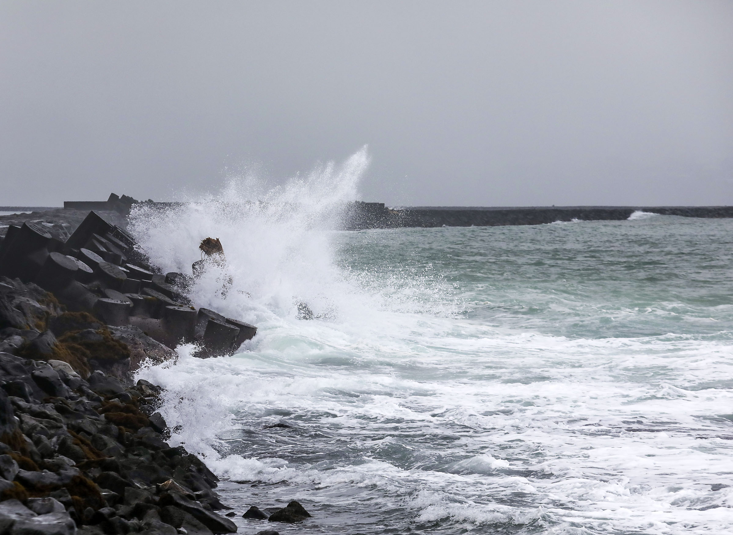
Original at 6:16 a.m. Dec. 31: Overlapping, medium-period northwest and north-northwest swells will maintain advisory-level surf, with little change through this evening (Dec. 31).
As a result, forecasters at the National Weather Service office in Honolulu issued a high surf advisory until 6 p.m. today for north-facing shores of the Big Island.
Large breaking waves of 10 to 15 feet are expected along northern shorelines, causing moderate impacts.
Strong breaking waves and strong currents also will make swimming dangerous.
The public is advised to heed all advice from ocean safety officials — when in doubt, don’t go out.
Surf is expected to decline through Friday.
Sponsored Content


