

Wave of resilience: Keaukaha community, schools to conduct tsunami evacuation exercise
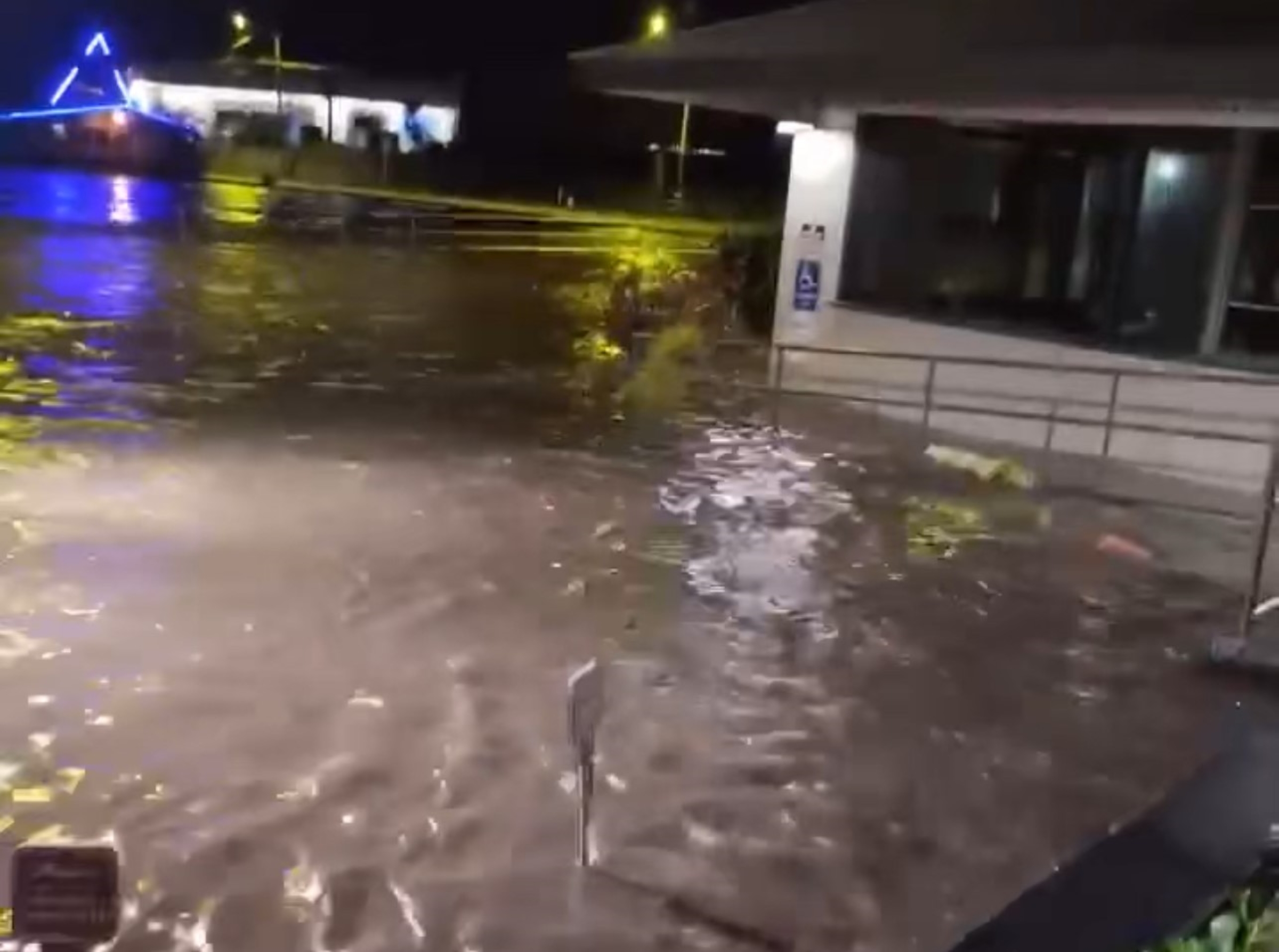
The best way to stay safe when the tsunami warning siren sounds — like it did this summer after a massive earthquake off the coast of Russia sent a tsunami wave across the Pacific — is to know how to evacuate.
Especially if you live on the coast.
Schools and residents in the Keaukaha community of Hilo this week are practicing their plans to get out of the area if and when those sirens sound again.
They are participating in an evacuation exercise Friday (Nov. 21) to strengthen resilience in the tsunami-vulnerable area adjacent to Hilo International Airport.
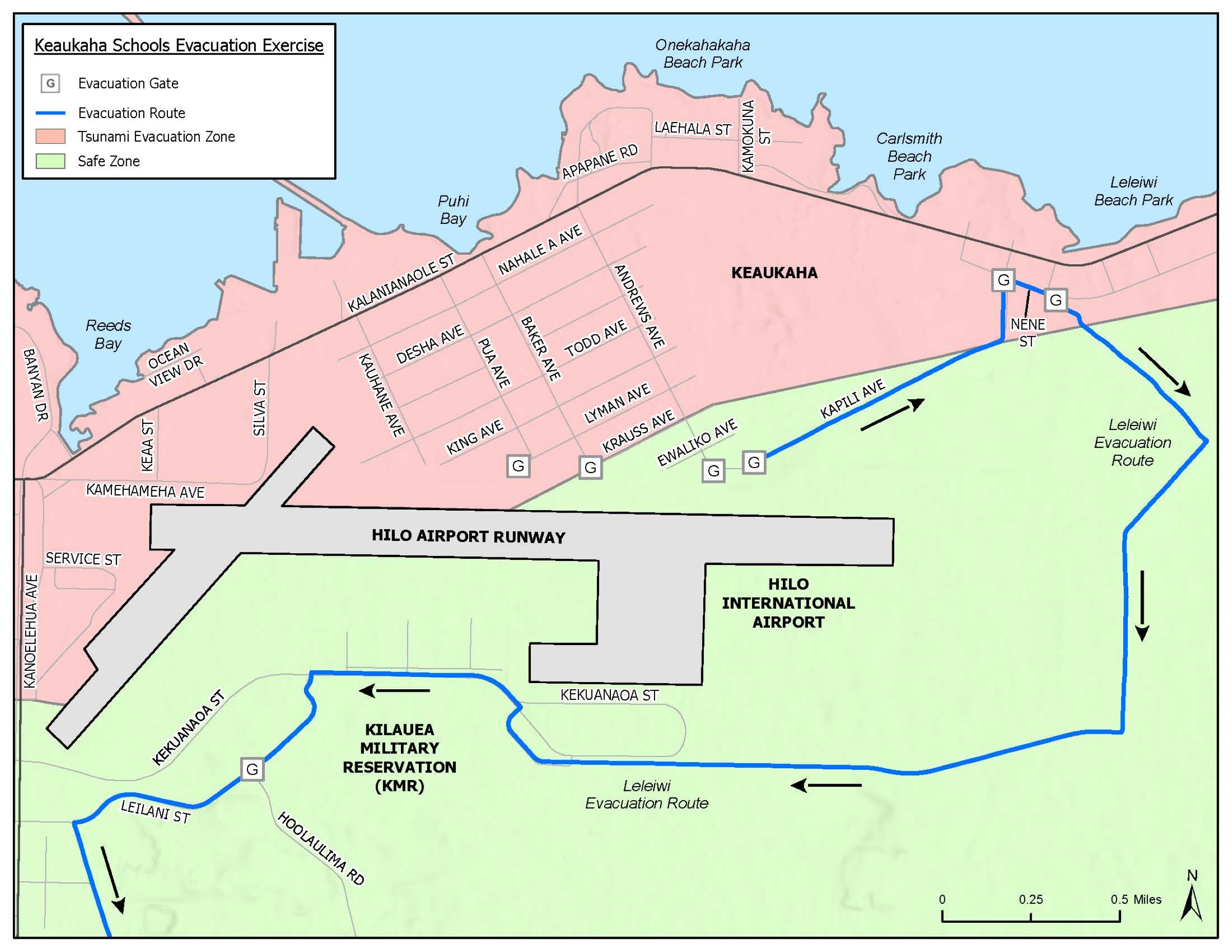
The exercise starts at 9 a.m. with students from participating schools following prepared evacuation plans as far as the airport gates at Andrews, Baker and Pua avenues. Hawaiʻi County also will open the Leleiwi Evacuation Route from 9 to 11 a.m. so residents can practice driving the route.
“Time is of the essence when a tsunami threatens Hawai‘i Island, so we encourage everyone living, working or learning in coastal areas to know and practice their escape routes,” said Hawaiʻi County Mayor Kimo Alameda in an announcement for the upcoming exercise.
Residents of the Keaukaha area used gates at the airport perimeter to cross the runway during evacuations for the July 29 tsunami warning. The perimeter gates will remain closed during this exercise, however, and people will not enter the airport grounds.
County personnel will open the gates along Nēnē Street for the Leleiwi Evacuation Route practice to allow residents to drive on and familiarize themselves with the evacuation route, which takes them away from the shore.
The county also will open the gates to access Kāpili Avenue to allow Keaukaha residents to access the evacuation route.
Officials from Hawai‘i County Civil Defense hosted a series of community meetings to share information about the evacuation routes and address concerns to improve public safety in the residential and commercial areas around the Hilo airport.
Civil Defense Administrator Talmadge Magno said the Nov. 21 exercise is a key piece of that public safety effort.
“Hilo has seen tragic damage and loss of life from tsunamis over the years,” said Magno in the announcement for the exercise. “The best way to stay safe is to move out of the inundation zone when a tsunami threatens, and learning these evacuation routes helps to make that possible.”
These schools will participate in the exercise:
- Keaukaha Elementary School.
- Kamehameha Schools Preschool – Keaukaha.
- Ke Ana Laʻahana Public Charter School.
- Ka ʻUmeke Kāʻeo Public Charter School – Kai Koholā.
- Ka ʻUmeke Kāʻeo Public Charter School – Pa Hoaka.
Workers with Civil Defense, Hawai‘i Police Department, Hawai‘i County Department of Public Works, Hawai‘i Department of Law Enforcement and Hawai‘i Department of Transportation – Airports will also participate, in addition to state Education Department personnel.
Sponsored Content

_1770333123096.webp)

