

Update: High surf still a concern for east-facing shores; forecasters extend advisory
Update at 4:35 p.m. Tuesday, Nov. 11, 2025: National Weather Service officials in Honolulu canceled the high surf advisory that was in place until 6 p.m. today; however, the advisory will remain in place through 6 p.m. Thursday (Nov. 13) for east-facing shores.
Large breaking waves of 9 to 12 feet are forecast through tonight, then 10 to 14 feet on Wednesday (Nov. 12). Impacts are expected to be high.
A combination of higher-than-predicted water levels, large breaking waves and strong onshore winds could lead to significant wave runup, beach erosion and localized coastal flooding.
Waves could wash across areas of the beach that typically remain dry, with potential overwash onto vulnerable low-lying coastal roadways and properties.
The public is advised:
- Heed all advice from ocean safety officials.
- Avoid driving through flooded roadways. If you are forced to drive through salt water, be sure to rinse your vehicle with fresh water as soon as possible after.
- Move electronics, vehicles or other valuables to higher ground.
- Monitor vessels to ensure mooring lines don’t get too tight and watch out for overwash around boat ramps.
- Secure canoes or other watercraft stowed on beaches.
Visit the Hawai‘i County Hazard Impact Map for additional information and any continued beach/park closures.
National Weather Service forecasters report that strong trade winds near and upstream of the islands is producing large and rough surf along east-facing shores. The primary swell direction is shifting from north-northeast to northeast.
As a result, north shore surf declined below advisory levels; however, large surf will persist along east-facing shores.
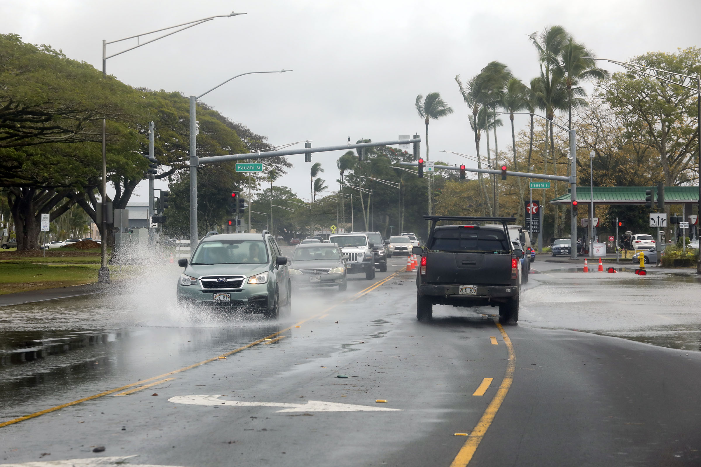
Update at 9 a.m. Tuesday: The ongoing high surf advisory for north- and east-facing shores has forced the closure of several Hilo beaches, and Bay Front Highway will remain closed through the day.
Along with Onekahakaha Beach Park and Coconut Island, other beach parks closed include: Carlsmith, Leleiwi and Richardsons.
Bay Front Highway will remain closed through today. Conditions will be reassessed on Wednesday morning.
Update at 4 p.m. Monday: The high surf advisory remains in effect until 6 p.m. Tuesday for north-facing shores and 6 p.m Wednesday for east-facing shores, according to the National Weather Service.
For north-facing shores, a moderate to large north-northeast swell will produce surf of 14 to 18-foot surf tonight, which will decrease to 10 to 15 feet on Tuesday.
Forecasters predict the swell will shift out of the northeast, but large surf will persist along east-facing shores through Wednesday night. Surf of 8 to 12 feet is expected tonight, which will increase to 10 to 14 feet on Tuesday.
Two Hilo beach parks, Onekahakaha Beach Park and Coconut Island, are set to be closed through tomorrow for debris clean-up.
Five Hilo beach parks were closed Monday for dangerous surf and debris. Most have reopened, except for Moku‘ola (Coconut Island) and Onekahakaha.
Other park closures may be necessary on Tuesday and will be announced as needed. View the County of Hawai‘i Hazard Impact Map for updated information about public facility emergency closures.
Update at 9:50 a.m. Monday: Several beach parks in Hilo are closed due to dangerous surf conditions.
The Hawai‘i County Civil Defense Agency has listed the following closures:
- Moku‘ola (Coconut Island)
- Onekahakaha
- Carlsmith (Four Mile)
- Leleiwi
- Richardson
Updates will be provided as they become available.
7:24 a.m. Monday update: Bay Front Highway in Hilo is partially closed to outbound Hāmākua traffic, and Onekahakaha Beach Park is closed, due to the high surf advisory for north- and east-facing shores.
The National Weather Service issued a High Surf Advisory for Hāmākua, North Hilo, South Hilo and Puna Districts through 6 a.m. Tuesday.
Beach-goers, swimmers, and surfers should heed all advice given by ocean safety officials and exercise caution when entering the water.
Original post: The National Weather Service is issuing a high surf advisory for north-facing shores of the Big Island, beginning Sunday at midnight and lasting until 6 a.m. Tuesday.
A moderate to large north-northeast swell is expected to fill in late tonight through Monday increasing surf heights to 14 to 18 feet.
North-facing shores of Maui, Molokaʻi, Oʻahu and Kauaʻi also are part of the high surf advisory.
Strong breaking waves and strong currents will make swimming dangerous. Heed all advice from ocean safety officials. When in doubt, don’t go out.
Sponsored Content

_1770333123096.webp)

