Kona Low Day 2: Flash flood warning for eastern half of Big Island extended into Sunday
This story was updated at 10:18 p.m. Saturday, Feb. 18.
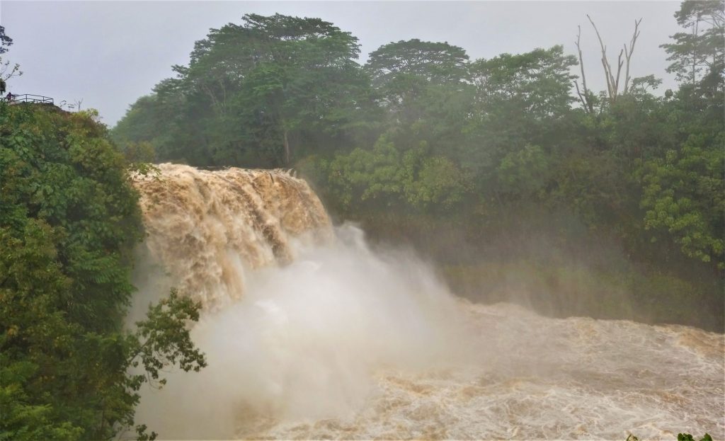
On the cusp of a third day of a low-pressure system to the southwest of the Hawaiian Islands has socked the Big Island and caused power outages, downed trees, washed out bridges and dumped a whole lot of rain on the eastern half of the Big Island, resulting in life-threatening flash flooding in some areas, Hawaiʻi County Civil Defense continues to recommend if you don’t have to go anywhere, don’t.
With no relief expected until later Sunday, Feb. 19, at the earliest, it seems like that might be the best course of action.

There’s proof.
A driver got trapped in flash flood waters in Kaʻū early Saturday morning, ignoring barriers blocking the roadway, and attempted to cross the flood waters when the vehicle became disabled and ended up half submerged. Fortunately, the driver was rescued without any injuries.
Several roadways remain closed and likely will until the rain and runoff cease.
As expected, the National Weather Service in Honolulu has extended a flash flood warning for the south, southeastern and eastern portions of the Big Island, this time until 1 a.m. Sunday, Feb. 19. Much of the island, mostly in those locations, has been under a flash flood warning consistently since Friday morning.
The National Weather Service in Honolulu also earlier in the day extended a flood watch in effect for the Big Island and Maui.
At 9:51 p.m., radar and rain gauges indicated that rainfall rates have eased over the southeast flank of the Big Island. However, runoff levels were still high and rain continued in some locations, with heavy rainfall is still possible in the warning areas.
Some locations that could continue to experience life-threatening flash flooding include Hilo, Hawaiian Paradise Park, Honokaʻa, Volcano, Glenwood, Hawaiʻi Volcanoes National Park, Mountain View, Wood Valley, Hawaiian Acres, Pōhakuloa Training Area, Pōhakuloa Camp, Keaʻau, Orchidland Estates, Pāhala, Papaikou, Pepeʻekeo, Pāhoa, Punaluʻu Beach and Honomū.
Do not cross fast-flowing or rising water in your vehicle or on foot. Turn around, don’t drown.
Stay away from streams, rivers, drainage ditches and culverts, even if they are currently dry. Multiple public road closures are expected, as well as landslides in steep terrain.

The storm will continue to slowly drift southeastward and weaken through Monday; however, the tropical moisture will linger over the state for the next few days, with periods of showers possible through the weekend. However, heavier rainfall rates have already decreased over the western islands and are forecast to decrease significantly over the eastern islands on Sunday and Monday.
Widespread rainfall remains over the eastern half of the Big Island and Maui tonight. The threats for periods of heavy rainfall and thunderstorms will remain for the most eastern islands in the state lasting into Sunday; however, the chances for additional heavy rainfall will decrease significantly during the next 24 hours.
Rainfall observations on the southeast and east slopes of the Big Island, from Kaʻū to Hilo, have reported an additional 4 to 8 inches with locally higher amounts Saturday, adding to the already several inches already received Friday. Some locations have received more than 13 inches of rain since the storm struck.
A high surf advisory that was in effect for the state’s east-facing shores was also canceled earlier Saturday, as advisory level surf was no longer expected.
Showers and thunderstorms could redevelop again over the western half of the state from late Monday into Wednesday as another cut off low drops in northwest of the island chain.
A high-pressure ridge building into the region from the northeast will produce breezy to windy easterly trade winds next week, pushing the tropical moisture and showers westward away from the islands from Wednesday onward.
For information about road closures, bus route cancellations and other impacts because of the storm, click here.
A brown water advisory also remains in effect for the Big Island.
The Hawaiʻi Department of Health said heavy rain has resulted in stormwater runoff entering coastal waters. The public is advised to stay out of flood waters and stormwater runoff because of possible overflowing cesspools, sewers, manholes, pesticides, animal fecal matter, dead animals, pathogens, chemicals and associated flood debris.
Not all coastal areas could be impacted by runoff; however, if the water is brown, stay out. Practice good personal hygiene and follow-up with your primary care physician if you have any health concerns.

A winter storm warning for the summits of Maunakea and Mauna Loa on the Big Island has been extended until noon Sunday, Feb. 19, as well, with heavy snow and freezing rain expected to continue. Up to a foot of additional snow accumulation and significant icing is forecast.
Travel to the summits will be life-threatening and impossible. Blowing snow will significantly reduce visibility at times, with periods of zero visibility. The road to the Maunakea summit remains closed.
So, with the Kona Low expected to continue drenching the Big Island on Sunday, maybe it’s a good time to curl up with a blanket and the cat – or other furry friend – and wait out the storm with a good book or hanging with family or friends inside, at home and staying safe, letting the flood waters recede.
And keep up with all the weather updates here on Big Island Now.
Sponsored Content
Comments


