

Kona Low storm on the Big Island: What you need to know
Here’s everything you need to know about the Kona Low storm as it sweeps over the Big Island. Stay up-to-date on power outages, road closures, public transportation, emergency shelters and more. Click here for more details about the storm.
The video above was posted by Harry Durgin on social media. The video shows rain and wind hitting Pāhoa at 8:45 a.m.
Power outages
Hawaiian Electric spokesperson Kristen Okinaka said the Big Island is not experiencing do not widespread outages. Earlier today, there were outages that impacted customers in Kea‘au and in the South Point area. Service was restored to the majority of those customers. There were about 400 customers in the Miloli‘i area who were without power, but their power was also restored.
The cause of the outages is under investigation.
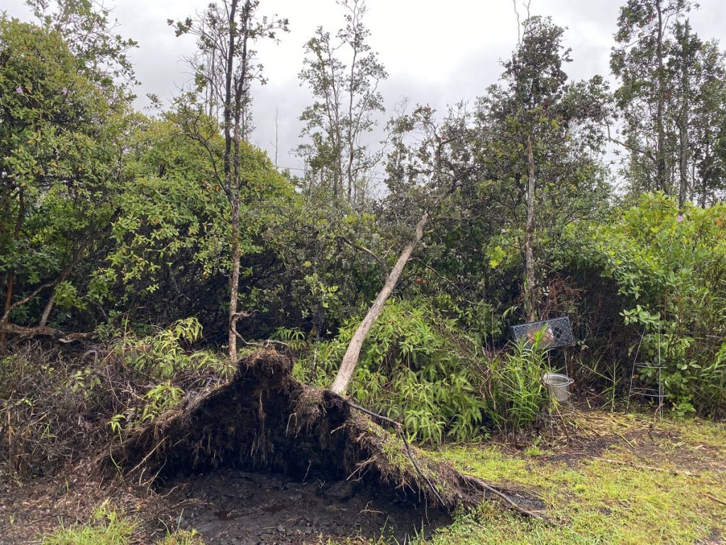
 Sarah Wilkinson posted a photo on Twitter of an uprooted ‘ōhi‘a tree in Puna this morning. She wrote: Experiencing ongoing gusty squalls with heavy showers this AM in Puna. Just lost a healthy ʻōhiʻa tree that had too shallow of a shallow root system to withstand the wind.”
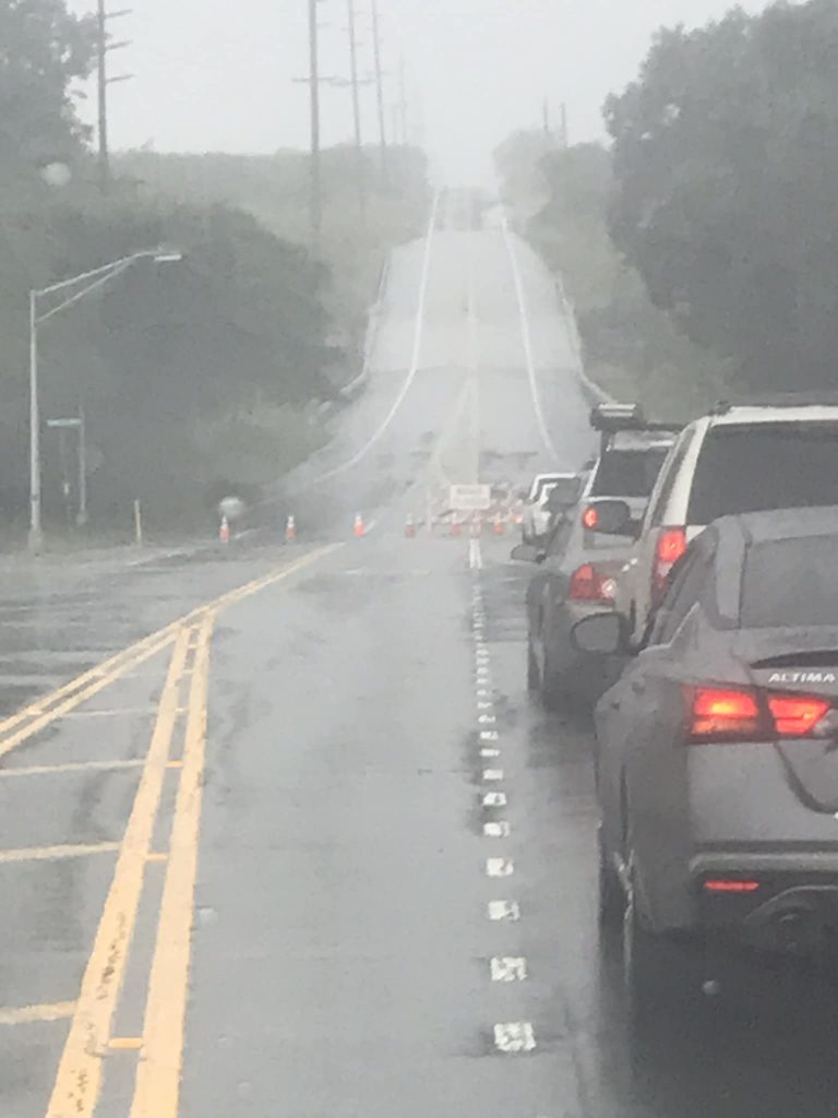
- Wade Makai captured a picture of traffic at Punalu‘u and Black Sand Beach as the road is closed due to flooding.


Road closures and public transportation
All lanes of Hawai‘i Belt Road and the Honomu Road junction area are now open. Landslide debris has been removed.
Hawai‘i Department of Transportation announced both lanes of Highway 11, between Nā‘ālehu and Pāhala, are closed at mile markers 59.5 to 60 for ponding in the roadway.
Hawai‘i Police Department is also advising motorists to avoid Highway 11 in the area of Kawa Bay in Ka‘ū from mile markers 56 to 62 because of flooding. Low water crossings along Wood Valley Road are also expected to be impassable.
The Hawaiʻi Fire Department is also responding to an incident in the Kaʻū District involving a vehicle that was swept off the roadway and into an embankment after entering an active road closure zone. Officials are asking the public to remain vigilant and follow all signage, barricades, and diversions for their safety.
The Waipiʻo Valley Access Road remains closed due to the early onset of the weather system, and more closures are expected in the coming days.
Hawai‘i Volcanoes National Park reports Mauna Loa Road from Kīpukapuaulu to lookout is closed. Kīpukapuaulu Trail and the Kahuku unit are also closed. Hilina Pali Road past the campground is closed but the campground is open.
The county’s public transportation, Hele On, has canceled several routes for Saturday. Route 10 will start and end in Pāhala. Canceled routes include:
- Route 1
- Route 2
- Route 12
- Route 60
- Route 75
- Route 80
- Route 90
- Route 301
- Route 401
- Route 402
- Route 403
Emergency shelters
Two emergency shelters in Kaʻū will remain open through the evening as active flooding and heavy rains continue to inundate the region. The shelters are located at the Nāʻālehu Community Center and the Robert Herkes Gymnasium in Pāhala.
The public can access information in real-time on the County of Hawaiʻi Civil Defense Hazard Map (https://tinyurl.com/2p845968) or via the County’s mobile application, Kāhea, which is available on both Android and iPhone.
Sponsored Content


