Tropical Storm Warning Issued as Darby Approaches

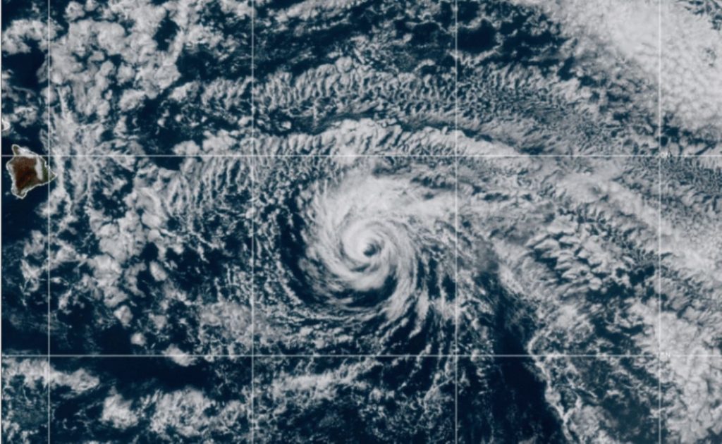
Darby is now a tropical storm, and despite its weakening trend and forecast track keeping it to the south, the Big Island is likely to still see some impacts. The National Weather Service in Honolulu also issued a tropical storm warning for waters around the state in anticipation of the storm’s arrival.
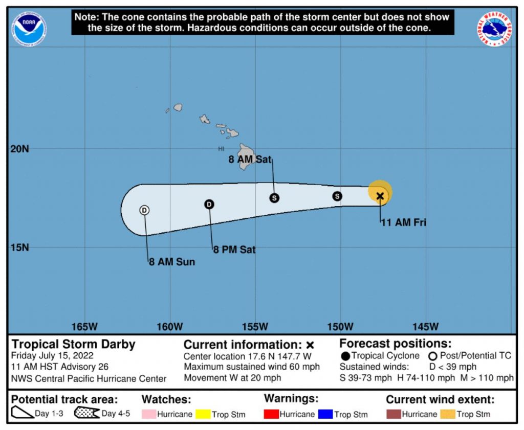
The Central Pacific Hurricane Center said in its 11 a.m. Friday, July 15, public advisory that Darby continues to weaken as it moves west. The storm is located about 505 miles east-southeast of Hilo and about 710 miles east-southeast of Honolulu.
Darby is expected to keep up its westward motion during the next couple of days and is moving at about 20 mph. The forecast track still shows the storm’s center, or its remnants, staying south of the Big Island, passing by on Saturday, July 16.
The storm has maximum sustained winds of 60 mph, with higher gusts. Tropical-storm-force winds extend outward from Darby’s center up to 60 miles.
Darby is expected to weaken to a tropical depression by tonight and then become a post-tropical cyclone Saturday before dissipating Sunday night, July 17.
Large swells generated by Darby are expected to affect portions of the Hawaiian Islands during the weekend. The swells are likely to produce hazardous surf and dangerous rip current conditions.
According to the National Weather Service, tropical storm conditions are expected tonight for southeast waters around the state as northeast-to-east winds increase and seas build to 10-14 feet. Elsewhere, seas of 8-10 feet are expected, and isolated thunderstorms are forecast over southeast waters.
Tropical storm conditions are expected to continue Saturday, with seas of 10-13 feet in southeast waters and 8-10 feet elsewhere around the state. Isolated thunderstorms also are expected to continue over southeast waters.
Darby is also expected to produce localized rainfall of up to 2-4 inches along windward portions of the Big Island and Maui, according to the Central Pacific Hurricane Center advisory. The rain could cause nuisance flooding, especially in low-lying and poor drainage areas.
The next complete advisory from the Central Pacific Hurricane Center about Darby is scheduled for 5 p.m. today.
Sponsored Content
Comments


