

Darby Continues to Weaken on Westward Trek South of Big Island

Hurricane Darby is forecast to continue weakening as it makes its westward trek to the south of the Big Island, according to the 5 p.m. advisory from the Central Pacific Hurricane Center on Thursday, July 14.
Darby is expected to become a tropical storm by Friday, July 15, and further weaken to a post-tropical cyclone by Saturday, July 16, before dissipating.
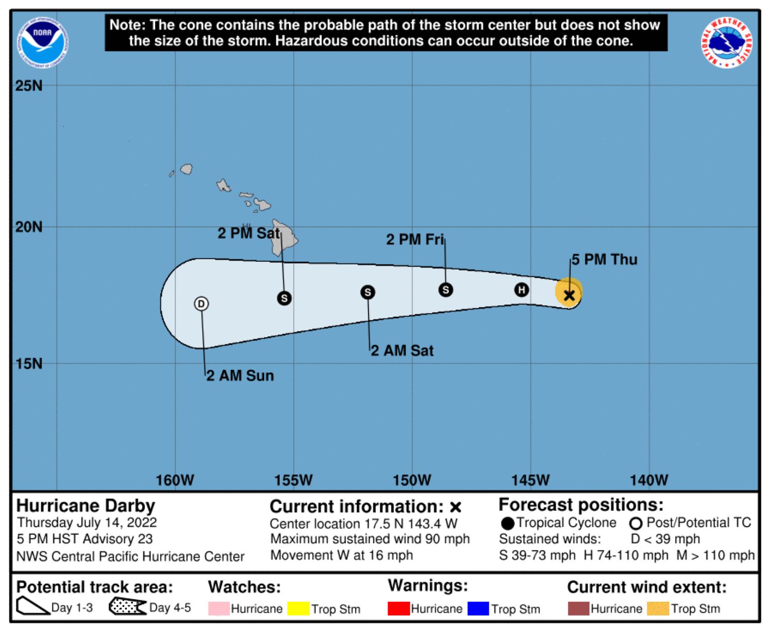
The center of the storm was located about 780 miles east of Hilo and about 980 miles east-southeast of Honolulu. It had maximum sustained winds of 90 mph, with higher gusts, making it a Category 1 storm, and it was moving west at 16 mph. Darby is expected to continue moving westward for the next few days, with the forecast track bringing the center of the storm, or its remnants, south of the Big Island on Saturday.
Hurricane-force winds currently extend outward from the storm’s center up to 10 miles, with tropical-storm-force winds extending outward up to 45 miles.
There are no watches or warnings in effect.
However, in preparation for any impacts from the storm, the Hawai‘i Emergency Management Agency has activated the State Emergency Operations Center. Hawai‘i County Civil Defense also said earlier today that the public is advised to secure outdoor items from possible wind damage and to address flooding concerns.
Civil Defense also said beachgoers, swimmers and surfers should exercise caution as strong breaking waves, shore break and rip currents because of high surf are expected this weekend and will make swimming difficult and dangerous. Beaches also could be closed without notice.
Depending on Darby’s track and how close it gets to the island, there is the potential for heavy rain and flooding from the storm. Trade winds also will strengthen in response to the storm or its remnants and high surf will arrive Friday night into Saturday, according to a meteorologist with the National Weather Service in Honolulu and the Central Pacific Hurricane Center.
Click here for hurricane preparedness tips. And click here for the latest forecast updates for Darby.
Sponsored Content


