

Trade Wind Weather Continues, Guillermo Update
Alerts
A Small Craft Advisory is in effect for the ʻAlenuihāhā channel as well as waters to the west and south of the Big Island through 6:00 a.m. Sunday. East winds up to 25 knots are expected with rough seas up to 11 feet.
**Click directly on the images below to make them larger. Charts include: Big Island high/low forecasted temperatures, projected winds, chance of cloud cover, projected localized weather conditions, vog/SO2 forecast and expected wave heights.**
Today
We expect high temperatures from 84° to 90°. Northeast winds are expected from 15 to 20 mph. Mostly cloudy skies are forecasted for windward areas with scattered showers. For leeward areas we expect a partly cloudy morning and afternoon clouds with scattered showers.
UV index at 13 (“extreme” exposure level)
Tonight
For leeward areas, partly cloudy skies are expected tonight with clearing as the night goes on. Windward spots are mostly cloudy and showers are likely. Northeast winds are forecasted from 15 to 20 mph. Low temperatures from 73° to 78° are expected.
Looking Ahead
Locally breezy trade winds are expected through the weekend. The trades will bring some showers to windward areas, mostly during nights and mornings. Remnant moisture from a former tropical depression (Eight-E) will reach us this weekend, bringing muggy weather and increased showers for windward areas, especially for the Big Island.
Hurricane Guillermo Update
The National Hurricane Center in Miami is issuing bulletins on Hurricane Guillermo, which is a little less than 2000 miles east-southeast of Hilo. The current forecast is for Guillermo to move west-northwest and strengthen, potentially crossing into the Central Pacific Hurricane Center area of responsibility on Saturday. Impacts to Hawaii will be very dependent upon the track and speed of the system, which is highly uncertain this far out in time. I will keep an eye on this system and begin doing regular updates when the system gets a little closer to the islands.
Our Big Island Now Weather homepage always includes daily: Sunrise | Sunset | Moonrise | Moonset | Moon Phase | Live Weather Cams | 5-day Forecast | Current Temperature & Conditions
**Click here for your detailed Big Island surf report.**
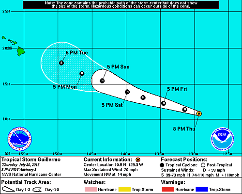
Image: NHC

Image: NOAA / NWS

Image: NOAA / NWS

Image: NOAA / NWS

Image: NOAA / NWS
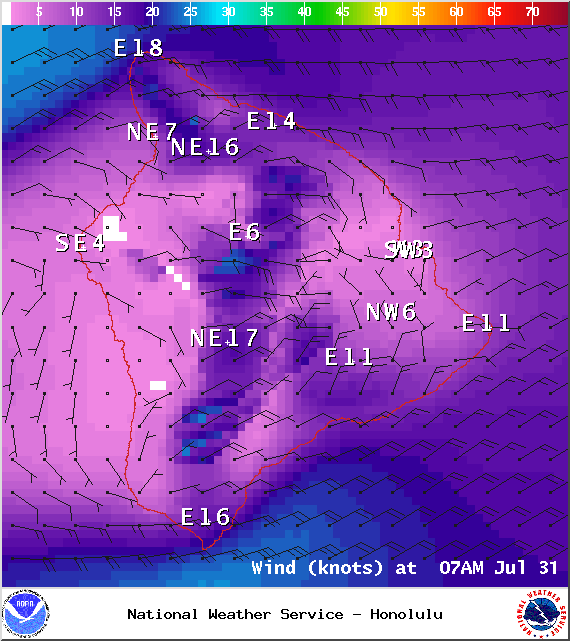
Image: NOAA / NWS
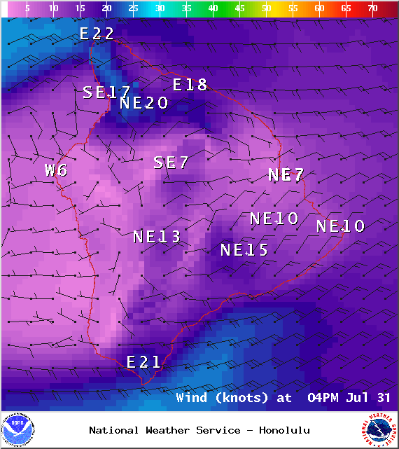
Image: NOAA / NWS

Image: UHSOEST
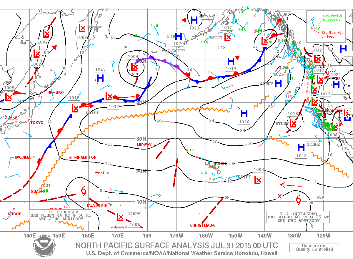
Image: NOAA / NWS

Image: NOAA / NWS
Sponsored Content


