

Guillermo Expected to Generate Swell
Alerts
A Small Craft Advisory is in effect for the ʻAlenuihāhā channel as well as waters to the west and south of the Big Island through 6:00 a.m. Sunday. East winds up to 25 knots are expected with rough seas up to 11 feet.
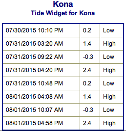
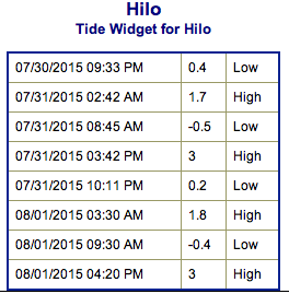
**Click directly on the images below to make them larger. Charts include: Big Island projected winds, tides, swell direction & period and expected wave heights.**
 Big Island Surf Forecast
Hilo side: Waist/shoulder high waves expected today for well exposed trade swell breaks. Best breaks could see sets up to head high waves from time to time. Messy conditions expected.
Kona side: Wave heights knee/waist high are expected. The best breaks could get belly/chest high sets. Spots not exposed to the south will be smaller.
South: Wave heights knee/waist high are expected. The best breaks could get belly/chest high sets. Spots not exposed to the south will be smaller.
 Small rideable pulses out of the south are expected but nothing super notable. August 3-5th we expect a new knee/thigh high swell with a better angled swell expected the 5-8th with waves possibly up to waist high or more.
Trade swell will push into northeasterly exposures over the next few days. Otherwise, the north Pacific is looking very quiet. Hurricane Guillermo may bring a potentially notable swell by Monday and into next week. This will depend on development of the system and where it ends up tracking.
Keep in mind, surf heights are measured on the face of the wave from trough to crest. Heights vary from beach to beach, and at the same beach, from break to break.
**Click here for your detailed Big Island weather report.**

Image: NOAA / NWS
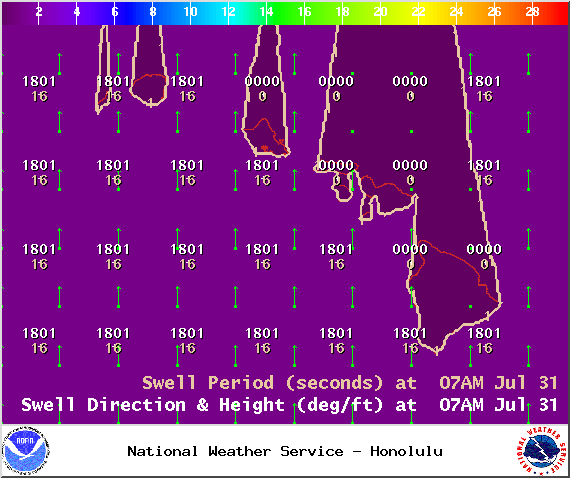
Image: NOAA / NWS
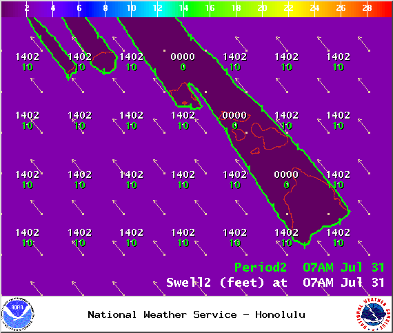
Image: NOAA / NWS
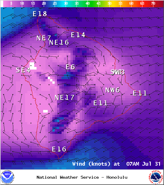
Image: NOAA / NWS
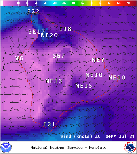
Image: NOAA / NWS
Image: NHC
Image: NOAA / NWS
Sponsored Content


