

Morning Sunshine, Leeward Haze
Alerts
A High Surf Advisory is in effect for the Kona side of the island from 6:00 a.m. Tuesday through 6:00 a.m. Thursday. Wave heights of 5 to 8 feet are expected Tuesday morning rising to 6 to 10 foot faces Tuesday afternoon and Wednesday. Expect strong breaking waves, shore break and strong longshore and rip currents making swimming difficult and dangerous.
**Click directly on the images below to make them larger. Charts include: Big Island high/low forecasted temperatures, projected winds, chance of cloud cover, projected localized weather conditions, vog/SO2 forecast and expected wave heights.**
Today
Today windward spots are expected to be partly sunny with isolated showers during the day. The Kona side is forecasted to get morning sunshine and afternoon cloud cover. East winds are forecasted around 15 mph. High temperatures should fall in the range of 79° to 84°.
UV index at 9 (“very high” exposure level)
Tonight
Partly to mostly cloudy skies are expected on the windward side with scattered showers. Leeward spots will get partly cloudy skies and isolated showers in the early evening, clearing as the night goes on. East winds are forecasted from 10 to 20 mph. Low temperatures from 67° to 72° are expected.
Next Full Moon: 8:06 a.m. on Mar. 5
Looking Ahead
Light to moderate easterly southeasterly winds and high pressure over the area will keep generally good weather conditions in place during the next couple of days. The combination of an approaching cold front from the northwest and increasing moisture over the area will bring cloud cover and increasing shower activity across the island chain starting Thursday and continuing through the weekend.
Our Big Island Now Weather homepage always includes daily: Sunrise | Sunset | Moonrise | Moonset | Moon Phase | Live Weather Cams | 5-day Forecast | Current Temperature & Conditions
**Click here for your detailed Big Island surf report.**

Image: NOAA / NWS

Image: NOAA / NWS

Image: NOAA / NWS

Image: NOAA / NWS
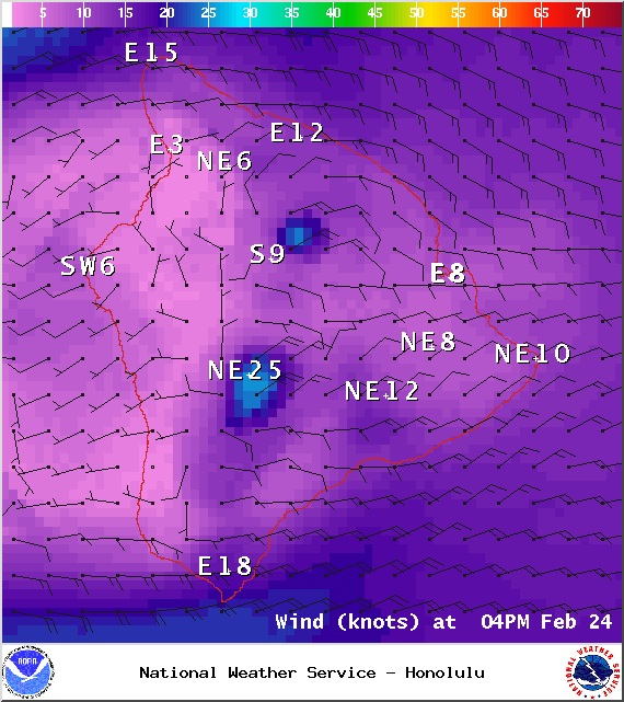
Image: NOAA / NWS

Image: NOAA / NWS

Image: UHSOEST
Image: NOAA / NWS
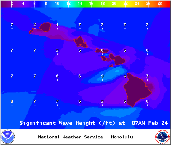
Image: NOAA / NWS
Sponsored Content

_1770333123096.webp)

