

June 27 Lava Flow Update – 1/30/15
Over the past week, minimal advancement has been seen in the major breakout portions of the June 27 lava flow.
Hawai’i County Civil Defense reported continuous stalls at every portion of the lava breakouts following its Friday morning overflight assessment.
The once leading flow front heading towards the Pahoa MarketPlace continues to show no advancement, along with the south margin breakout that was active during the same time.
During its overflight, Civil Defense made note that the distal breakout that spawned from the north margin continues to show no advancement, although signs of activity and flow pad widening are occurring just behind the stalled front.
No advancement has been seen in this portion of the breakout since between Sunday and Monday morning, when the flow sluggishly advanced 50 yards.
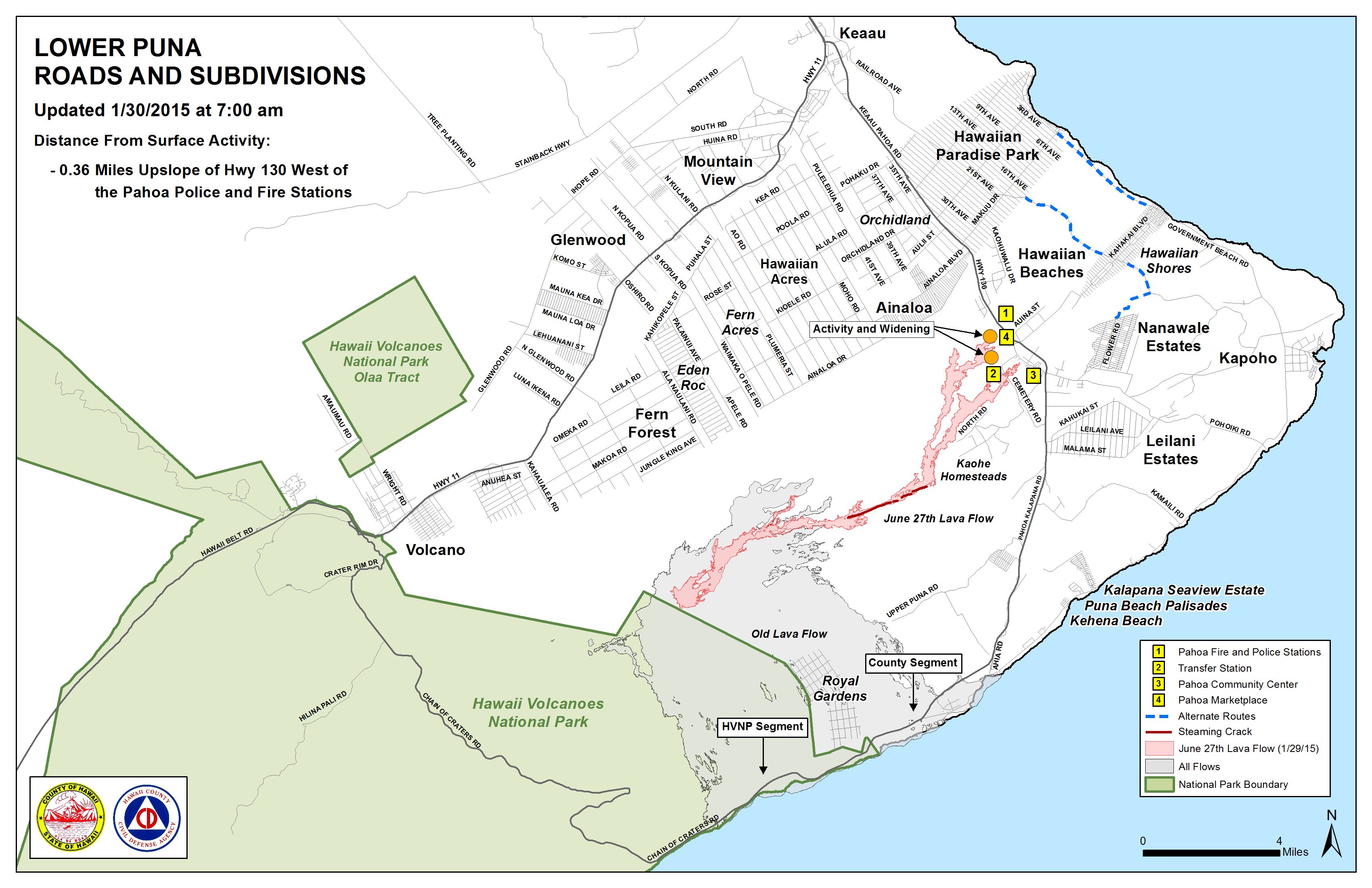
At the current time, the north margin breakout remains about 0.36 miles from Highway 130 in the area west of the Pahoa Police and Fire stations.
Two additional breakouts along the north margin breakout, 1-1.5 miles upslope from the stalled original flow front, have displayed little activity and have not shown signs of advancement.
Officials have been closely monitoring various breakouts along both margins of the flow, as well as within the flow pad. At the time, none of the activity is posing an immediate threat to communities in the area.
Both Civil Defense and Hawaiian Volcano Observatory continue to maintain a watchful eye on all lava flow activity. Should any changes occur the public will remain informed.
Friday morning smoke conditions were reported as light, with a light south wind blowing smoke in a north/northeast direction. As usual, these smoke conditions have the possibility of changing and individuals who are sensitive are advised to take necessary precautions.
According to officials, there is currently no brush fire activity and fire conditions continue to be monitored closely.
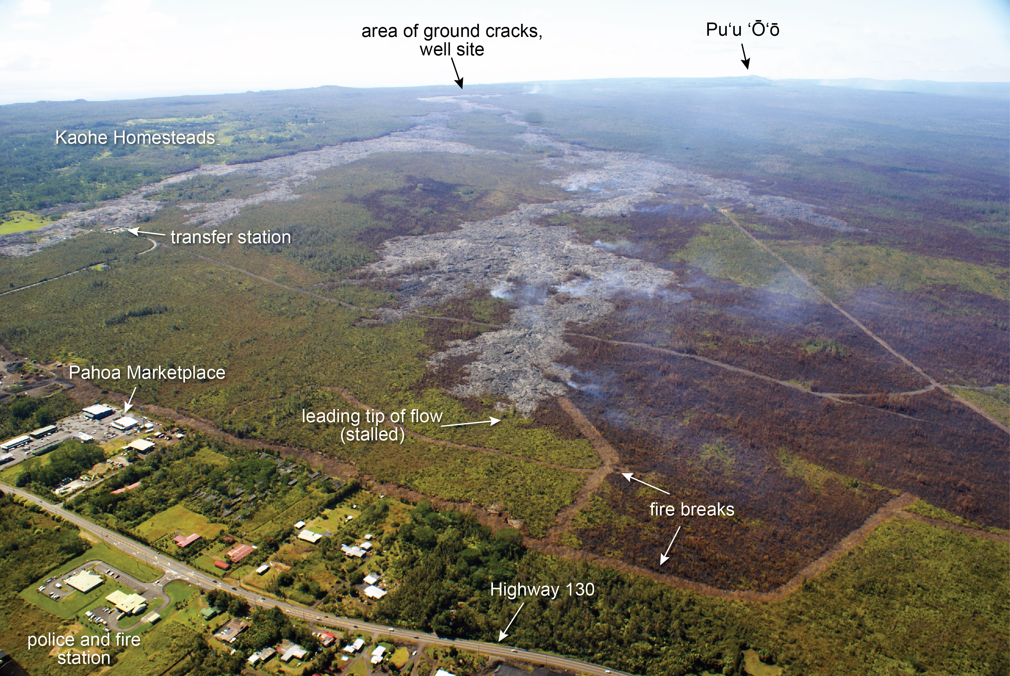
The leading tip of the June 27 lava flow, seen in this photo taken on Jan. 29, has not advanced significantly over the past week and remains roughly 500 meters (550 yards) upslope of Highway 130, west of the fire and police station. HVO photo.
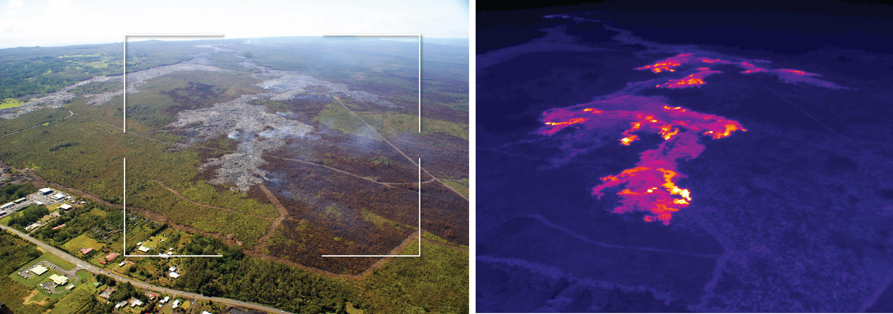
This comparison of a normal photograph and a thermal image from Jan. 29 shows the position of active breakouts relative to the inactive flow tip. The white box shows the rough extent of the thermal image on the right. In the thermal image, active breakouts are visible as white and yellow areas. Although active breakouts are absent at the inactive tip of the flow, breakouts are present just a short distance behind the tip, and are also scattered further upslope. HVO image.
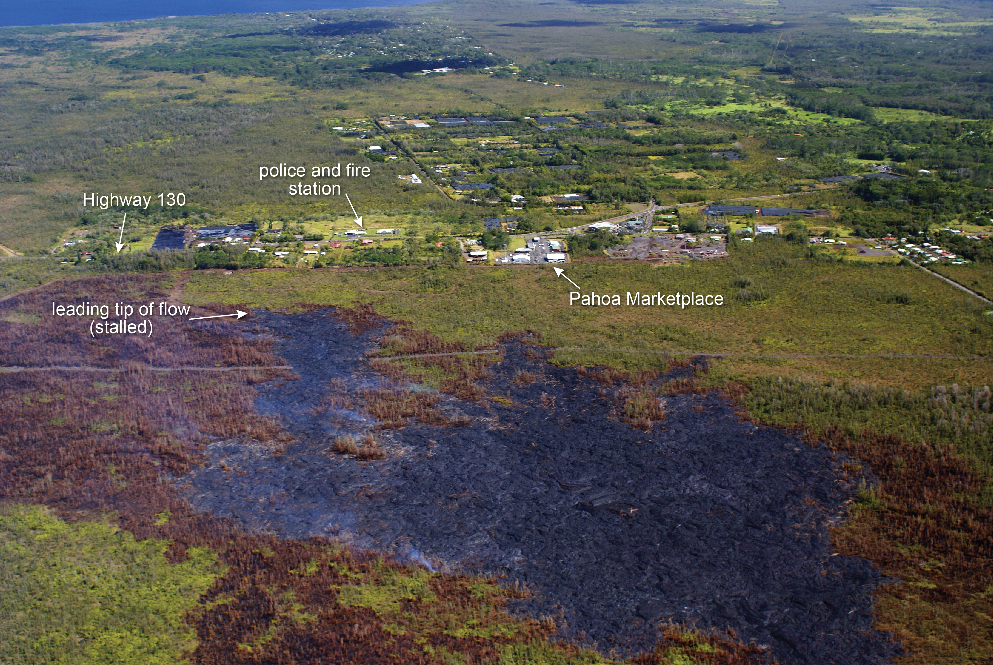
This photograph taken on Jan. 29 looks downslope and shows the proximity of the flow front to the highway. HVO photo.
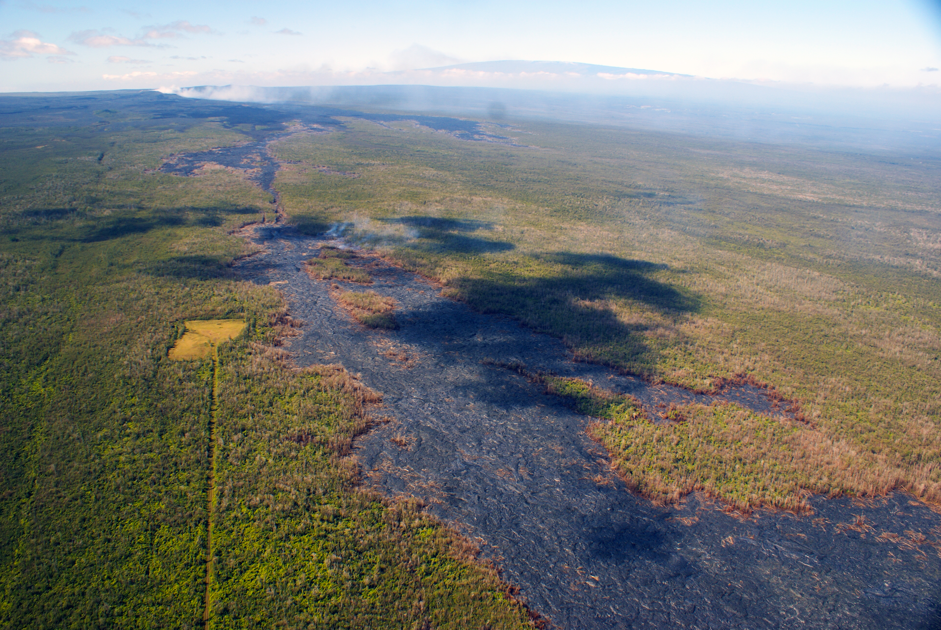
This photograph, taken on Jan. 29, looks upslope along the ground crack system of Kīlauea’s East Rift Zone. A small breakout from the lava tube is burning forest just left of the center of the photograph. In the upper left, thick fumes are emitted from Puʻu ʻŌʻō. Near the top of the photograph, the snow-covered peak of Mauna Loa can be seen. HVO photo.
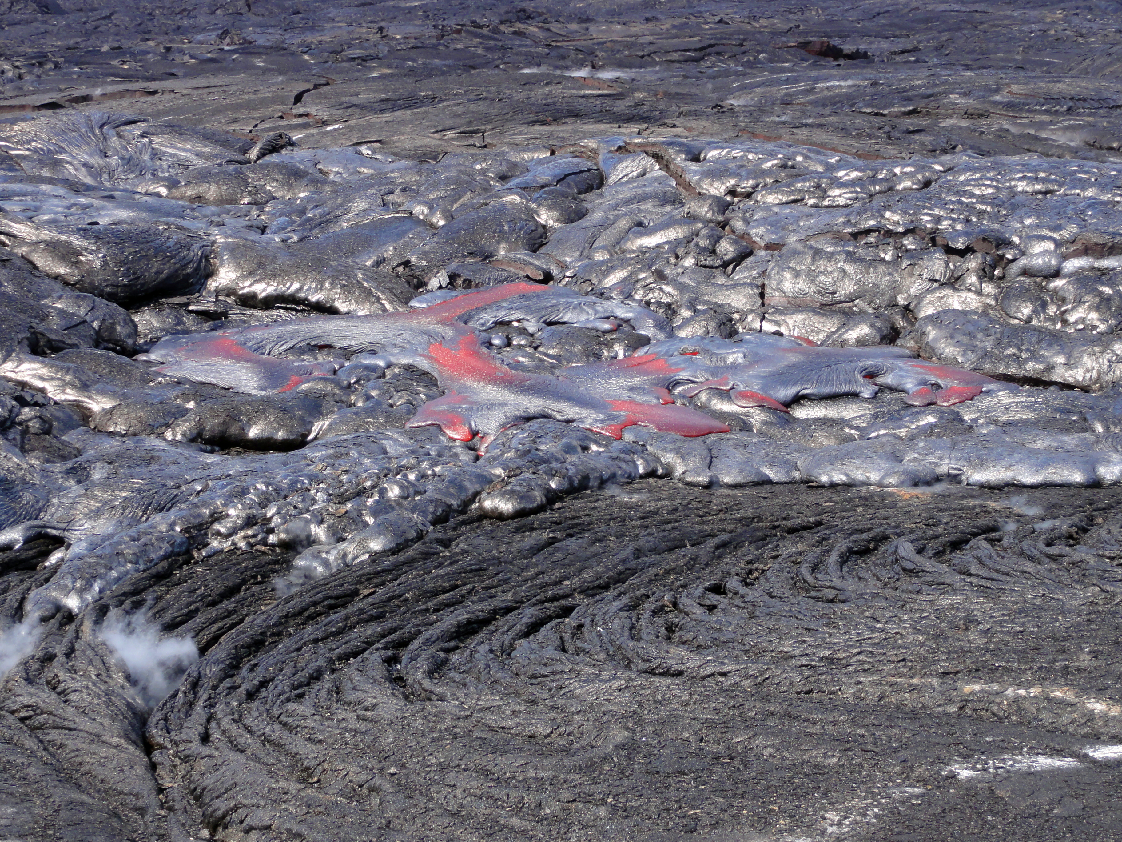
In the upslope portion of the June 27th flow field, a breakout was active on Jan. 29 north of the forested cone of Kahaualeʻa. Some of this lava was the “blue glassy” type of pāhoehoe, which often represents lava that has been stored within an inflated flow for several days. HVO photo.
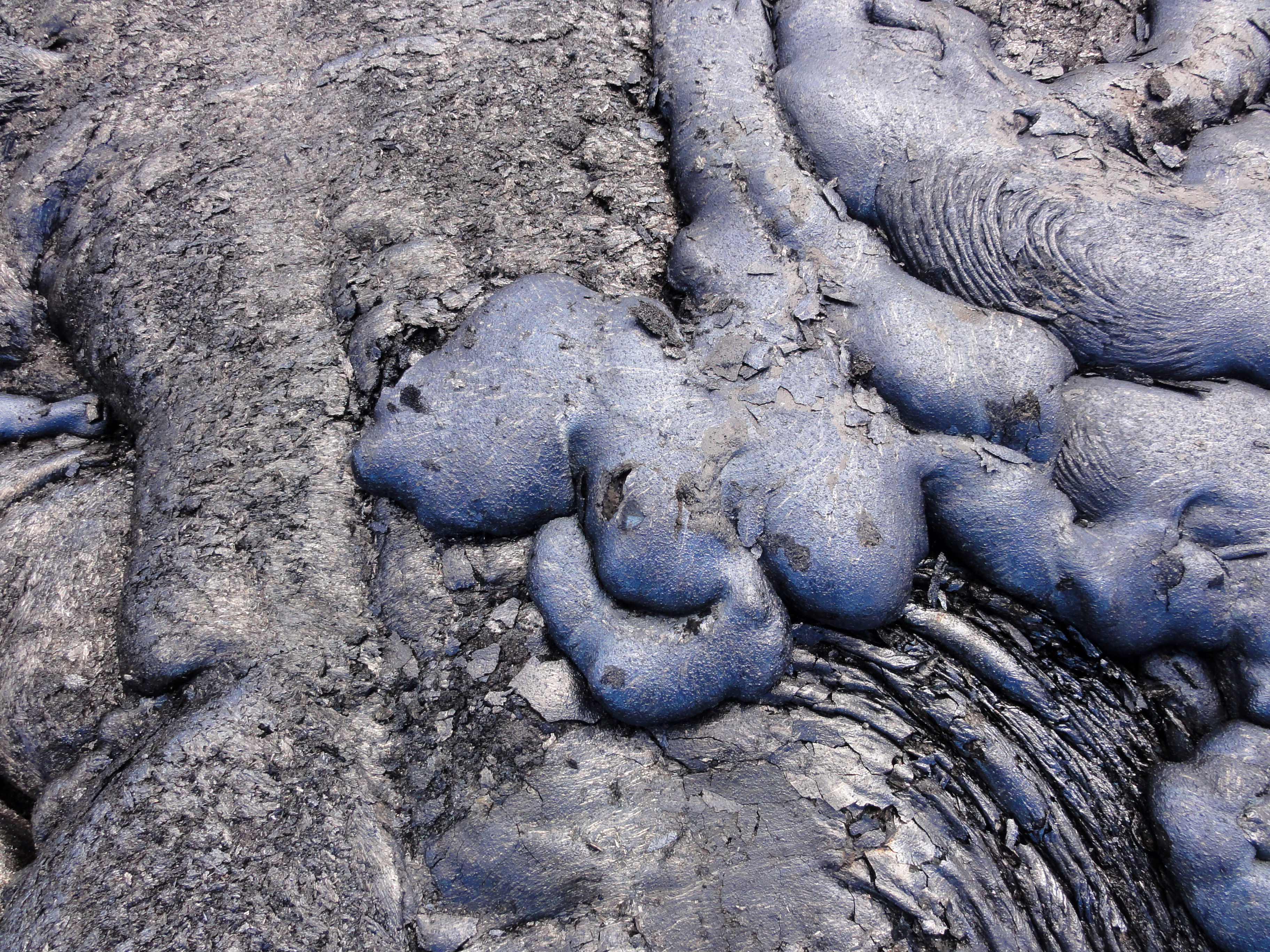
A closer look at the blue glassy type of pāhoehoe, whose color stands out from the more typical black lava surface on the left side of the photo, taken on Jan. 29. For scale, the photograph width is about two meters (yards). HVO photo.
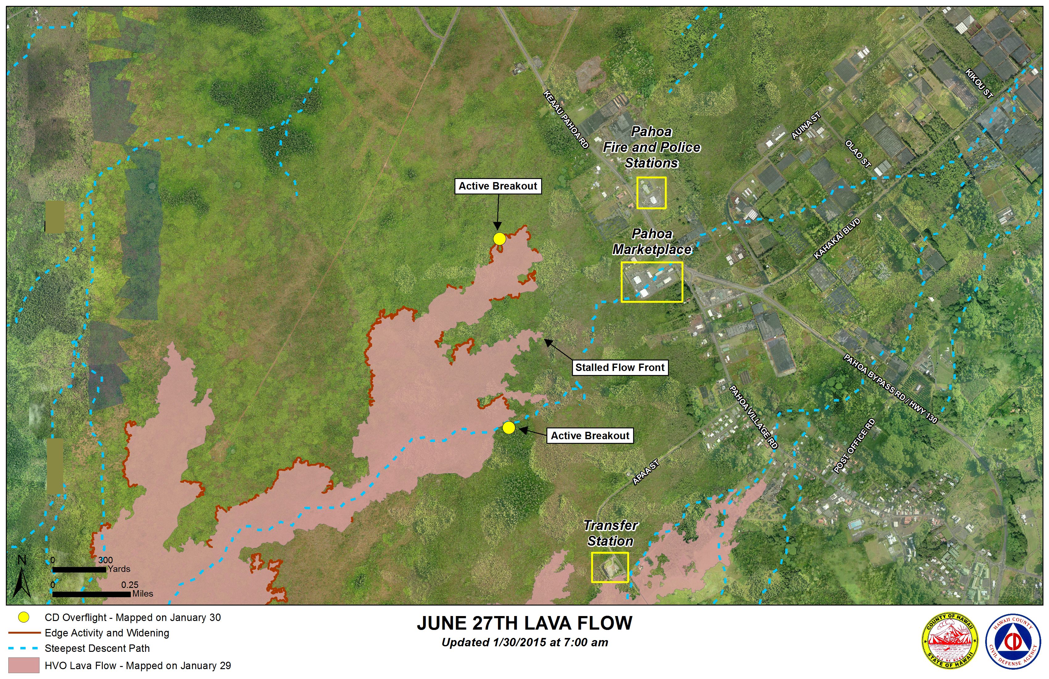
Hawai’i County Civil Defense lava flow map, as of Jan. 30 at 7 a.m. Civil Defense photo.
Hawai’i County Civil Defense lava flow map, as of Jan. 30 at 7 a.m. Civil Defense photo.
Sponsored Content


