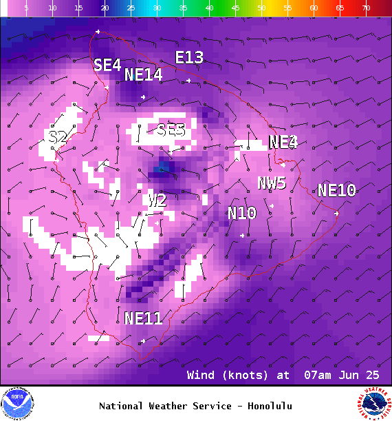
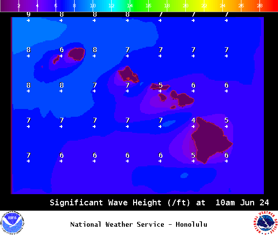
**Click directly on the images below to make them larger. Charts include: Big Island high/low forecasted temperatures, projected winds, chance of cloud cover, projected localized weather conditions, vog/SO2 forecast and expected wave heights.**
+
SWIPE LEFT OR RIGHT
ARTICLE CONTINUES BELOW AD
ARTICLE CONTINUES BELOW AD
Looking Ahead
Trade winds should be blowing through next week. A disturbance high in the atmosphere may keep windward areas rather wet through this weekend.
ARTICLE CONTINUES BELOW AD
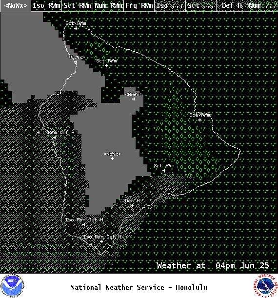
Today
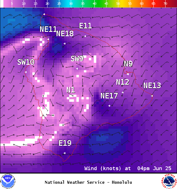
Partly sunny with scattered showers today for windward spots. Mostly sunny skies in the morning for the Kona side with mostly clouds skies in the afternoon and isolated showers. Winds are from 15 to 20 mph out of the northeast with afternoon sea breeze for the Kona side. High temperatures from 82° to 87°.
UV index at 12 (“extreme” exposure level)
ARTICLE CONTINUES BELOW AD
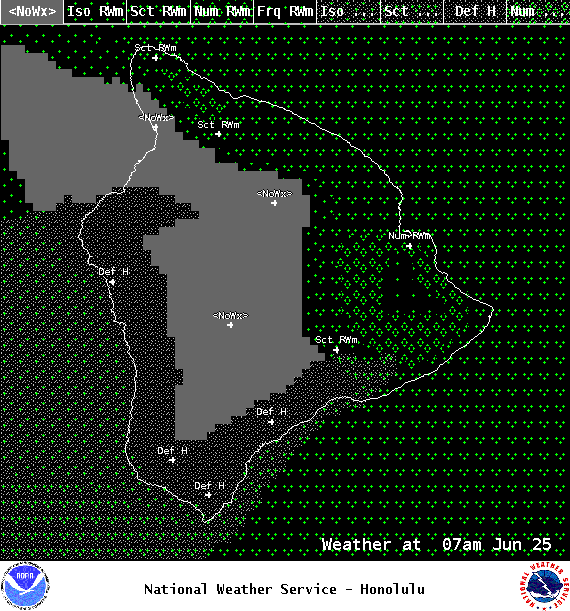
Tonight
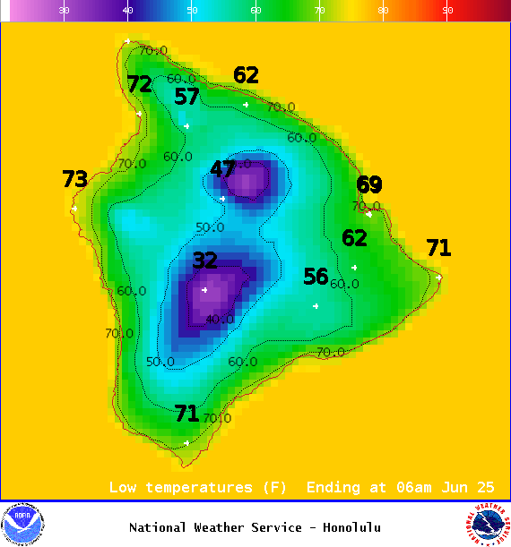
Northeast winds tonight from 10 to 15 mph. Numerous showers for windward spots tonight. Skies should clear as the night goes on for lee areas. Low temperatures from 69° to 74°.
This comments section is a public community forum for the purpose of free expression. Although Big Island Now encourages respectful communication only, some content may be considered offensive. Please view at your own discretion. View Comments