


Nolo weakens to Category 1 storm; hurricane watch discontinued for Big Island
Tropical storm warning, flood watch and high surf advisory for east- and south-facing shores of the island remain in effect; tropical storm conditions are happening in some locations of the island, with additional rain expected and large swells causing life-threatening surf and rip currents.
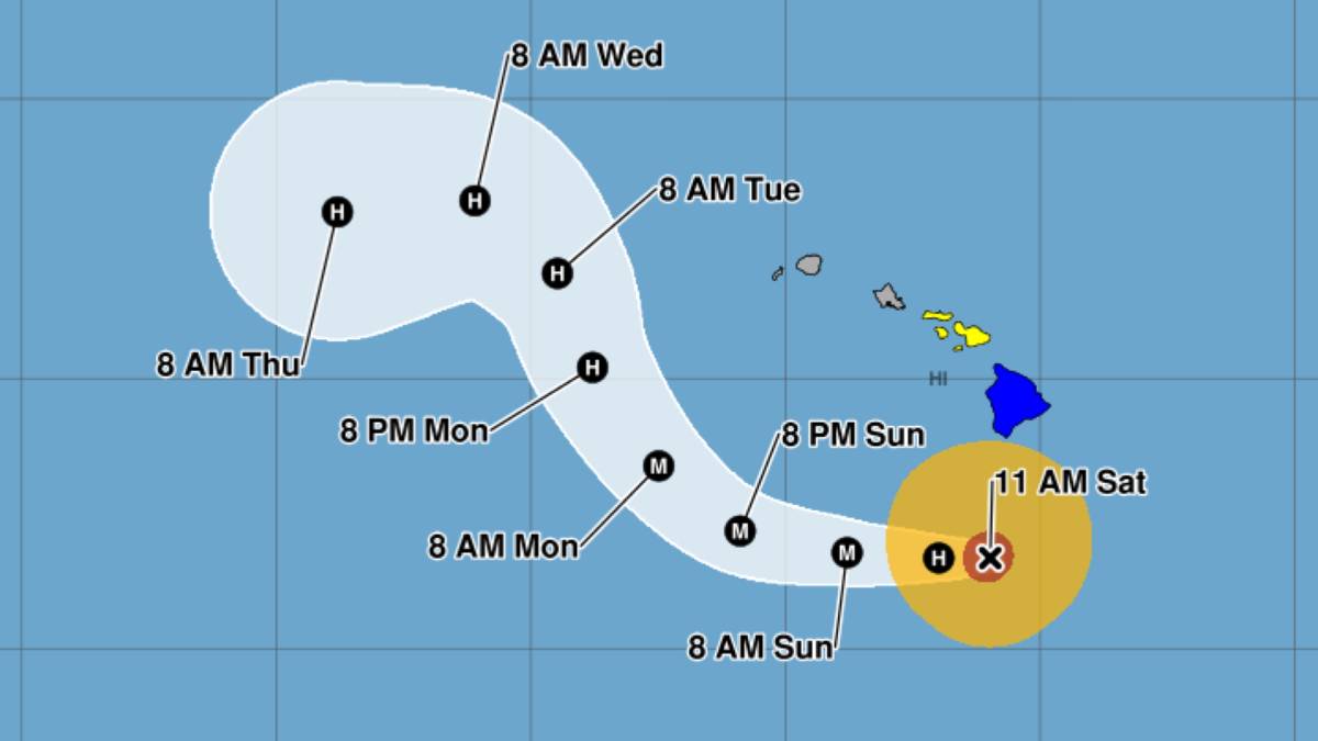
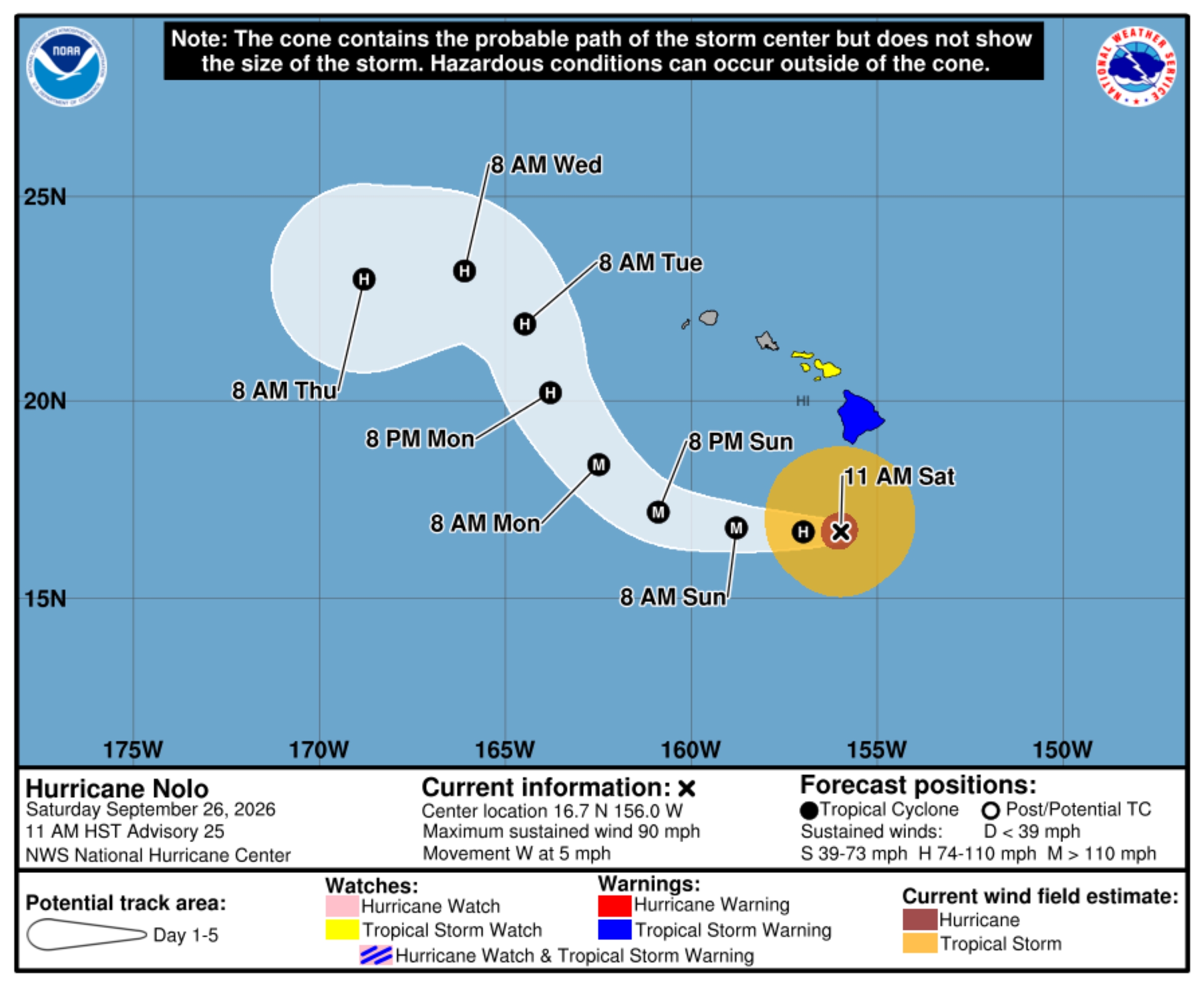
The hurricane watch previously in effect for the Big Island was discontinued; however, a tropical storm warning remains in effect as now Category 1 Hurricane Nolo is moving slowly west at about 5 mph, with maximum sustained winds of 90 mph and higher gusts.
The storm as of the 11 a.m. advisory update is located about 160 miles south of South Point.
Gusty winds, heavy rain and large waves continue to be forecast for portions of the state, including the Big Island. A flood watch and high surf advisory for south- and east-facing shores of the island also remain in effect.
Despite its already weakening from Category 2 on Saturday morning, Nolo is still predicted to strengthen into a major hurricane Sunday and peak in intensity early Monday. Thereafter, steady weakening is expected.
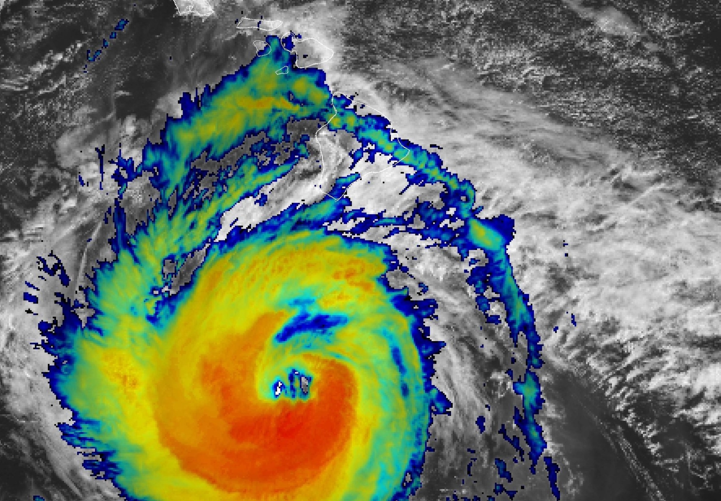
Hurricane force winds extended outward up to 35 miles from the storm center and tropical storm force winds outward up to 150 miles.
Nolo is expected to accelerate westward through the weekend, turning toward the northwest and north-northwest Monday and Tuesday.
Its center is forecast to remain well south and southwest of the main Hawaiian Islands.
Hazards affecting land
Wind:
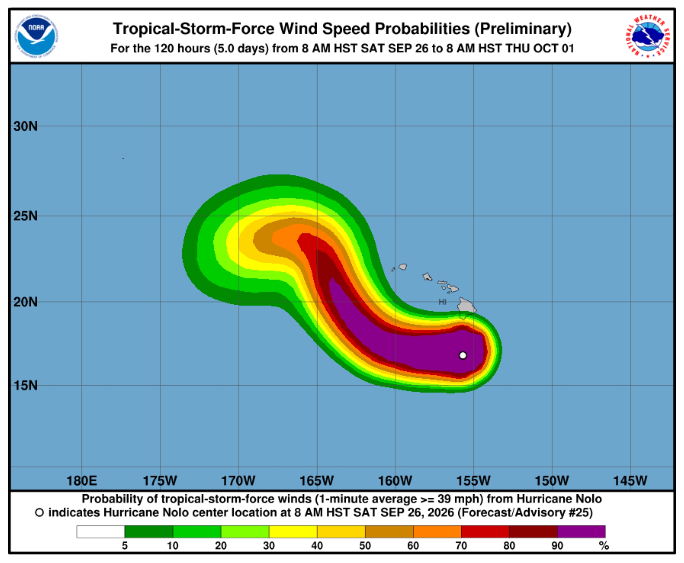
- Tropical storm conditions are occurring on portions of the Big Island.
- Strong and gusty winds are possible for all of the Hawaiian Islands through the weekend.
Rainfall:
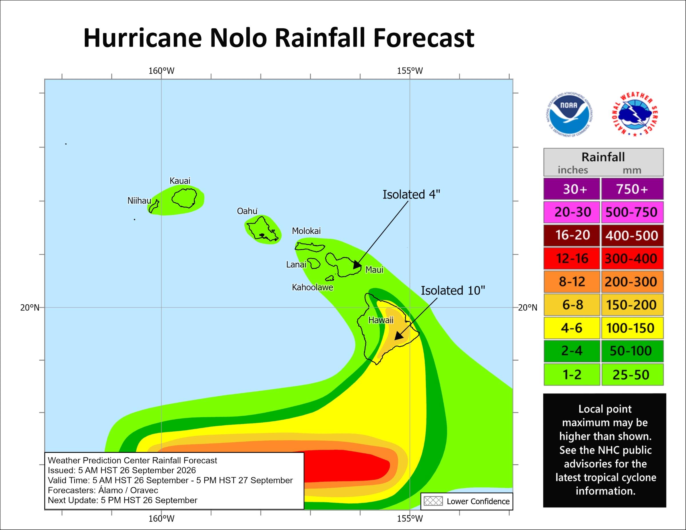
- For the eastern and southern portions of the Big Island, Nolo will produce additional rainfall totals 3 to 6 inches, bringing storm totals to 10 to 20 inches with isolated maximum amounts of 25 inches.
- This rainfall could produce significant, life-threatening flooding and mudslides, especially in areas of steep terrain.
- For western portions of the island, rainfall totals of 1 to 2 inches are expected.
Storm surge:
- The threat of significant storm surge diminished, yet water levels along the coast will remain elevated through upcoming tide cycles because of persistent, dangerous wave action.
Surf:
- Swells generated by Nolo are affecting exposed east- and south-facing shores of the Big Island.
- These swells are likely to cause life-threatening surf and rip current conditions.
More storm forecast Information
For more scientific information about the storm forecast, click here. For storm information specific to your area, including possible inland watches and warnings, monitor products issued by the National Weather Service Honolulu forecast office.
Additional resources
- Disaster preparedness information: American Red Cross.
- Appropriate preparations: Ready.gov.
What Big Island residents and visitors need to know
Also be sure to check out “What Big Island residents need to know about Hurricane Nolo” at Big Island Now for information about shelters, closures and other storm-related items that will help keep you safe.








