


Hawaiʻi Island under Hurricane Watch as storm strengthens
Tropical Depression Fifteen-E is expected to produce rainfall totals of 15 to 20 inches across the Big Island, with maximum amounts of 35 inches.
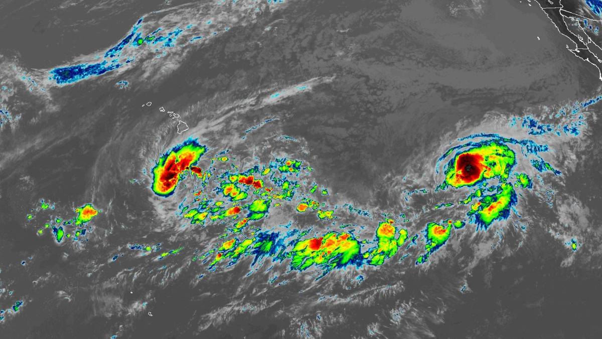
Editorʻs Note: Updated at 11 a.m. Wednesday, Sept. 23.
At 11:01 a.m., Hawaiʻi County officials issued a Hurricane Watch for Hawaiʻi Island.
Tropical Storm Nolo is expected to strengthen as it moves northward, potentially making its closest approach to Hawaiʻi’s Big Island on Saturday. Residents there should follow local officials’ advice, including evacuating if told.
About 320 miles south-southeast of South Point as of 5 a.m. on Wednesday, the advisory puts the system potentially making its closest approach to the Big Island on Saturday, Sept. 26.
Further strengthening into a hurricane is likely on Thursday, and it may become a major hurricane by this weekend.
The depression’s maximum sustained winds remain near 35 mph with higher gusts. The system is moving west-northwest at about 6 mph. This motion is expected for the next day or so.
A sharp turn to the north and north-northeast is expected on Thursday, with this motion continuing through the end of the week.
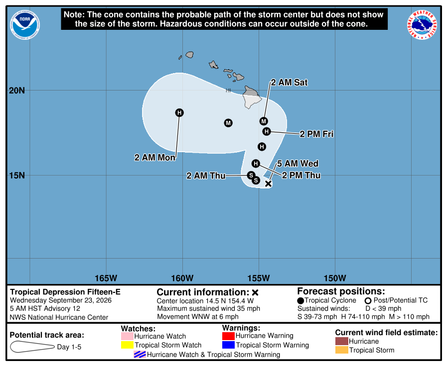
Rainfall
Tropical Depression Fifteen-E will produce rainfall totals of 15 to 20 inches across the Big Island, with maximum amounts of 35 inches. This rainfall may produce catastrophic, life-threatening flooding and mudslides, especially in areas of steep terrain.
Rainfall totals of 5 to 10 inches with maximum amounts of 20 inches expected across Maui.
Across the remainder of the Hawaiian Islands, rainfall totals of 1 to 3 inches, with maximum amounts of 6 inches, are expected, with isolated flooding possible.
Surf
Swells generated by Tropical Depression Fifteen-E are expected to reach the east and south-facing shores of the Big Island on Friday, spreading westward and building through the weekend.
These swells are likely to cause life-threatening surf and rip current conditions.







