

Volcano Watch: ‘Stick Season’ in Hawaiʻi? What happened to the leaves around summit of Kīlauea?
Volcano Watch is a weekly article and activity update written by U.S. Geological Survey Hawaiian Volcano Observatory scientists and affiliates. Today’s article is by Hawaiian Volcano Observatory gas field engineer Mike Cappos.
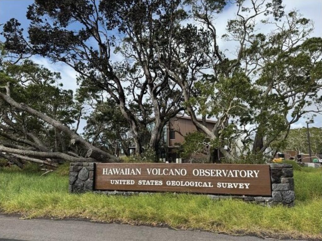
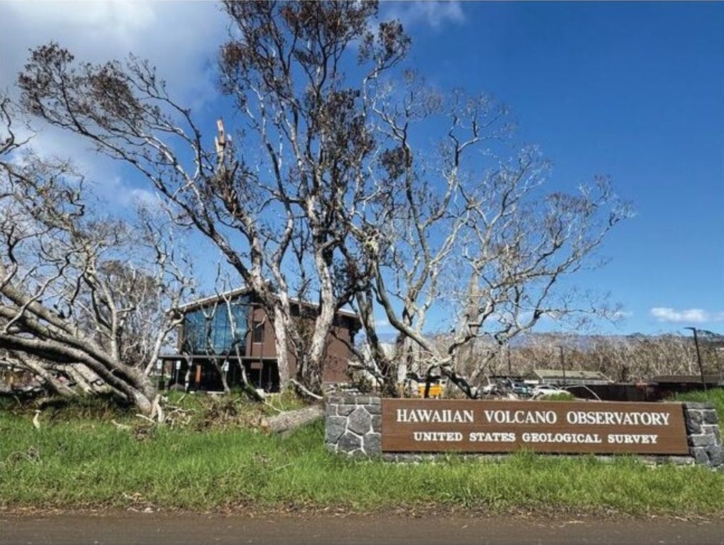
As you walk along Crater Rim Trail from Wahinekapu, or Steaming Bluffs, heading toward Uēkahuna Overlook in Hawaiʻi Volcanoes National Park, you’ll notice far less green vegetation and foliage than usual.
Commonly, in the Northeastern United States after all the leaves fall off the trees during the fall, you’ll hear it referred to as “stick season,” which means ski season is right around the corner!
Seasons are far more subtle here in the Hawaiian Islands, and vegetation doesn’t usually shed leaves in preparation for winter. So, what’s going on here?
Large eruptive plumes produced by the ongoing episodic summit eruption of Kīlauea volcano, which contain high concentrations of volcanic gases and tephra, and wind direction are the key to this answer.
The eruption began Dec. 23, 2024, and continues to have spectacular high lava fountaining episodes, a historic 48 in total at the time of this writing.
Dominant northeast trade winds during most of the fountaining episodes carried the hazardous eruption plumes to the southwest into the Kaʻū Desert, away from public viewing areas in Hawaiʻi Volcanoes National Park and communities near the summit of Kīlauea.
However, winds shift during winter months, bringing “kona” winds, which emanate from the south.
Hawaiʻi weathered through multiple intense kona low storm systems from January through April, which pushed Kīlauea’s eruptive plume toward the north, impacting areas of Hawaiʻi Volcanoes National Park and surrounding communities.
Vegetation needs to endure long periods of exposure to elevated levels of sulfur dioxide gas during kona winds, as the gas is continuously released from the active summit vents.
Sulfur dioxide is a highly acidic gas that forms dilute sulfuric acid when it reacts with water, whether it be in the form of rain, fog or morning dew.
Water samples collected downwind of Kīlauea’s summit during the lava lake days from 2008-18 showed acid rain with a pH of 4 or less, with normal rainwater having a pH of about 7.
This acid rain ‘burns’ the foliage, turning it brown. To make things worse, vegetation also needs to breathe.
When sulfur dioxide is brought into the plant through its stomata — the tiny breathing pores in their leaves — it reacts with the water within the leaves themselves and further damages the plant.
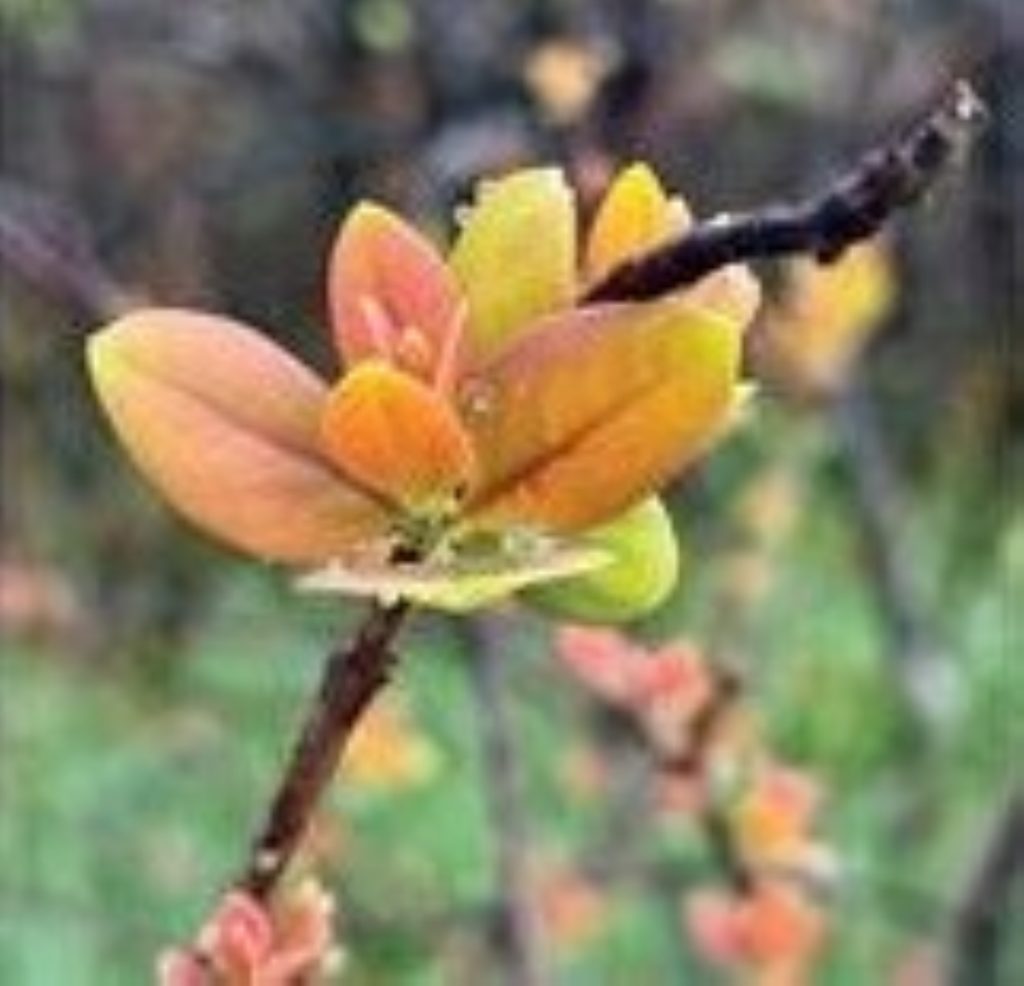
One tree found in abundance around the Kīlauea summit has a secret weapon to help combat this.
Native ʻōhiʻa lehua trees are highly adapted to survive in the volcanic environments of the Hawaiian Islands. They have the amazing capability to close their stomata, so the trees can “hold their breath” when toxic volcanic gases are blown their way.
This helps reduce the internal impact sulfur dioxide has on the trees. However, even ʻōhiʻa need to breathe eventually, and prolonged exposure to high concentrations of gas can still cause damage to these hearty native trees.
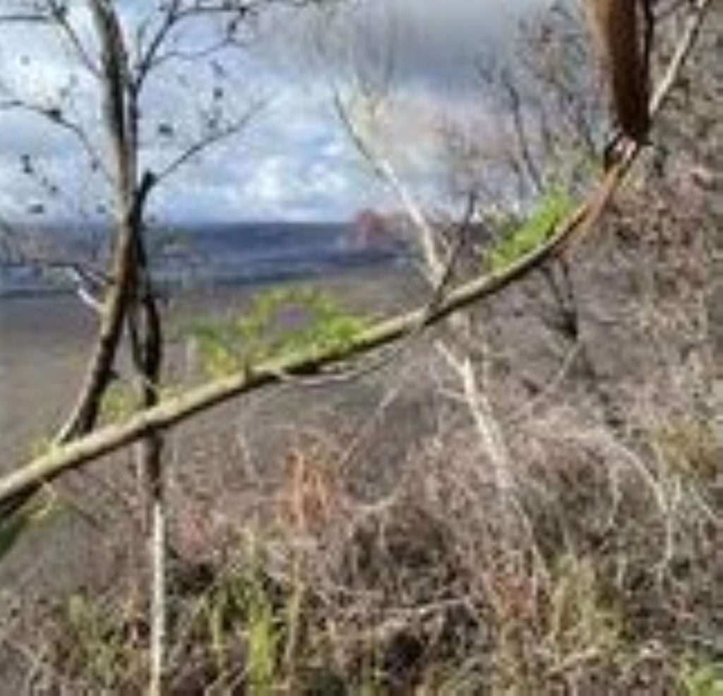
In the Kīlauea summit area, particularly around the Kilauea Military Camp and Volcano Golf Course community, vegetation was hit hardest as this area was “staring down the barrel” of the eruptive plume during kona winds.
Tephra fall in this area from high fountaining episodes between January and April was not inconsequential.
As light as tephra seems to us because it floats on water, when it falls out of the eruptive plume it has enough energy to strip the foliage right off the trees.
Combine this tephra fall with a very strong kona low, like the back-to-back storms that hit the island in March during Episode 43, and vegetation was devastated, looking very similar to what happened around Kīlauea Iki during its 1959 eruption.
This is how the Devastation Trail in Hawaiʻi Volcanoes National Park got its name! Vegetation needed to endure tephra fall and exposure to sulfur dioxide, a one-two punch.
With late spring and summer upon us, thankfully the trade winds returned, which at last is giving the vegetation around the summit area a reprieve.
There are already signs of renewed foliage starting to pop out. And while it might take some time to get back to the lush greenery this area is used to, the healing process has begun!
* * * * * * * * *
VOLCANO ACTIVITY UPDATES
KĪLAUEA volcano
VOLCANO ALERT LEVEL: Advisory
Kīlauea has erupted episodically since Dec. 23, 2024, within the summit caldera inside Hawaiʻi Volcanoes National Park. Historic Episode 48 of summit lava fountaining happened for 9 hours June 1. No unusual activity has been noted along Kīlauea’s East Rift Zone or Southwest Rift Zone.
WHAT’S NEXT: Summit region inflation since the end of Episode 48 indicates another fountaining episode is possible. Models indicate Episode 49 is most likely to begin sometime between the next 10 and 15 days.
MAUNA LOA volcano
VOLCANO ALERT LEVEL: Normal
Mauna Loa is not erupting. Earthquake counts increased slightly in May from the month before, according to the June 4 monthly activity update for the volcano from Hawaiian Volcano Observatory, and inflation continued.
Clustering of events under Mokuʻāweoweo, Mauna Loa’s summit caldera, and the upper Southwest Rift Zone is still present. A total of 170 earthquakes were detected beneath the summit region during the May reporting period, while April had 132 earthquakes.
A magnitude-6.0 earthquake May 22 was located deep beneath the west flank of Mauna Loa and beneath the Island of Hawaiʻi; it was not related to volcanic processes or magma movement, but rather because of bending of the Pacific Plate from the weight of the Hawaiian Islands.
Data from global positioning system instruments on Mauna Loa show consistent rates of slow inflation at the summit during the past 6 months, which is associated with refilling of the summit reservoir system following the 2022 eruption.
Hawaiian Volcano Observatory continues to closely monitor Kīlauea and Mauna Loa.
* * * * * * * * *
EARTHQUAKES
One earthquake was reported felt during the past week in the Hawaiian Islands:
- MAGNITUDE-4.6 earthquake at 5:58 p.m. June 2 located 3 miles west-northwest of Kahaluʻu-Keauhou at a depth of 21 miles.
Visit the Hawaiian Volcano Observatory website for past “Volcano Watch” articles, Kīlauea and Mauna Loa updates, volcano photos, maps, recent earthquake information and more. Email questions to ask HVO@usgs.gov.
Sponsored Content


