

Soggy situation: 12 Big Island locations already recorded 2 or more inches of rain, including 2 with more than 11 inches
Forecasters with National Weather Service Honolulu Forecast Office remain confident about the potential for flooding from heavy and excessive rainfall drowning the islands, with moderate to locally heavy showers beginning to move in Tuesday, April 7, from the south.
Bottom line up front: Increased moisture will bring heavy rain episodes, heightening the risk of flash flooding.
Confidence about the timing for possible flooding risk even increased since Monday, with forecasters reporting in their morning storm briefing Wednesday that they are now pretty sure the likely period of most significant storm impacts will be Wednesday, April 8, through Friday, April 10.
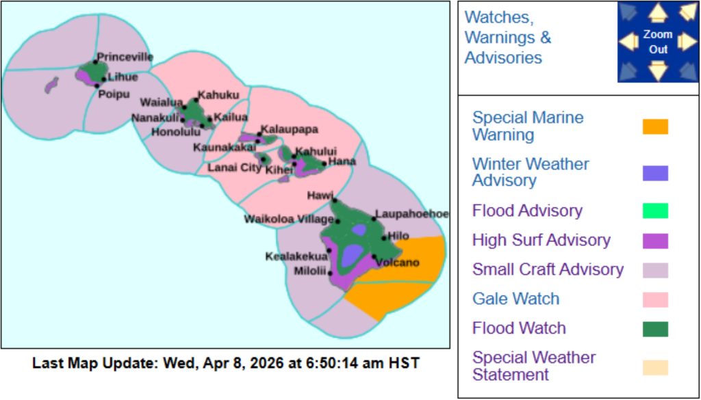
A flood watch — in effect from 6 a.m. Wednesday to 6 p.m. Friday — was already issued for the entire island state
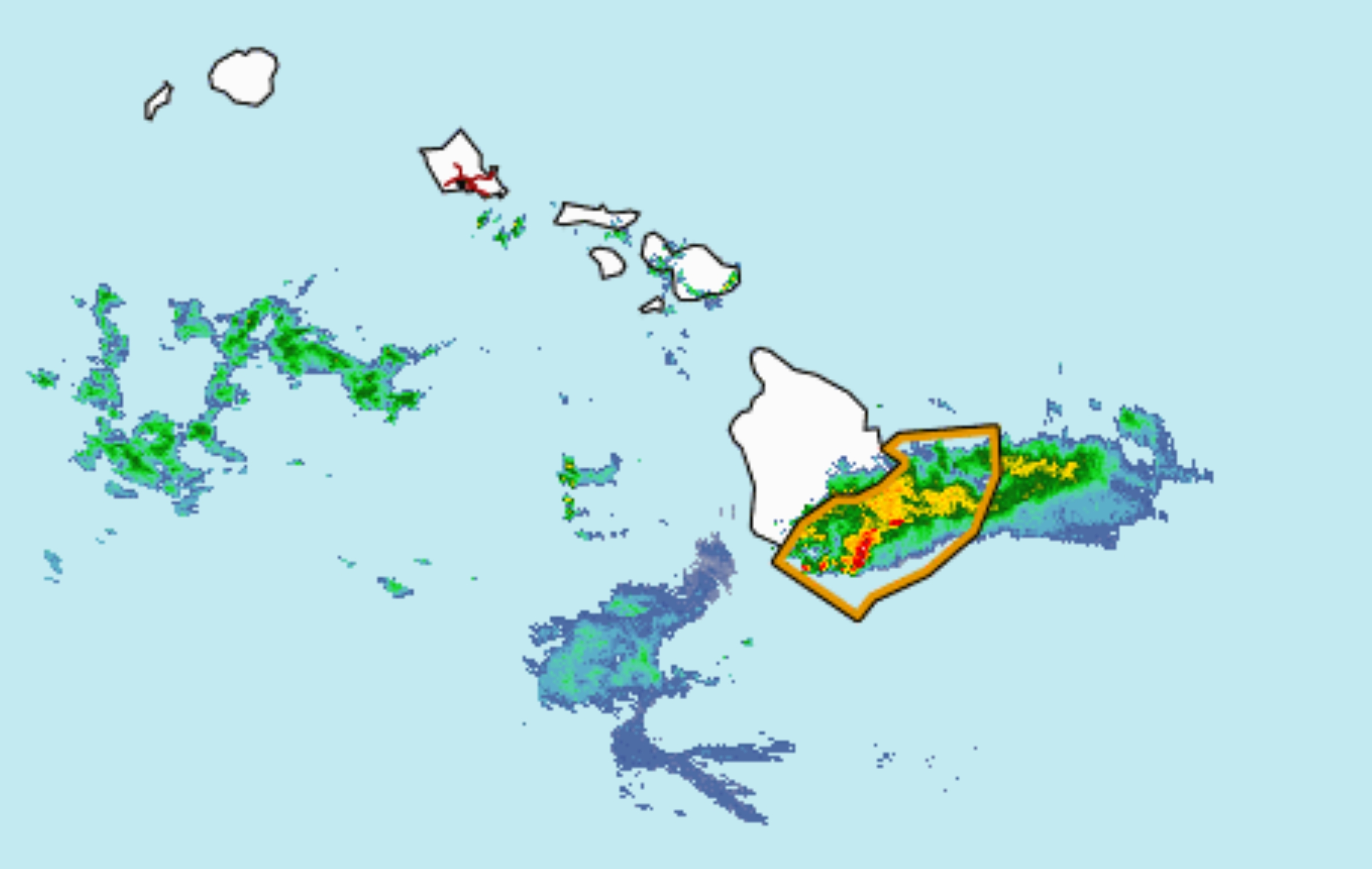
Tuesday night into early Wednesday morning was already a pretty soggy situation for some eastern and southeastern portions of the Big Island. Several flood advisories later replaced by flash flood warnings were issued for parts of Puna and Kaʻū from later Tuesday afternoon until just before 5 a.m. Wednesday.
Persistent rain — falling at a rate of 1 to 3 inches an hour — moved over downslope makai parts of the two districts for several hours.
Some communities that likely experienced flooding included Hawaiian Paradise Park, Hawaiʻi Volcanoes National Park, Volcano, Glenwood, Mountain View, Hawaiian Acres, Orchidland Estates, Pāhoa, Wood Valley, Pāhala, Punaluʻu Black Sand Beach, Kawa Flats, Nāʻālehu, Fern Forest, Eden Roc, Fern Acres, Kalapana, Kurtistown and ʻĀinaloa.
National Weather Service Honolulu Forecast Office preliminary 24-hour rainfall totals collected by automated rain gauges around the island, ending at 6 a.m. Wednesday, included several amounts of 2 inches or more:
- Kealakomo: 15.36 inches.
- Pāhoa (15015): 11.74 inches.
- Pāhoa (UHM): 9.71 inches.
- Pali 2: 9.71 inches.
- Kapapala: 6.11 inches.
- Pāhala (15004): 5.20 inches.
- Kapapala Ranch (15003): 4.17 inches.
- Nāhuku: 4.04 inches.
- Mountain View (15014): 3.74 inches.
- Hilo Airport: 2.25 inches.
- Glenwood (15013): 2.11 inches.
- Kaiholena: 2.01 inches.
The highest rainfall total collected during the same time period at the northern end of the state on Kaua‘i was in Hanapepe with 1.19 inches of rain.
All of the automated rain gauges on the Garden Isle recorded collecting rainfall, but none other than the Hanapepe gauge reported an inch or more.
The Big Island will stay soggy through Wednesday and likely the rest of the week.
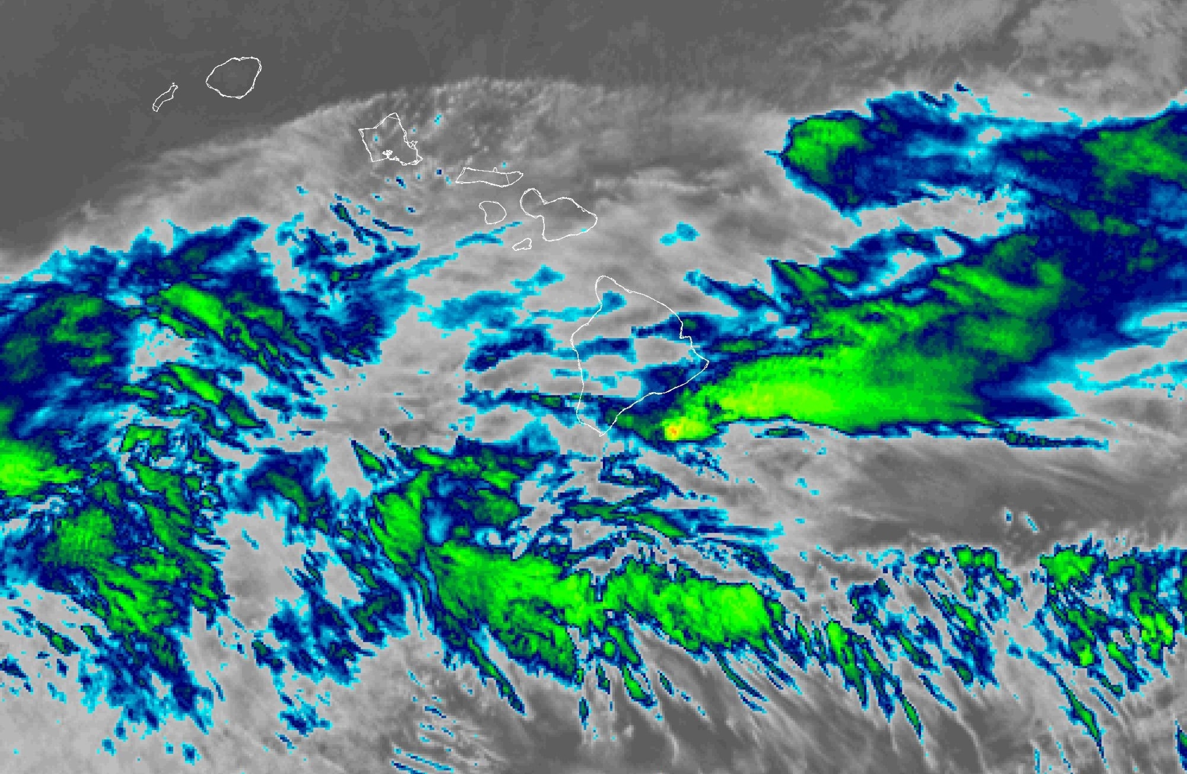
Rain was again moving in from the south Wednesday morning.
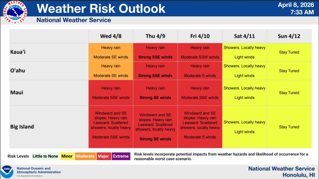
National Weather Service forecasters say there is a major risk of heavy rain along windward and southeastern slopes along with scattered showers and locally heavy rainfall forecast for leeward areas. That’s a greater risk in Wednesday morning’s storm brief than the moderate risk forecast Tuesday.
Winds are still forecast to be moderate from the south-southeast.
Kaua‘i has a moderate risk for heavy rain Wednesday, with moderate winds from the souheast.
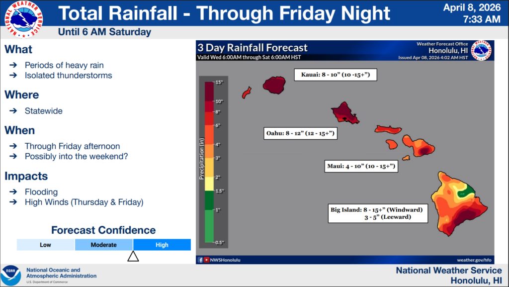
The rainfall forecast from Wednesday morning’s storm briefing showed windward locations of the Big Island possibly receiving a total of 8 to 15 inches of rain or more and 3 to 5 inches possible in leeward areas during a 3-day period ending at 6 a.m. Saturday.
 Courtesy Graphic: National Weather Service
- Courtesy Graphic: National Weather Service
- Courtesy Graphic: National Weather Service
- Courtesy Graphic: National Weather Service
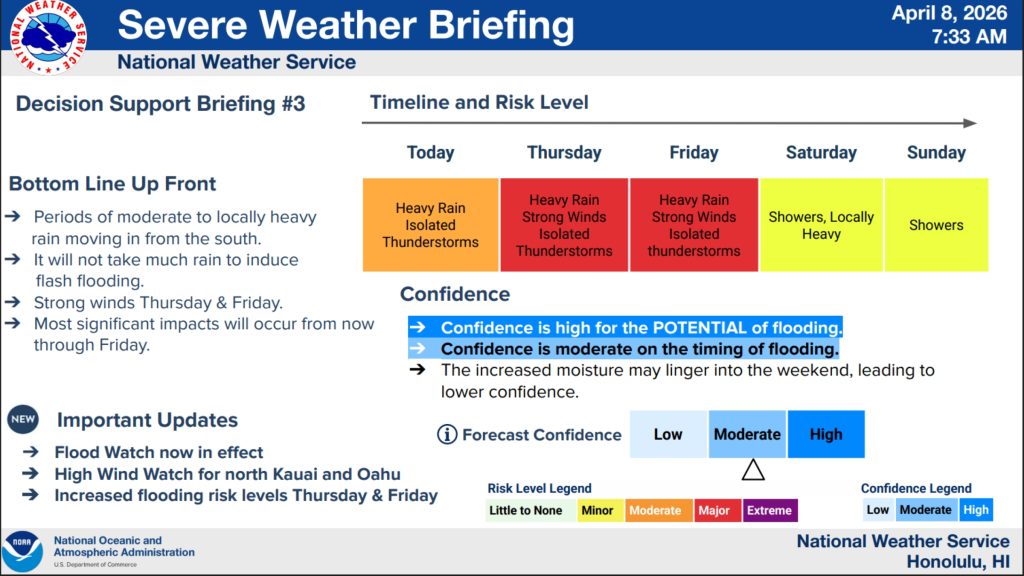


“It will not take much rain to induce flash flooding,” said National Weather Service in its Wednesday morning storm briefing, adding that the flooding risk increases Thursday and Friday.
Kaua‘i is forecast to receive from 8 to 10 inches of rain, depending on where on the island during the same period, with some locations possibly recording more, perhaps even as much as up to 15 inches.
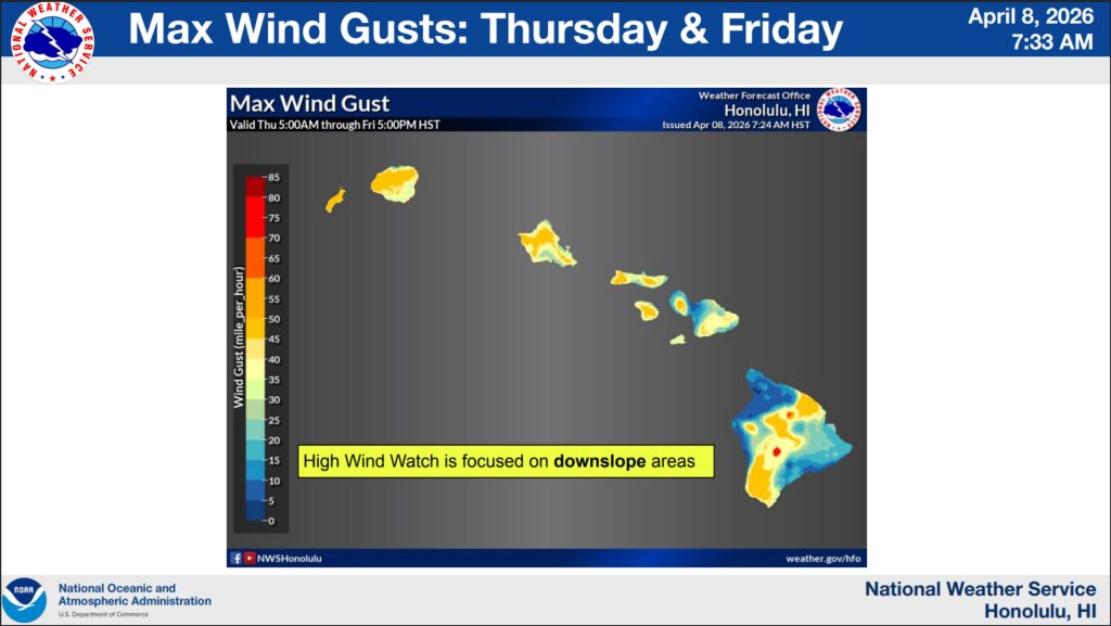
A high wind watch will be in effect from 6 a.m. Thursday through 6 a.m. Friday for the north and interior mountain portions of Kaua‘i, with south winds of 20 to 30 mph, and gusts up to 60 mph.
Winds that strong can blow down trees and power lines, making widespread power outages possible. Travel also could be difficult, especially high-profile vehicles.
The public is advised to take precautions now to protect their property, including tying down loose objects or moving them inside and to higher ground.
A high surf advisory is in effect through 6 a.m. Thursday for south-facing shores of the entire state.
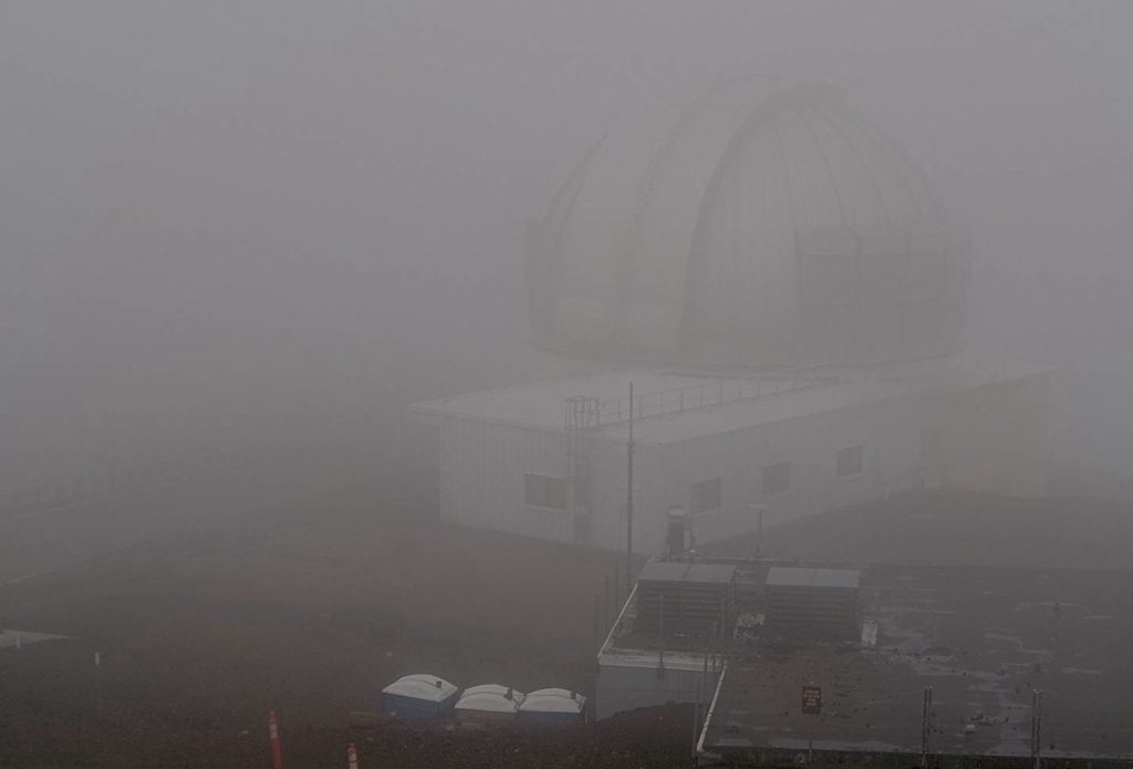
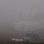
And a winter weather advisory continues through 6 a.m. Friday above 12,500 feet at the summits of Mauna Kea and Mauna Loa on the Big Island.
Snow and freezing rain are expected, with total snow accumulations of up to 6 inches and ice accumulation up to a quarter-inch possible. Winds will also gust as high as 55 mph.
- Webcam image captured at just after 9 a.m. Wednesday, April 8, 2026, looking southwest from United Kingdom Infrared Telescope atop Mauna Kea on the Big Island. A winter weather advisory is in effect for Big Island summits above 12,500 feet.
- Courtesy Graphic: National Weather Service
Looking ahead to the rest of this week, there is a major risk for more heavy rain, strong winds and isolated thunderstorms Thursday and Friday throughout the state.
There is a minor risk for locally heavy showers with light winds Saturday on all islands. That’s as far as National Weather Service forecast models extend as of Wednesday morning.
Get the latest advisory, watch and warning information and forecast details from the National Weather Service Honolulu Forecast Office website. You can also find the best local forecast information on the Big Island Now Weather page.
Sponsored Content


