

Volcano Watch: U.S. Geological Survey updates Volcano Observatory Notice to Aviation alerts
“Volcano Watch” is a weekly article and activity update written by U.S. Geological Survey Hawaiian Volcano Observatory scientists and affiliates.
A Volcano Observatory Notice to Aviation alert is used by volcano observatories around the globe to inform the aviation community — pilots, air traffic managers, dispatchers, meteorologists and airlines — about volcanic activity that could pose an aviation hazard.
An upcoming change in message formatting will improve the way aviators get this information.
U.S. Geological Survey is designated by the Federal Aviation Administration as the entity to issue Volcano Observatory Notices to Aviation within the United States, a duty that comes along with the responsibility to follow content and format requirements established by the International Civil Aviation Organization.
The Volcano Observatory Notice to Aviation format was recently updated to conform to aviation sector standards.
It is now machine-readable to allow notifications to be ingested into flight planning software used by airlines and distributed via the Aeronautical Fixed System of communication. However, the new format is not human friendly, as it is in all capital letters and uses aviation abbreviations, such as “VA” for volcanic ash.
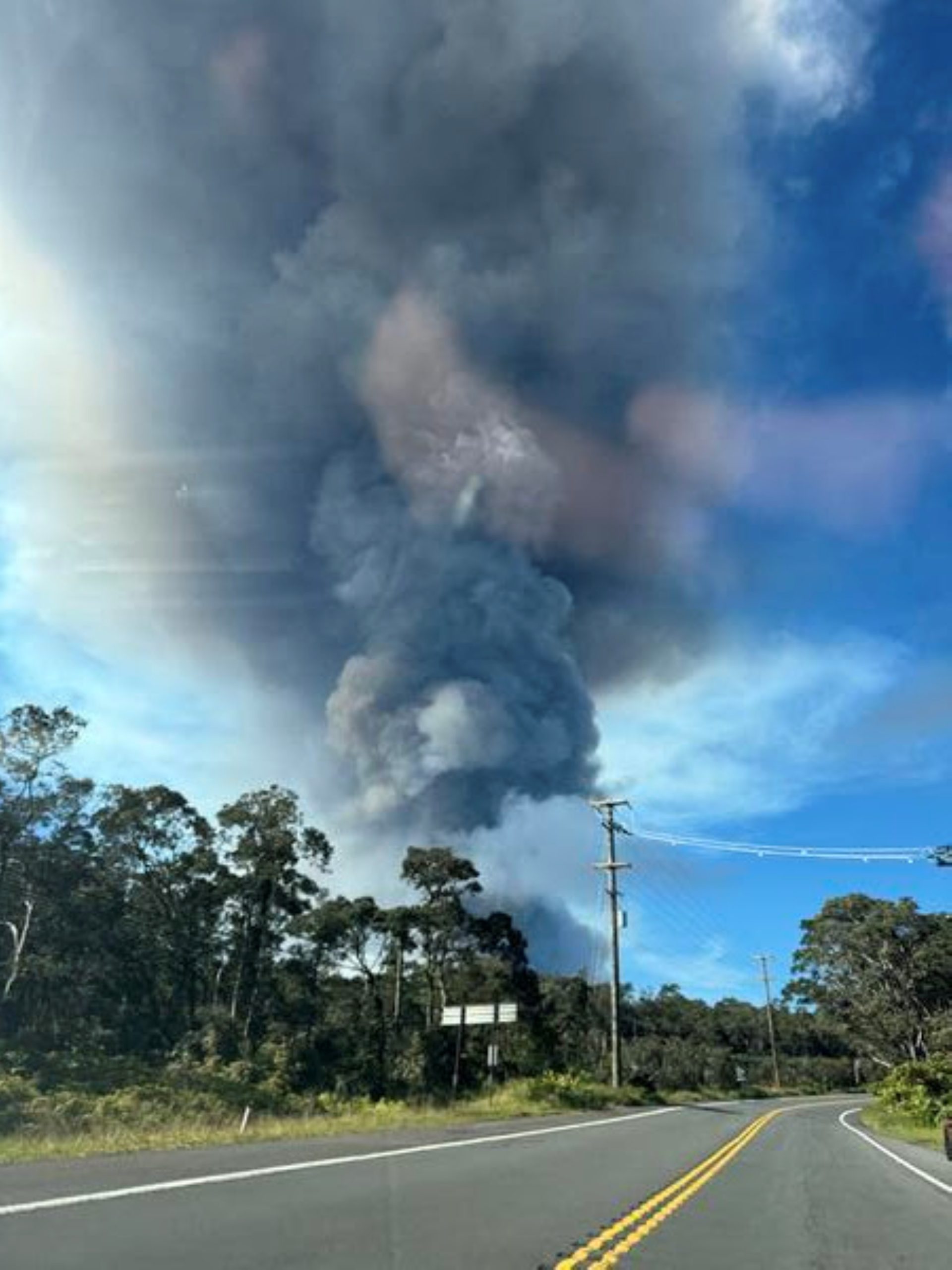
Volcano Observatory Notices to Aviation provide information important for aviation, such as elevation of the volcanic plume above sea level — the plume includes ash and gas that can rise thousands of feet above a lava fountain — or direction ash is being transported by the wind.
A Volcanic Activity Notice is the U.S. Geological Survey notification product informing officials and the public about volcanic activity and potential ground hazards.
This information is specifically shared with partner response agencies such as Hawaiʻi County Civil Defense and Hawaiʻi Volcanoes National Park, as well as Hawaiʻi residents and visitors.
These two notifications also include the Volcano Alert Level and Aviation Color Code System — a word or color used to quickly communicate a volcano’s hazard level.
But what is a hazard?
Hazards are anything with a potential source of danger. Volcanoes can have different hazards on the ground versus in the air, which is why the notification system is two-tiered.
Volcano Alert Level ranks volcano status for ground hazards
- Normal: The volcano is not erupting and in a low-level background state of activity.
- Advisory: There is some elevated activity — such as ground deformation or earthquakes — that could escalate to an eruption.
- Watch: An eruption is likely, or an eruption is occurring with limited hazards.
- Warning: A hazardous eruption is imminent, underway or suspected.
Volcano Aviation Color Code focuses on aviation hazards
Each color code mainly focuses on the threat of volcanic ash to the aviation sector:
- Green and Yellow: The same definition as Normal and Advisory Volcano Alert Levels.
- Orange: Eruption likely or is occurring with no/minor ash.
- Red: Eruption with significant ash emission is imminent, underway or suspected.
An Unassigned alert level or aviation color code means there is not enough monitoring data to assess the level of ground or aviation hazards.
Alert levels and aviation color codes of Hawai‘i volcanoes often are at the same level, so-to-speak, but they also can be split depending on conditions.
During the 2022 Mauna Loa eruption, for example, the volcano’s alert level was at the highest level of Warning because a lava flow was encroaching on Daniel K. Inouye Highway, also known as Saddle Road, while its aviation color code was at Orange because there was only minor ash emission.
Kīlauea has been at Watch/Orange for most of the ongoing episodic summit eruption that started Dec. 23, 2024.
However, the aviation color code could be raised to Red in the future if the plume is high enough to potentially impact the aviation sector. Its alert level could also be raised to Warning in the future if there is the possibility of tephra fallout like what occurred Jan. 24 during Episode 41 of lava fountaining.
You can subscribe to receive notifications from the Volcano Alert Level and Aviation Color Code System using the Volcano Notification Service.
The change in Volcano Observatory Notice to Aviation format means information will be provided to the aviation sector in the same manner as other meteorological advisories, watches and warnings as well as forecast information.
Hawaiian Volcano Observatory will issue its first Volcano Observatory Notice to Aviation in the new format when the next Kīlauea fountaining episode begins — and the aviation community will get that information more quickly and effectively than ever before.
VOLCANO ACTIVITY UPDATES
KĪLAUEA volcano
VOLCANO ALERT LEVEL: Watch
Kīlauea has erupted episodically since Dec. 23, 2024, within the summit caldera. Episode 42 lava fountaining happened Feb. 15 for just less than 10 hours. No unusual activity has been noted along Kīlauea’s East Rift Zone or Southwest Rift Zone.
WHAT’S NEXT? Summit region inflation since the end of Episode 42 indicates another fountaining episode is possible, with models suggesting Episode 43 could begin between March 10 and 15.
MAUNA LOA volcano
VOLCANO ALERT LEVEL: Normal
Mauna Loa is not erupting. Read more about the current status of Mauna Loa in the March 5 monthly update issued by Hawaiian Volcano Observatory.
Hawaiian Volcano Observatory continues to closely monitor Kīlauea and Mauna Loa.
EARTHQUAKES
Two earthquakes were reported felt in the Hawaiian Islands during the past week:
- MAGNITUDE-2.6 at 12:11 p.m. March 2 located 1 mile north-northeast of Mountain View.
- MAGNITUDE-3.9 at 10:39 p.m. March 1 located 11 miles southeast of Pāhala at a depth of 21 miles.
Visit the Hawaiian Volcano Observatory website for past “Volcano Watch” articles, Kīlauea and Mauna Loa updates, volcano photos, maps, recent earthquake information and more. Email questions to askHVO@usgs.gov.
Sponsored Content


