


Land of fire and ice: Winter weather forecast at Big Island summits as threat of wildfire ignition remains below
This story was updated at 7:40 p.m. Oct. 24, 2025, to reflect the extension of a wind advisory in effect for the summits of Mauna Kea and Mauna Loa. Read toward the end of the story for additional details.
Who needs a fictitious song, book series written by George R.R. Martin based on that song or two TV series based on both to imagine a land of fire and ice?
Hawai‘i might not have dragons like the Targaryens in “Game of Thrones” and “House of the Dragon,” but it does offer real life flames and frigidness from time to time — and it’s happening this weekend.
Dry, windy conditions will persist the remainder of today and likely Saturday for much of the Big Island — with the threat of wildfires igniting flames at lower elevations under a continuing red flag warning — as high pressure moves east and strengthens north of the islands.
An upper level low is now also forecast to move in over the island tonight as it treks in the opposite direction of its high pressure cousin and to its eventual destination just west of the state Saturday.
The first forecasted winter weather of the season then becomes increasingly possible at the summits Mauna Kea and Mauna Loa on the Big Island as moisture increases over the eastern end of the islands with the arrival of the new upper level low.
Forecasters with the National Weather Service in Honolulu issued a winter weather advisory in effect from 6 p.m. today (Oct. 24) until 6 a.m. Sunday (Oct. 26) for the summit regions of both mountains as travel could become very difficult with blowing snow significantly reducing how far you can see, including periods of zero visibility.
Total snow accumulations of 3 to 5 inches are expected. Ice accumulation of up to 0.1 inch also is forecast.
A winter weather advisory means periods of snow, sleet or freezing rain will cause travel difficulties.
The public is advised to be prepared for slippery roads and limited visibilities and use caution while driving.
Temperatures at the summit of Mauna Kea ranged from 0 degrees Celsius to 1.9 Celsius at about 4:15 p.m. Friday.
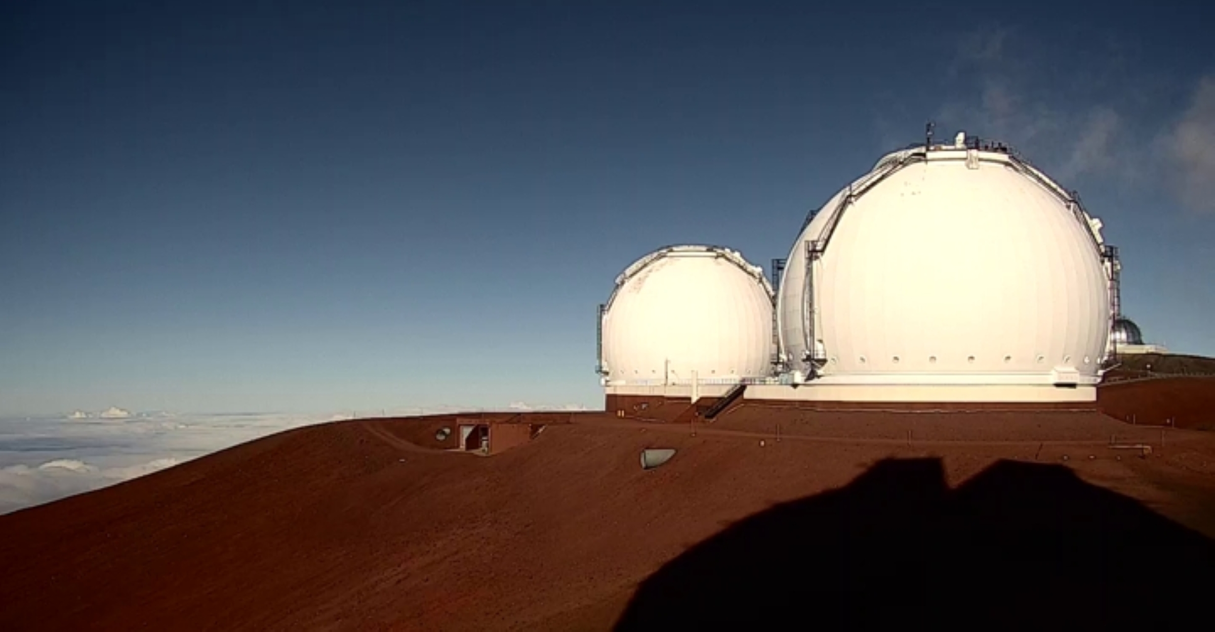
A glance at the summit webcams available at most of the observatories revealed a pretty clear day so far, with dry conditions along with sunshine and blue skies overhead.
Relative humidity ranged from the lowest of 23% to a high of 66%.
Winds were blowing mostly from easterly directions at speeds of wide ranging and sustained 10 to 45 mph. Gusts in some spots were as fast as 55 mph.
Relative humidity levels had started to increase shortly before 4:30 p.m., with only one observatory reporting a value of less than 30%.
National Weather Service forecasters also extended a wind advisory in effect for the Big Island summits until 6 a.m. Saturday, as east winds of 35 to 45 mph, with gusts up to 60 mph, are expected to continue wailing overnight.
Winds that strong can make driving and walking dangerous because of the possibility of doors being forcefully opened and damaging hinges or wind slamming doors shut and potentially causing injuries.
The public is advised that anyone with travel plans to either summit should consider postponing them until conditions improve.
If you must travel to the summit region of either mountain, use extra caution and be especially extra careful when opening and closing doors.
Visit the National Weather Service Honolulu forecast office website for additional information about weather watches, warnings or advisories as well as up-to-date forecast information for your area.
Sponsored Content


