

UPDATE: Dry, windy conditions to persist, keeping danger of wildfires in the forecast
Update at 3:33 p.m. Aug. 2, 2025: Dry and windy conditions will keep their grip on the islands for at least another day, producing critical fire weather conditions again through Sunday afternoon.
Forecasters with the National Weather Service in Honolulu again extended the red flag warning — now in effect until 6 p.m. Aug. 3 — for leeward and interior portions of the Big Island continue to be under danger of wildfire.
Winds will be strongest over and downwind of terrain, especially this afternoon through the evening, and then begin to slowly decline Sunday, though critical fire weather conditions are expected as dry weather persists over leeward areas.
East-northeast trades at 15 to 30 mph, with gusts up to 50 mph, can be expected in the advisory locations — mainly portions of North and South Kohala, North and South Kona, Kaʻū, Puna and other interior locations of the Big Island — along with relative humidity levels as low as 35% to 45%.
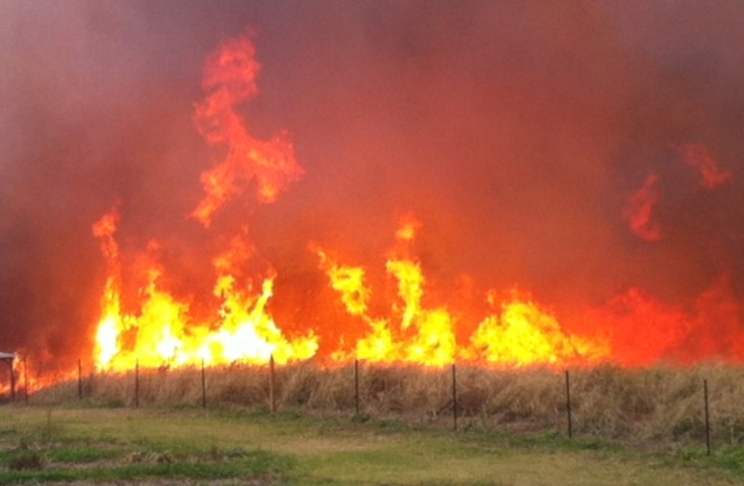
With enough dry fuel sources available, these conditions can contribute to extreme fire behavior. Any fires that develop will likely spread rapidly.
Keep in mind, however, that a red flag warning does not predict new fire starts.
Because of these conditions, Hawai’i County Mayor Kimo Alameda signed an emergency proclamation July 31.
Visit the Hawai’i Wildfire Management Organization website for actions you can take to protect life and property from wildfires.
Update at 2:29 p.m. Aug. 1, 2025: A dry and locally windy trade wind flow will continue to produce critical fire weather conditions through the afternoon of Aug. 2, with winds strongest over and downwind of terrain.
Winds should begin a slow decline Sunday, though near critical fire weather conditions are expected as dry weather persists over leeward areas.
Therefore, forecasters at the National Weather Service office in Honolulu extended until 6 p.m. Aug. 2 the red flag warning in effect for portions of North and South Kohala, North and South Kona, Kaʻū, Puna and other interior locations of the Big Island.
East winds sustained at 15 to 30 mph, with gusts up to 50 mph combined with relative humidity falling to between 35% and 45% during the afternoon plus dry fuel sources can contribute to exteme fire behavior.
Hawaiʻi County Civil Defense reports that while a red flag warning does not predict fires will ignite, any that develop will likely spread rapidly and be difficult to control.
Because of these conditions, Hawai’i County Mayor Kimo Alameda signed an emergency proclamation July 31 prohibiting:
- All outdoor burning and open flames.
- All “hot work” such as grinding, welding, flame cutting or other spark-producing operations.
Heat from vehicle exhaust systems also can ignite dry grass, so the public is advised to park cars on areas that are paved or where vegetation is trimmed and cleared.
High winds contribute to wildfire hazard. Delay activities that could throw off sparks until wind dies down.
Visit the Hawai’i Wildfire Management Organization website for actions you can take to protect life and property from wildfires.
Original post from 11:19 a.m. July 31, 2025: A red flag warning was issued by the National Weather Service for the Big Island and for portions of the state through the evening of Aug. 1.
The Hawaiʻi Emergency Management Agency, also known as HIEMA, is alerting that critical fire weather conditions, strong winds, low humidity, and dry fuels are creating an extreme wildfire risk, according to a press release.
“We cannot afford to be careless when conditions are this dangerous,” stated Gov. Josh Green.
Additionally, HIEMA officials ask residents to refrain from disposing of lit cigarette butts or burning yard waste, as non-native, fire-prone grasses and shrubs cover more than 25% of Hawaiʻi’s landscape. These plants create “fine fuels” that can lead to rapid and unpredictable fire spread.
“A single spark can have devastating consequences. It is everyone’s kuleana — our shared responsibility — to prevent ignition and protect our communities,” added James Barros, HIEMA Administrator.
Any fires that develop will likely spread rapidly. The red flag warning is in effect till 6 p.m. on Friday, however, it may and can be extended, dropped, or modified as conditions evolve.
Hawaiian Electric is also monitoring high winds and dry conditions.
At the moment, Public Safety Power Shutoff is in a “watch,” meaning that if weather conditions intensify in the next 24 to 48 hours, Hawaiian Electric may proactively shut off power in communities with high exposure to wildfire risk.
“While we hope shutting off power won’t be necessary, we have to take this threat seriously, and we urge our customers to be prepared and stay informed, said Jim Alberts, Hawaiian Electric senior vice president and chief operations officer.
Additionally, outages unrelated to the company’s PSPS program could still occur due to high winds and other conditions.
Green asks that people take the warning seriously.
Report any smoke or flames to Hawai‘i Island police dispatch at 808-935-3311 or call 911 in an emergency.
For weather updates, call the National Weather Service automated weather line at 808-245-6001 or visit the NWS website by clicking here.
Sponsored Content


