

Several more areas now reopen with end of Kīlauea middle East Rift Zone eruption
More areas of Hawai‘i Volcanoes National Park and state lands are being reopened following the middle East Rift Zone eruption of Kīlauea volcano that ended Sept. 20.

The national park reports Maunaulu parking lot, Puʻuhuluhulu and Maunaulu reopened last weekend. Nāpau Trail is open again to the junction with Nāulu Trail, which also reopened.
However, areas east of Makaopuhi Crater remain shuttered because of volcanic and wildfire-related hazards.
Nāpau Trail past Makaopuhi Crater, Nāpau Campground and Nāpau Crater all remain closed because of hazards including scalding steam vents, new ground fractures, burning vegetation and fire-weakened trees, fresh pāhoehoe lava crust that can cause serious cuts and rough, uneven terrain that can cause falls.
Nāpau Crater and most of the campground were inundated by lava during the four eruptive episodes of the mid-September eruption.
A wildfire ignited by the eruption burned about 90 acres of forest and continues to smolder in the remote area.
Only one campsite remains at Nāpau.
Visitors should always plan ahead and check the park website for any closures or hazards.
 Hardened black lava from Kīlauea volcano’s recent middle East Rift Zone eruption from Sept. 15-20 covers what was once a camp site near and scorched ʻōhiʻa trees in the Nāpau campground at Hawaiʻi Volcanoes National Park. (National Park Service photo/H. Vidal)
- Hawaiʻi Volcanoes National Park staff carry a closure sign Sept. 29 on Nāpau Trail inside the park. (National Park Service photo/M. Gallegos)


The Hawai‘i Department of Land and Natural Resources reports access is being restored as of noon today to its Kahaualeʻa Natural Area Reserve on the Big Island.
Kahaualeʻa Trail, also known as the Captain’s Trail, will reopen at the same time.
The state Land Department’s Division of Forestry and Wildlife encourages visitors to check eruption information from the Hawaiian Volcano Observatory website before visiting.
For general information about closures of trails and natural area reserves on the Big Island, call the Division of Forestry and Wildlife at 808-974-4221.
Kīlauea is not currently erupting.
Lava flows from the September eruption covered about two-thirds of the Nāpau Crater floor and a total of about 156 acres inside the crater and areas just west.
- Lava from Kīlauea volcano flows inside Kahaualeʻa Natural Reserve Area Reserve during a previous eruption. (Photo courtesy of the Hawaiʻi Department of Land and Natural Resources)
- Recent pāhoehoe flows contrast with the lush native forest as you walk along Kahauale‘a Trail in the Kahaualeʻa Natural Area Reserve. (Photo from the Kahauale‘a Trail website)
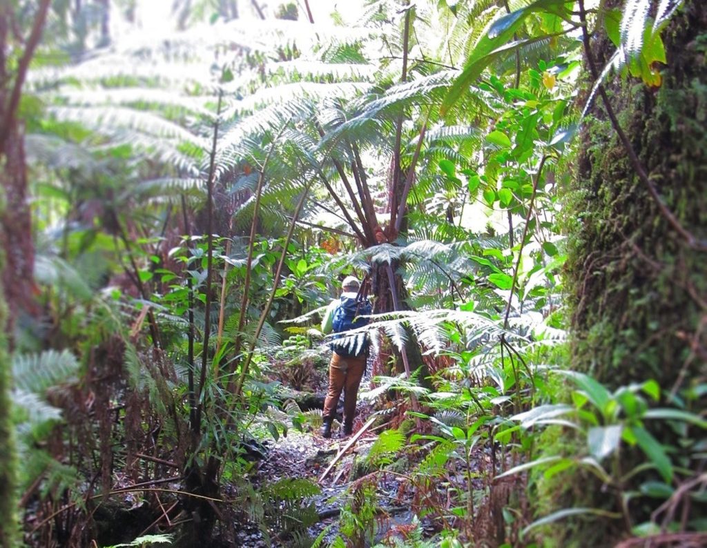
- Large hāpuʻu, or tree ferns, dwarf hikers as they pass under the multiple canopies of the forest along Kahauale‘a Trail in the Kahaualeʻa Natural Area Reserve. (Photo from the Kahauale‘a Trail website)


Sponsored Content


