

Highway Repairs Completed Following Kīlauea Eruption & Hurricane Lane
The Hawai‘i Department of Transportation (HDOT) Highways Division reports that the emergency repairs on Hawai‘i Island of damages caused by the Kīlauea East Rift Zone Eruption (May to September 2018) and Hurricane Lane (August 2018) have been completed.
Kīlauea Eruption
During the Kīlauea eruption, daily earthquakes caused severe damage to Māmālahoa Highway (Highway 11) between mile markers 28 and 32 in Volcano. HDOT first used Ground Penetrating Radar (GPR) to determine the nature and extent of damage to the highway at specific locations. Repairs were extensive and involved 24/7 lane closures that enabled reconstruction of the roadbed from depths up to 10 feet.
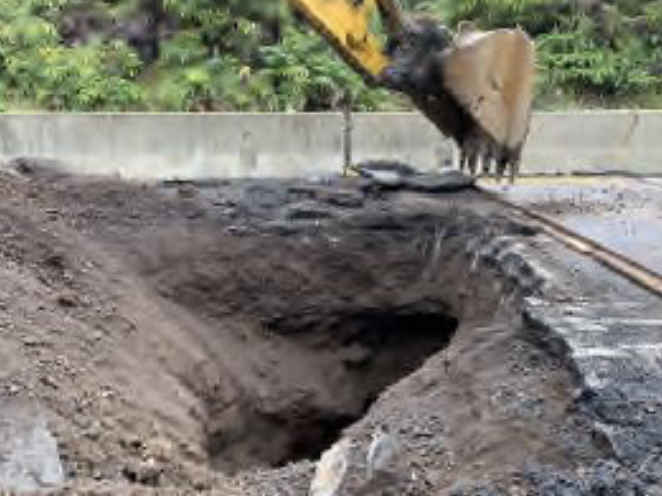
Subsurface voids occurred on Mamalahoa Highway (Highway 11) at mile markers 28.7, 29.1, 29.3, 30, 30.1, and 30.7 due to volcanic activity. PC: HDOT
In February, upon completion of site-specific repairs, a follow-up GPR survey was performed for the corridor between mile markers 28 and 32. The GPR survey confirmed that all subsurface voids and cracks of concern under Māmālahoa Highway were properly repaired.
Hurricane Lane
As a result of Hurricane Lane, the HDOT Highway system sustained significant storm water damage from a record 50-inches of rain. The newly constructed Daniel K. Inouye Highway (Highway 200) between mile markers 8 and 11 and Māmālahoa Highway (Highway 11) in the vicinity of Kurtistown and Mountain View experienced severe road and drainage system damage due to the sheer volume of runoff within such a short time period. All drainage systems have been repaired.
Slope stabilization of the cliff at Makea Stream, Hawaii Belt Road (Highway 19) mile marker 11 at Makea Stream. PC: HDOT.
The Hurricane Lane storm water also caused numerous landslides and embankment failures. Surface water flow caused landslides along Hawai‘i Belt Road (Highway 19) that threatened several residential structures at mile markers 3.2, 3.6, 6.6, 7.1 and 15.6. The most severe landslide occurred at mile marker 7.1 at the State Right-of-Way (property line) and required construction of a mechanically stabilized wall. Other earthen slopes were restored and hardened with masonry.
Surface water flow from adjacent private properties and an overflowing Makea stream exposed boulders in the roadbed of Hawai‘i Belt Road (Highway 19) and a landslide exposed a nearly 50-foot cliff at mile marker 11. Both the exposed boulders and cliff were stabilized using a system of 30-foot long soil nails and covered by cementitious shotcrete material.
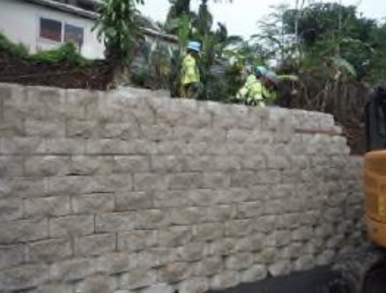
Following a landslide during Hurricane Lane, HDOT constructed a mechanically stabilized earth (MSE) wall on Highway 19 at mile marker 7.1. PC: HDOT.
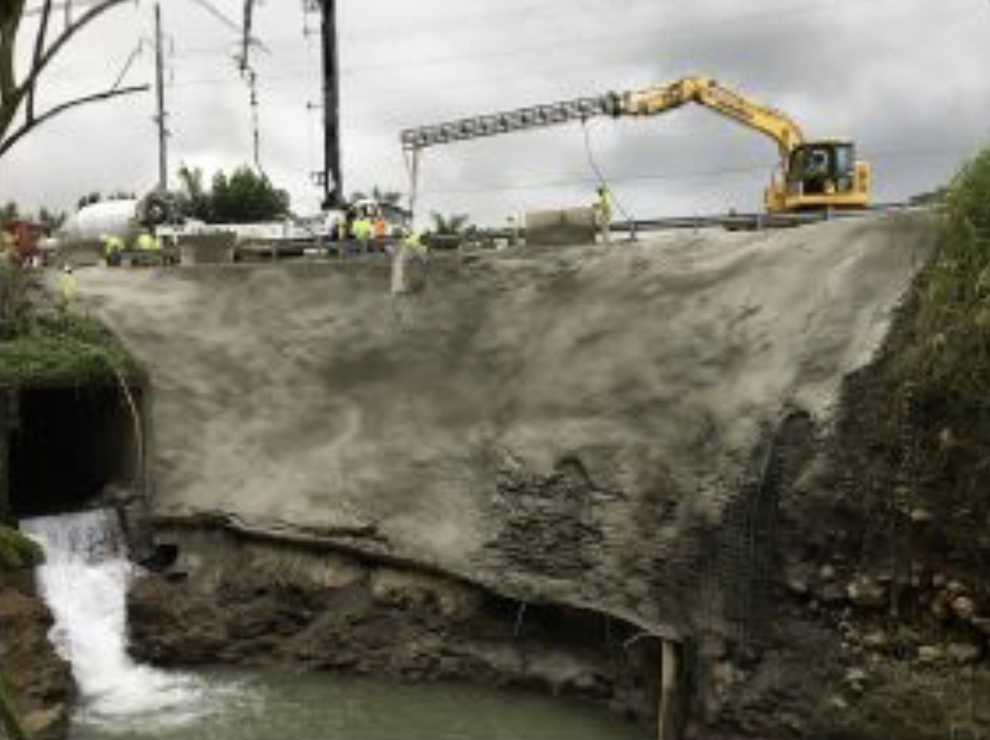
Similar high water flows at Kapue Stream eroded the foundation at Kapue Bridge, Hawai‘i Belt Road (Highway 19) mile marker 6.53. The contractor used masonry to stabilize the foundation and surrounding area to protect from future water erosion.
Sponsored Content


