


New Map Released, Lava Flowing Towards Ocean
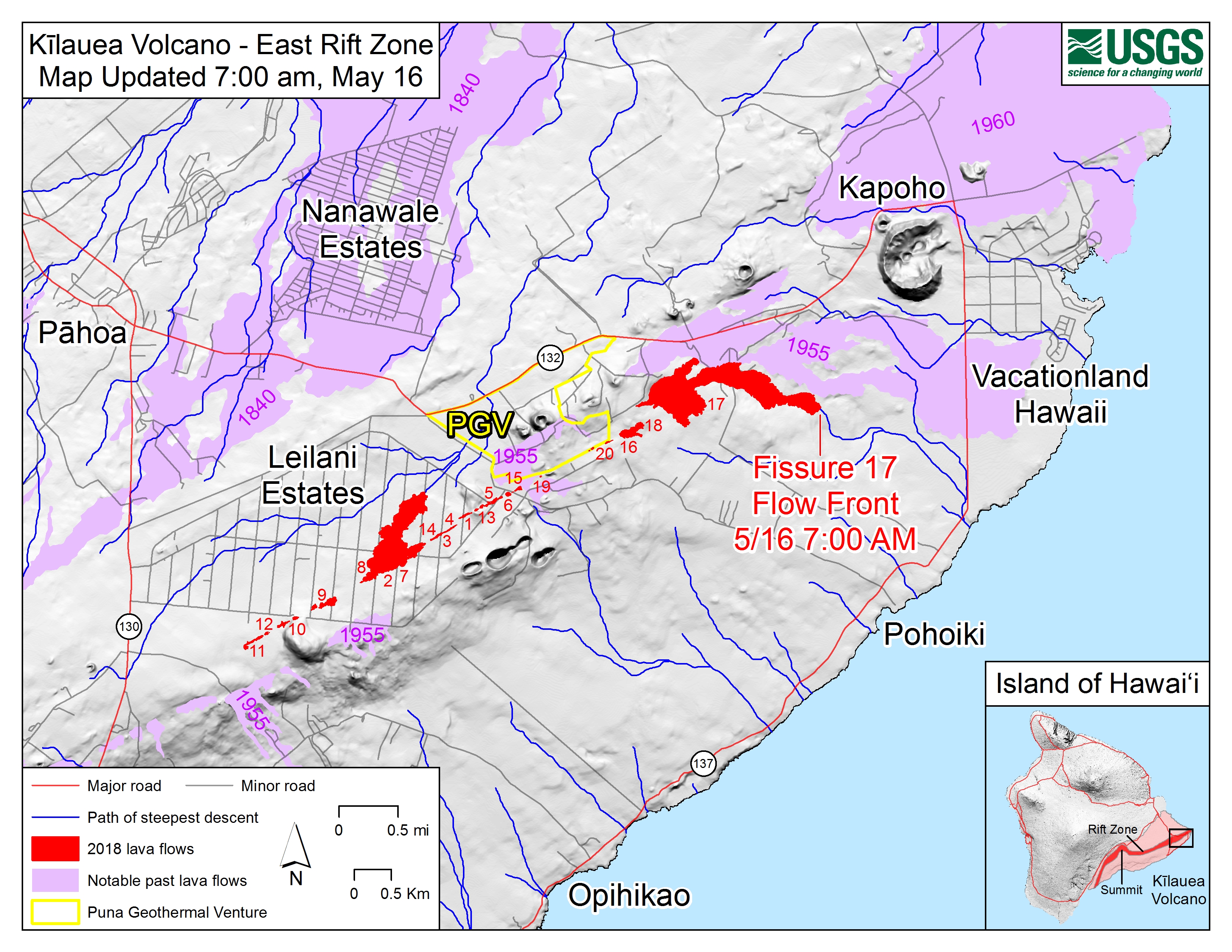
The U.S. Geological Survey released this map showing the location of the lava flow spreading from fissure 17 as of 7 a.m. Wednesday, May 16, 2018.
Click to enlarge
The flow is following a path of steepest descent (blue line) south of a 1955 ‘a‘ā flow. Shaded purple areas indicate lava flows erupted in 1840, 1955, 1960, and 2014-2015.
ADVERTISEMENT






