

Surf Forecast: New Swell Expected Around 20th
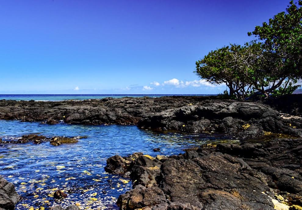
Image: James Grenz
Alerts (as of 1:00 a.m.)
There are no marine alerts posted at this time.
**Click directly on the images below to make them larger. Charts include: Big Island projected winds, tides, swell direction & period and expected wave heights.**
Big Island Surf Forecast
Hilo side: Surf heights are expected to be ankle/waist high today.
Kona side: Wave heights are expected to be knee/thigh high today. Flat for many Kona breaks not catching the swell.
South: Wave heights are expected to be knee/thigh high today. Best bet is South Point.
No significant swells are expected through much of the week, with surf remaining well below advisory levels on all shores. The models show a long period south swell could arrive Saturday
Keep in mind, surf heights are measured on the face of the wave from trough to crest. Heights vary from beach to beach, and at the same beach, from break to break.
**Click here for your detailed Big Island weather report.**
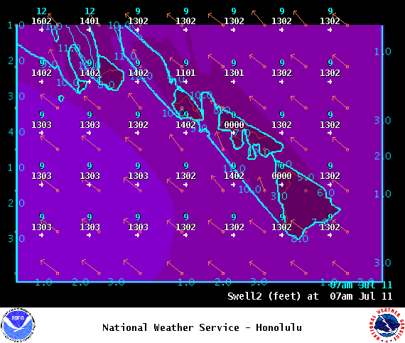
Image: NOAA
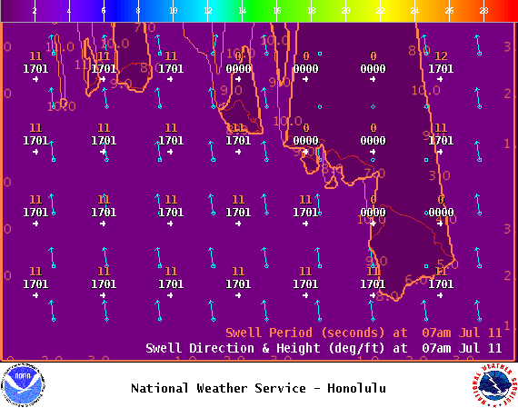
Image: NOAA
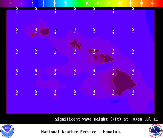
Image: NOAA
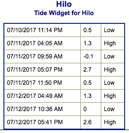
Image: NOAA
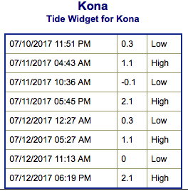
Image: NOAA
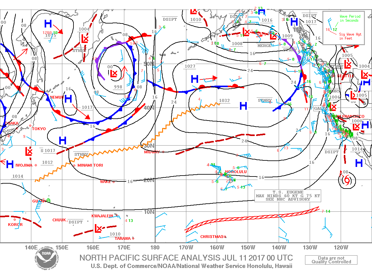
Image: NOAA
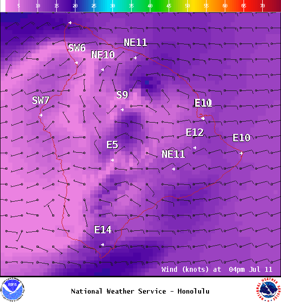
Image: NOAA
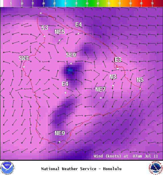
Image: NOAA
Sponsored Content


