

Gusty Southwest Winds, Front on The Way
Alerts
All alerts will be posted HERE and updated regularly throughout this weather event.
**Click directly on the images below to make them larger. Charts include: Big Island high/low forecasted temperatures, projected winds, chance of cloud cover, projected localized weather conditions, vog/SO2 forecast and expected wave heights.**
Today, Friday, January 2, 2015
Today, we expect partly sunny skies with clouds building in the afternoon. Very windy conditions are forecasted at the summits of Mauna Kea and Mauna Loa. Scattered showers are expected through the day for windward spots and in the afternoon for the Kona side. The UHSOEST vog model shows haze over the Hilo side in the afternoon. Winds are expected out of the southwest from 10 to 25 mph with higher gusts. High temperatures should fall in the range of 78° to 83°.
Sunrise: 6:55 a.m.
Sunset: 5:54 p.m.
UV index at 7 (“high” exposure level)
Tonight
Mostly cloudy skies are expected with scattered showers and a chance of thunderstorms. If thunderstorms develop, they may be accompanied by gusty winds and locally heavy rainfall. Southwest winds are expected from 15 to 30 mph with gusts up to 50 mph in some spots. Low temperatures are forecasted from 68° to 73° degrees.
Moonrise: 4:13 p.m.
Moonset: 5:35 a.m. on Jan. 3
Next Full Moon: Jan. 4 at 6:54 p.m.
Next New Moon: Jan. 20 at 3:14 a.m.
Looking Ahead
Friday a strong cold front is expected to sweep down the island chain. Gusty southwest winds will increase Friday afternoon ahead of the front with heavy rain, thunderstorms and potentially damaging winds along the front. The front is expected to pass over Kauai Friday evening, Oahu and Maui county Friday night, and the Big Island Saturday morning. The front is expected to move quickly, at about 25 mph, so the threat for flooding is greatly reduced but can’t be ruled out. The greatest threat for damage comes from the winds. Cool and dry weather is expected after the front passes.
Almanac for Hilo Airport
Maximum Temperature for today:
Normal 79°
Record 85° / Set in 1981
Minimum Temperature for today:
Normal 64°
Record 58° / Set in 1960 and tied in 1971
**Click here for your detailed Big Island surf report.**
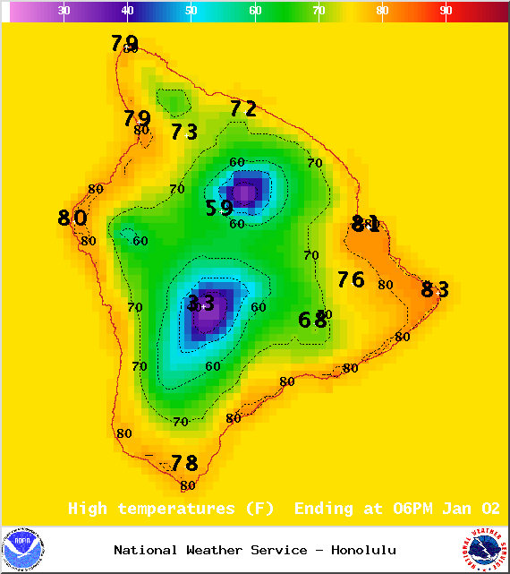
Image: NOAA / NWS
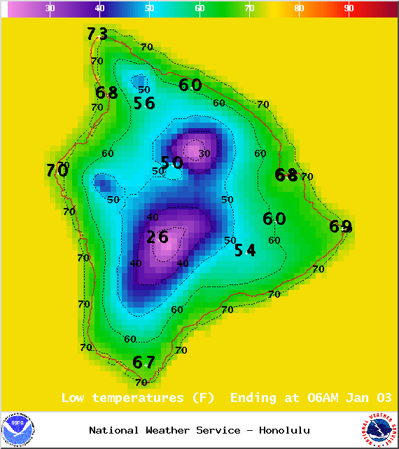
Image: NOAA / NWS
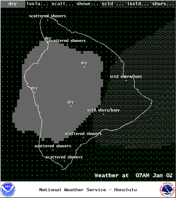
Image: NOAA / NWS
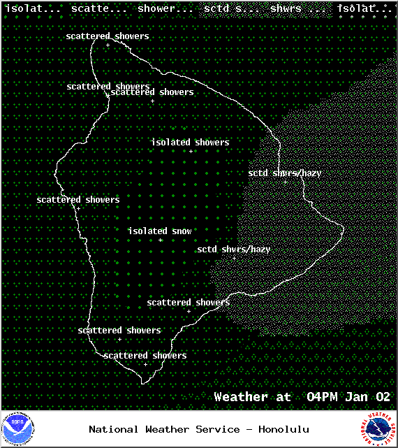
Image: NOAA / NWS
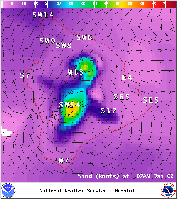
Image: NOAA / NWS
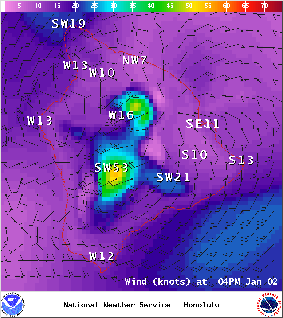
Image: NOAA / NWS
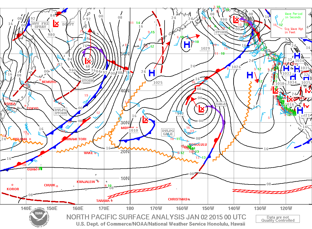
Image: NOAA / NWS
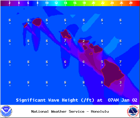
Image: NOAA / NWS
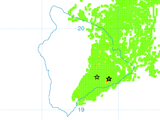
Image: UHSOEST
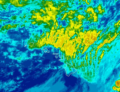
Image: NOAA / NWS
Sponsored Content


