


Volcano Watch: Beneath the boardwalk; the scientific legacy of Haʻakulamanu
“Volcano Watch” is a weekly article and activity update written by U.S. Geological Survey Hawaiian Volcano Observatory scientists and affiliates. Today’s article is written by Hawaiian Volcano Observatory gas technician Christine Sealing.
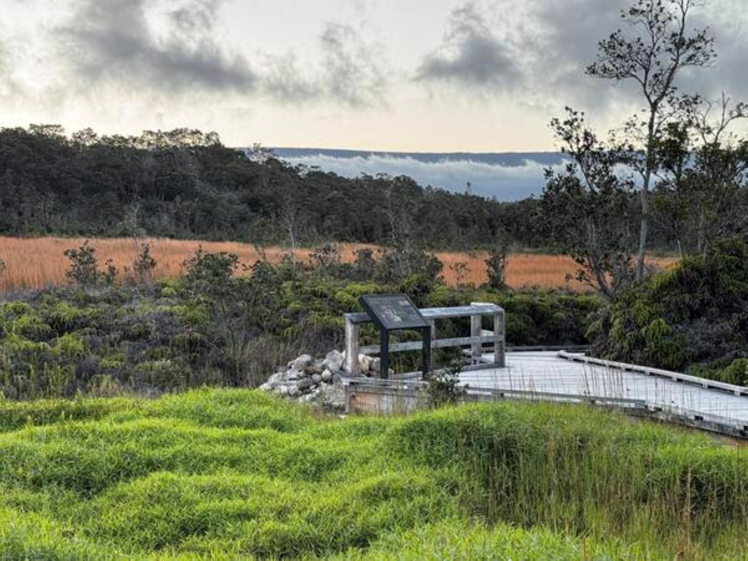
Just off the boardwalk at Haʻakulamanu (Sulphur Banks) in Hawaiʻi Volcanoes National Park, beneath an unassuming pile of rocks and rubble, lies the beginning of more than 100 years of geochemical research at Kīlauea.
Like most scientists, Hawaiian Volcano Observatory Founder Thomas Jaggar was filled with curiosity.
The volcanologist who studied Kīlauea for 10 years could not help but wonder what if there was a way to know when a volcano was getting close to eruption?
As magma gets closer to the surface it heats the surrounding rocks. In the early days of modern volcanology, without an understanding of how deep magma is stored at Kīlauea and how quickly it ascends, Jaggar thought perhaps tracking temperature fluctuations below the surface might provide some indication when activity at the volcano was about to change.
So he set up an experiment in May 1922 to find out.
The first in a series of shallow wells, about 12 inches in diameter, was drilled “between a large steaming crevasse and the main bank of red clay and sulphur” at Haʻakulamanu. Drilling was done by rudimentary machine, and water hauled from Volcano House was poured down the hole to lubricate a drill bit, which was turned by hand each time the drill stem was raised.
It was an arduous process made more dangerous by the scalding steam emanating from the hole. After being plagued by problems, the decision was made to stop drilling at 22 feet.
Encouraged by the high temperatures in the first well and curious whether the chemistry of gases from the man-made wells would match the chemistry of the natural fumaroles, Jaggar had the drill rig moved 140 feet away and tried again.
Three more wells were drilled between 1922 and 1923 at Haʻakulamanu just a few feet away from each other. The second well reached a depth of 50 feet before intersecting a large crack beneath the surface, which stopped the drilling.
The scorching steam and acid gases made work at each well a challenge. The first several feet of rock below the surface were soft, having been effectively cooked by heat and the corrosive gases. Soon, however, the altered material gave way to rocks Jaggar described as “mineralized basalt lava with much iron sulphide (pyrite).”
After detailing the slow progress and difficulties in his monthly bulletin, Jaggar wryly remarked, “These results show that basaltic lava sheets are hard rocks to drill.”
Despite the challenges, the wells began yielding data almost immediately.
Aside from recording the chemically altered geology as it came out of the hole, Jaggar also measured the temperature of steam at depth as drilling progressed. In each well, by 10 feet deep the temperature reached about 204 degrees, which corresponds to the boiling point of water at the 3,900 feet elevation of Haʻakulamanu, and it remained steady to the base of the well.
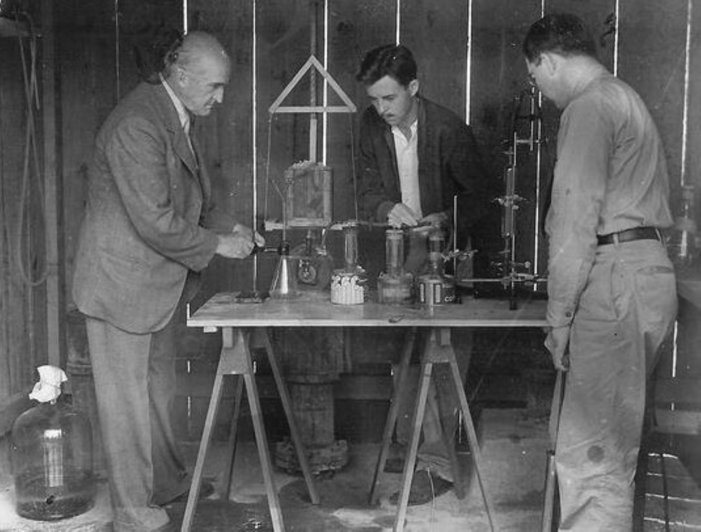
Visiting colleague Eugene Allen from Carnegie Institution of Washington confirmed the chemistries of the wells and fumaroles were indeed a match, saying, “I had not anticipated that the drill holes, like natural fumaroles, would serve as vents tor escaping gases … As soon as it had been ascertained that the gases from the drill-holes responded to the same tests as those from the natural fumaroles, attention was focused entirely on the former … .”
Although Allen’s preliminary analyses returned mixed results, they hinted at what we now understand: the gases at Haʻakulamanu come directly from the magma beneath Kaluapele, Kīlauea’s caldera.
Hawaiian Volcano Observatory scientists since 1922 have tracked gas chemistry from the wells at Haʻakulamanu. Although the original well heads have long since disintegrated, hot gases continue to seep from the place where Jaggar conducted his first experiments.
With new analytical laboratories coming soon to replace the ones lost during the 2018 eruption, today’s observatory scientists are looking forward to a new era of measurements, continuing the work of geochemists who came before us.
So the next time you walk down the boardwalk at Haʻakulamanu, give a nod to geochemistry and the little pile of rubble that started it all.
* * * * * * * * *
VOLCANO ACTIVITY UPDATES
KĪLAUEA volcano
VOLCANO ALERT LEVEL: Advisory
Kīlauea has erupted episodically since Dec. 23, 2024, within the summit caldera. Episode 56 of lava fountaining in Halema’uma’u Crater lasted about 6 hours Nov. 5.
The summit region switched from deflation to inflation at the end of fountaining. Summit sulfur dioxide emissions are elevated. No unusual activity was noted along Kīlauea’s East Rift Zone or Southwest Rift Zone.
WHAT’S NEXT: The forecast window for Episode 57 lava fountaining is Nov. 16-21.
MAUNA LOA volcano
VOLCANO ALERT LEVEL: Normal
Mauna Loa is not erupting. Read the latest activity update issued Nov. 5 online for Mauna Loa.
Hawaiian Volcano Observatory continues to closely monitor Kīlauea and Mauna Loa volcanoes.
* * * * * * * * *
EARTHQUAKE ACTIVITY UPDATES
Two earthquakes were reported felt during the past week in the Hawaiian Islands:
- MAGNITUDE-2.6 earthquake at 2:41 a.m. Nov. 10 located 4 miles north-northeast of Puakō at a depth of 2 miles.
- MAGNITUDE-2.9 earthquake at 12:08 p.m. Nov. 6 located 3 miles northeast of Kalaʻoa at a depth of 8 miles.
Visit the Hawaiian Volcano Observatory website for past “Volcano Watch” articles, Kīlauea and Mauna Loa updates, volcano photos, maps, recent earthquake information and more. Email questions to askHVO@usgs.gov.