


Volcano Watch: Such great heights; measuring Kīlauea’s lava fountains
“Volcano Watch” is a weekly article and activity update written by U.S. Geological Survey Hawaiian Volcano Observatory scientists and affiliates.
“How tall is the fountain?”
Volcano watchers keep coming back to that single question once lava fountains start at Kīlauea, and there have been plenty of opportunities to ask as we’ve now had 56 fountaining episodes during the past 2 years at the volcano’s summit.
Some of these fountains peaked fairly low (a little higher than about 300 feet), but some have been absolutely towering (higher than about 1,500 feet). Episode 56 fountains on Nov. 5 reached at least about 660 feet.
So how do Hawaiian Volcano Observatory geologists actually measure fountain height?
There are actually two sets of measurements.
First, there are real-time estimates put in status reports and daily updates. Second, there are more detailed and accurate measurements calculated later meant for scientific analysis.
The first set of measurements are done in real-time from the webcams. During the course of a fountaining episode, Hawaiian Volcano Observatory scientists monitor webcams such as the K2cam at Uēkahuna Bluff. We use an overlay on the image with an approximate scale based on the camera’s field of view and distance to the vent.
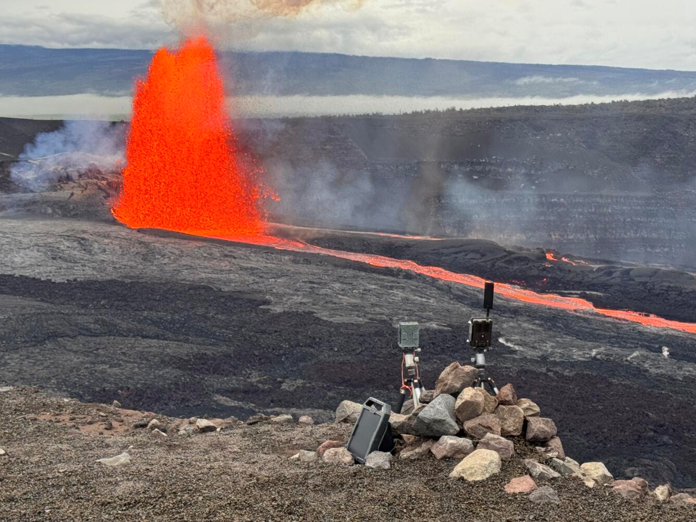
The second set of measurements is a bit more time consuming. Once the fountaining episode ends, observatory geologists hike out to the caldera rim to swap data cards on a network of timelapse cameras. These cameras run 24/7 and capture one image per minute onto their internal data cards.
Timelapse cameras aren’t a new tool at Hawaiian Volcano Observatory.
They were used extensively in the 1980s to track the height of fountains at Puʻuʻōʻō, and in those days the images were stored on film that had to be developed. Since then, observatory geologists and field engineers have been improving the timelapse systems, developing home-grown solutions and testing many different off-the-shelf models.
Today, we use compact digital cameras that store tens of thousands of images onto a small data card.
These timelapse cameras have a fixed lens (no zoom) so their field of view is stable, which makes quantitative measurements from the images much simpler and less prone to error.
To measure the exact field of view that the camera captures, we do measurements in the lab first. This entails capturing images of a checkerboard calibration grid from various angles and feeding these images into software that calculates precise field of view and amount of lens distortion.
The timelapse images from the field are first culled to just the fountaining episode before being brought into another piece of software that allows us to manually track features in a sequence of images and record pixel coordinates.
Hawaiian Volcano Observatory geologists go through the images one-by-one and manually click at the top of the fountain. A long list of pixel coordinates of the fountain top is then recorded, which might take an hour or so for 500 to 800 images.
Subtracting the pixel coordinates of the vent produces a height of the fountain in units of image pixels.
To get the fountain height in yards or meters, you then need to know the size of the pixel footprint. This can be calculated using two pieces of information.
First, there is the camera field of view from the lab measurements described above. Second is the distance between the camera and the vent, which is easy to determine from GPS coordinates and our aerial mapping of the vent complex.
Note that the measurements are made to the top of the continuous fountain body — basically the portion that completely blocks the view to the other side. Above the fountain body there is a span of discontinuous incandescent particles, but these aren’t included in the height.
So the measurement is a bit more conservative than what many people might estimate, as the human eye might naturally include some of those incandescent particles in the fountain height.
Could automated tools like artificial intelligence or machine learning be used to speed up the measurements? Yes, possibly. But the top of the fountain is often subjective or sometimes obscured, so it is a harder problem than it might seem at first.
Right now, manual measurements are the most trusted, but applying artificial intelligence to imagery such as this is an ongoing project.
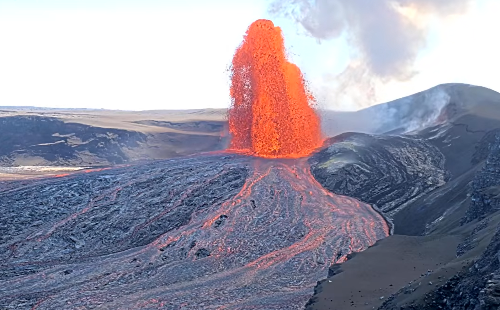
As long as the episodic summit eruption of Kīlauea persists, Hawaiian Volcano Observatory will continue to measure and monitor it. Fountain height measurements for the first 50 episodes have been compiled into a recently published data release.
* * * * * * * * *
VOLCANO ACTIVITY UPDATES
KĪLAUEA volcano
VOLCANO ALERT LEVEL: Remained at Watch as of early the evening of Nov. 5
Kīlauea has erupted episodically since Dec. 23, 2024, within the summit caldera. Episode 56 of the historic eruption began shortly after noon Nov. 5 and ended abruptly just after 6 p.m. the same day, following about 6 hours of lava fountaining.
Summit sulfur dioxide emissions were elevated. Ground-level sensors near the eruptive vents indicated that winds were blowing from the northeast, which suggested volcanic gas emissions and volcanic material could be distributed to the southwest from Halemaʻumaʻu Crater.
No unusual activity has been noted along Kīlauea’s East Rift Zone or Southwest Rift Zone.
MAUNA LOA volcano
VOLCANO ALERT LEVEL: Normal
Mauna Loa is not erupting. The Nov. 5 Mauna Loa monthly update reports that earthquake counts at the volcano were within typical levels during October, and minor inflation continues.
Mauna Loa had a slight increase in seismic activity compared with the previous month; a total of 66 earthquakes were detected in Mauna Loa’s summit region during the October reporting period after 53 in September. These variations are within the typical range for the past 2 years. Most earthquakes occurred deep beneath the upper Southwest Rift Zone or were broadly scattered around the upper flanks.
Read the most recent Mauna Loa activity updates online.
Hawaiian Volcano Observatory continues to closely monitor Kīlauea and Mauna Loa.
* * * * * * * * *
EARTHQUAKE ACTIVITY UPDATES
No earthquakes were reported felt during the past week in the Hawaiian Islands.
Visit the Hawaiian Volcano Observatory website for past “Volcano Watch” articles, Kīlauea and Mauna Loa updates, volcano photos, maps, recent earthquake information and more. Email questions to askHVO@usgs.gov.