


Nolo becomes hurricane with additional steady to rapid intensification expected
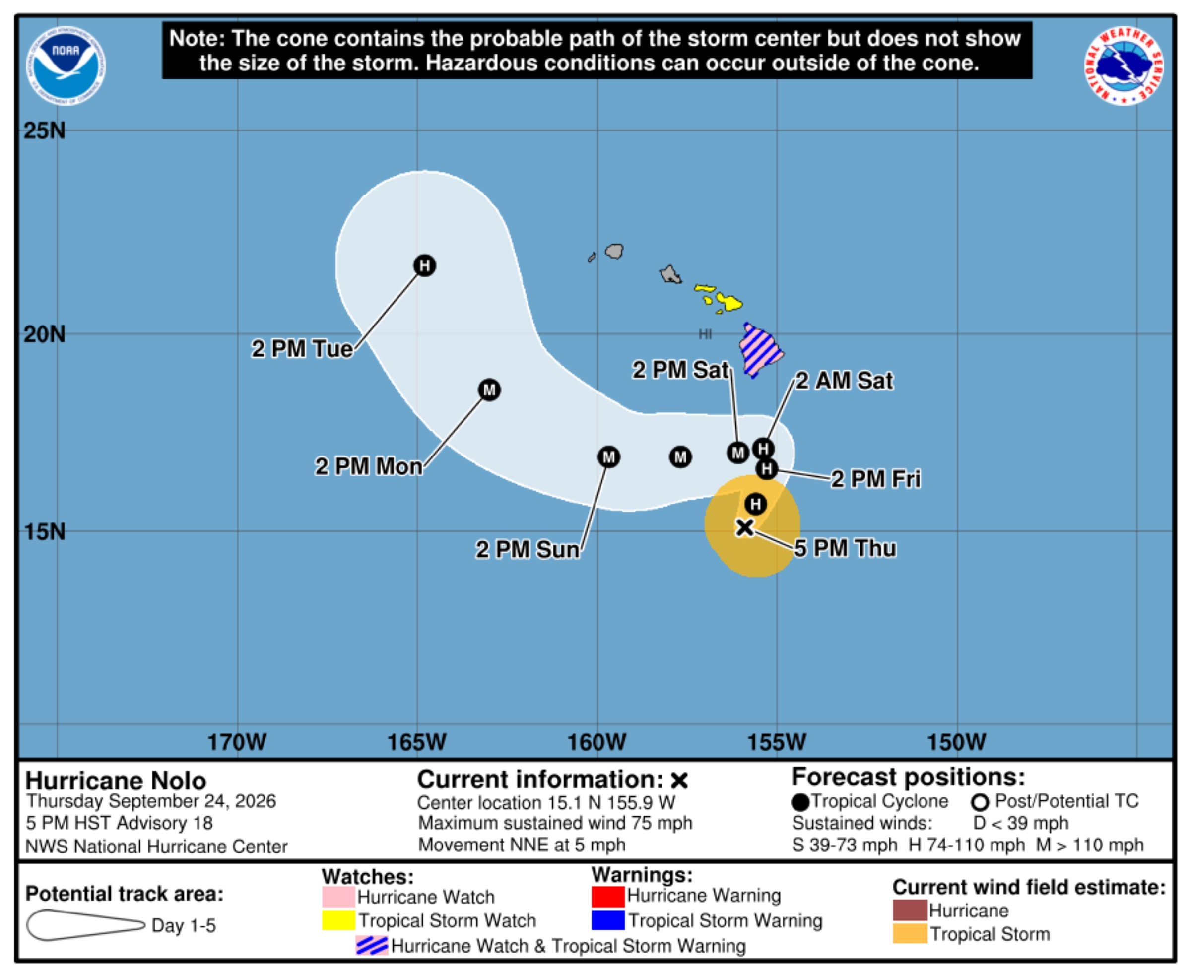
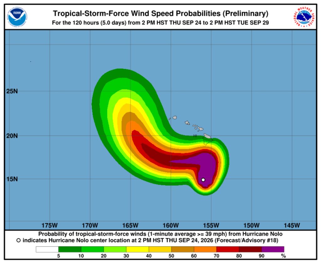
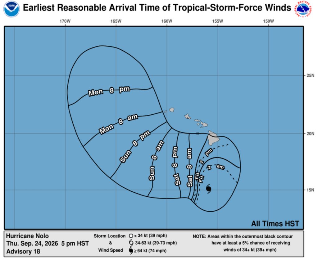
Expected to become a major hurricane by this weekend and pass near or just south of the Big Island on Saturday, with tropical storm conditions expected to begin Friday night and hurricane conditions possible Saturday.
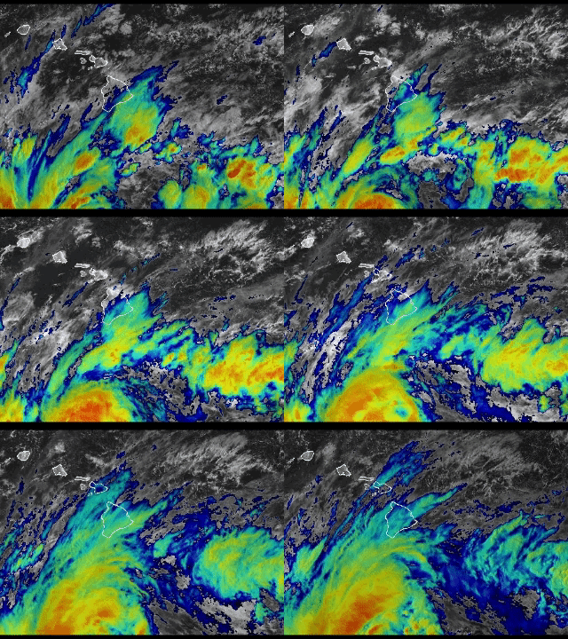
U.S. Air Force reconnaissance aircraft reports that Nolo is officially a hurricane as of the 5 p.m. advisory update from national and Central Pacific hurricane forecasters.
The storm is located about 270 miles south of South Point, with maximum winds of 75 mph and higher gusts, moving about 5 mph to the north-northeast. Additional steady to rapid intensification is forecast, and Nolo is forecast to become a major hurricane by this weekend.
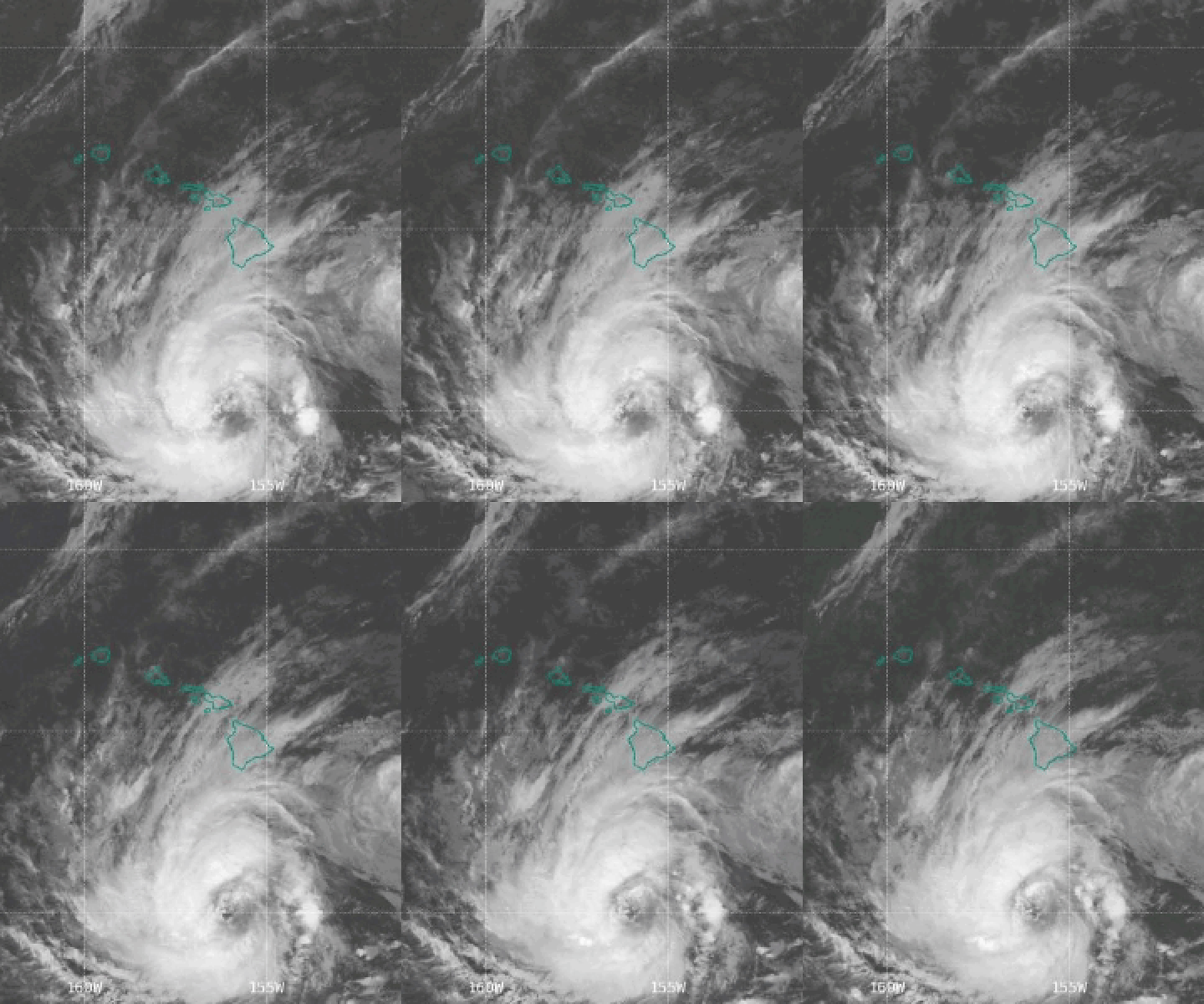
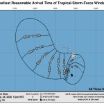
Hurricane force winds extend outward up to 30 miles from Nolo’s center and tropical storm force winds outward up to 105 miles.
A hurricane watch, tropical storm warning, high surf advisory and flood watch remain in effect for the Big Island, which forecasters expect to receive excessive heavy rainfall during the next several days.
A faster motion to the north-northeast is expected later tonight through Friday followed by a sharp westward turn Saturday just to the south of the Big Island.
Nolo is then forecast to continue westward through the weekend, with the center passing south of Hawai’i. However, impacts will be felt well-outside the center of the storm.
Key messages
- Nolo is expected to pass near or just south of the Big Island on Saturday as a major hurricane. Tropical storm conditions are expected to begin Friday night on the island, with hurricane conditions possible Saturday, particularly in areas of steep terrain. Residents should follow advice given by local officials, including evacuating if told to do so.
- The time to finish preparations for significant heavy rain and flooding impacts on the Big Island is now. Heavy rainfall will increase in coverage and intensity throughout the rest of today and Friday. Periods of heavy rain are expected to continue around the island through the weekend. Life-threatening, catastrophic flooding and mudslides are possible, especially in areas of steep terrain across the eastern and southern portions of the Big Island.
- Large and damaging waves are likely along portions of the Big Island’s coastline into the weekend.
Hazards affecting land
WIND: Tropical storm conditions are expected to begin by late Friday, with hurricane conditions possible by early Saturday.
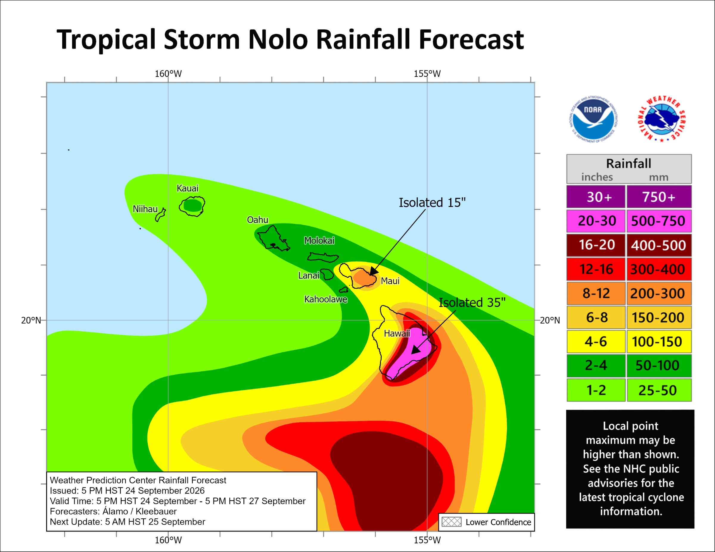
RAINFALL: Nolo will produce rainfall totals of 15 to 30 inches, with maximum amounts of 35 inches, for eastern and southern portions of the Big Island, possibly producing catastrophic, life-threatening flooding and mudslides, especially in areas of steep terrain. For the western portions of the island, rainfall totals of 5 to 8 inches, with maximum amounts of 10 inches, are expected.
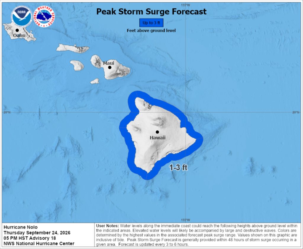
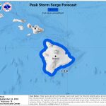
STORM SURGE: Combination of a dangerous storm surge and tide will cause normally dry areas near the coast to be flooded by rising waters moving inland from the shoreline. The water could reach 1 to 3 feet above ground in some areas if peak surge happens at the time of high tide. The deepest water is expected along the immediate coast and accompanied by large and dangerous waves. Surge-related flooding depends on the relative timing of the surge and tidal cycle, and can vary greatly over short distances.
SURF: Swells generated by Nolo are expected to reach exposed east-, southeast- and south-facing shores of the Big Island by Friday, spreading westward and building through the weekend. These swells are likely to cause life-threatening surf and rip current conditions. A high surf advisory is in effect for east and southeast shorelines of the island.
TORNADOES: Tornadoes will be possible associated with Nolo, mainly over and near the Big Island, along and to the right of the track of the hurricane.
 Courtesy Graphic: National Hurricane Center and Central Pacific Hurricane Center website
- Courtesy Graphic: National Hurricane Center and Central Pacific Hurricane Center website
- Courtesy Graphic: National Hurricane Center and Central Pacific Hurricane Center website
Additional information
- Disaster preparedness information: American Red Cross.
- Appropriate preparations: Ready.gov.
For storm information specific to your area, including possible inland watches and warnings, monitor products issued by the National Weather Service Honolulu forecast office.
Also be sure to check out the “What Big Island residents need to know about Hurricane Nolo” at Big Island Now.







