Moke holding steady as it advances toward Hawaiʻi; Big Island forecast to feel brunt of impacts from new tropical storm
Flood watch will be in effect from late Saturday night through Monday afternoon as Moke is expected to bring total rainfall of 5 to 10 inches, with maximum amounts of 15 inches, to windward and southeast parts of the island, including those hard-hit a week ago by Hurricane Lala.
Updated 5:56 p.m., Friday, Aug. 21, 2026:
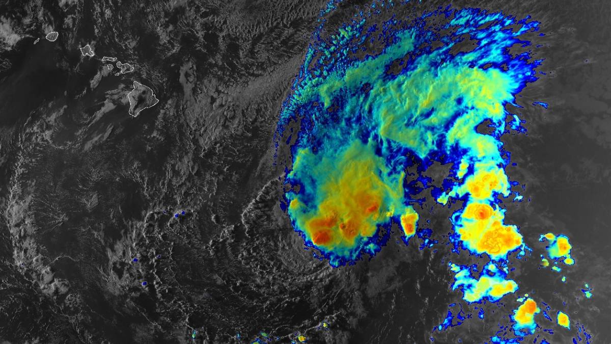
Tropical Storm Moke is holding steady this afternoon, with heavy rainfall and gusty winds still forecast for portions of the Hawaiian islands this weekend and early next week.
A flood watch will be in effect from late Saturday night through Monday afternoon for the Big Island, with possible flash flooding caused by excessive rainfall from Moke in windward and southeast portions of the island.
Unfortunately, the same southern areas of the Big Island that were hit hard by Hurricane Lala a week ago are expected to once again experience possible flash flooding from those heavy rains.
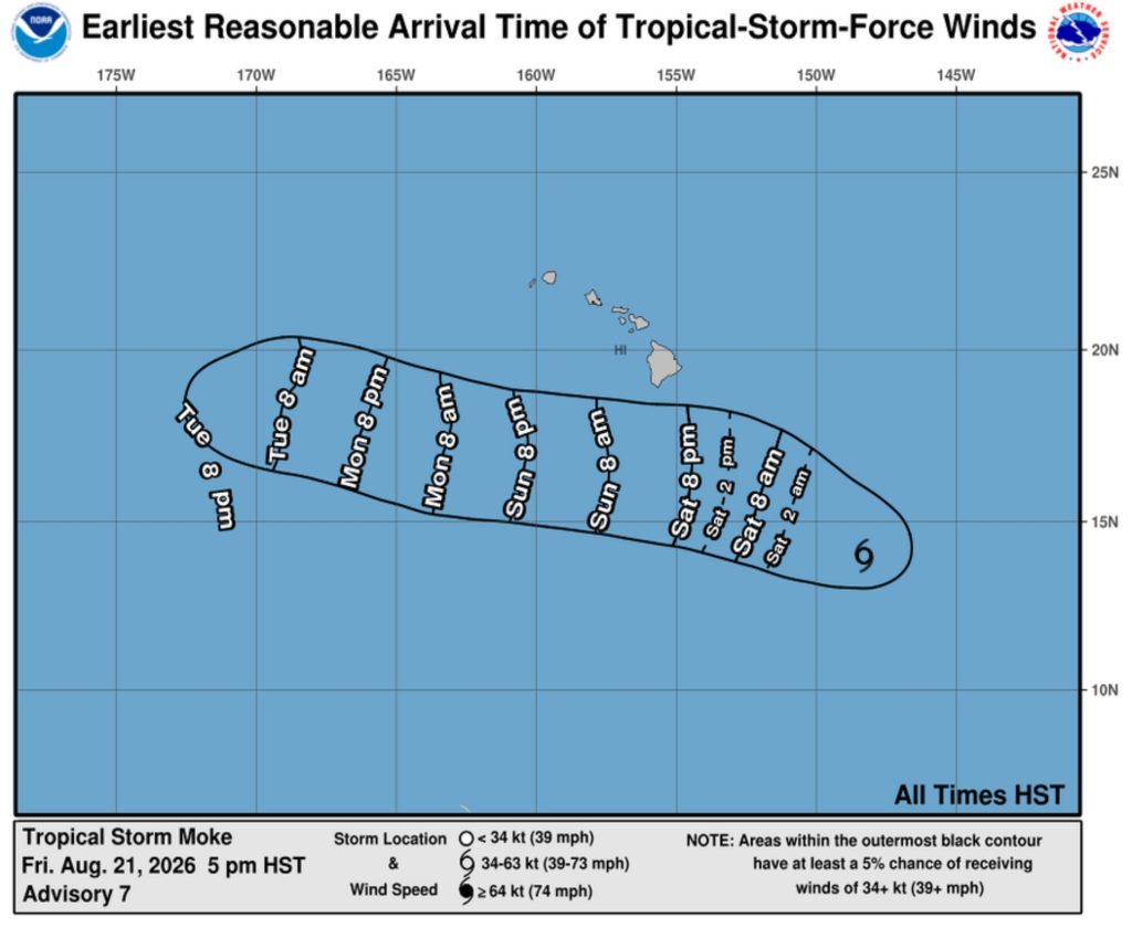
Central Pacific Hurricane Center reports in its 5 p.m. Friday update that Moke was about 595 miles southeast of Hilo, moving west-northwest at about 12 mph, with maximum sustained winds of 45 mph and higher gusts.
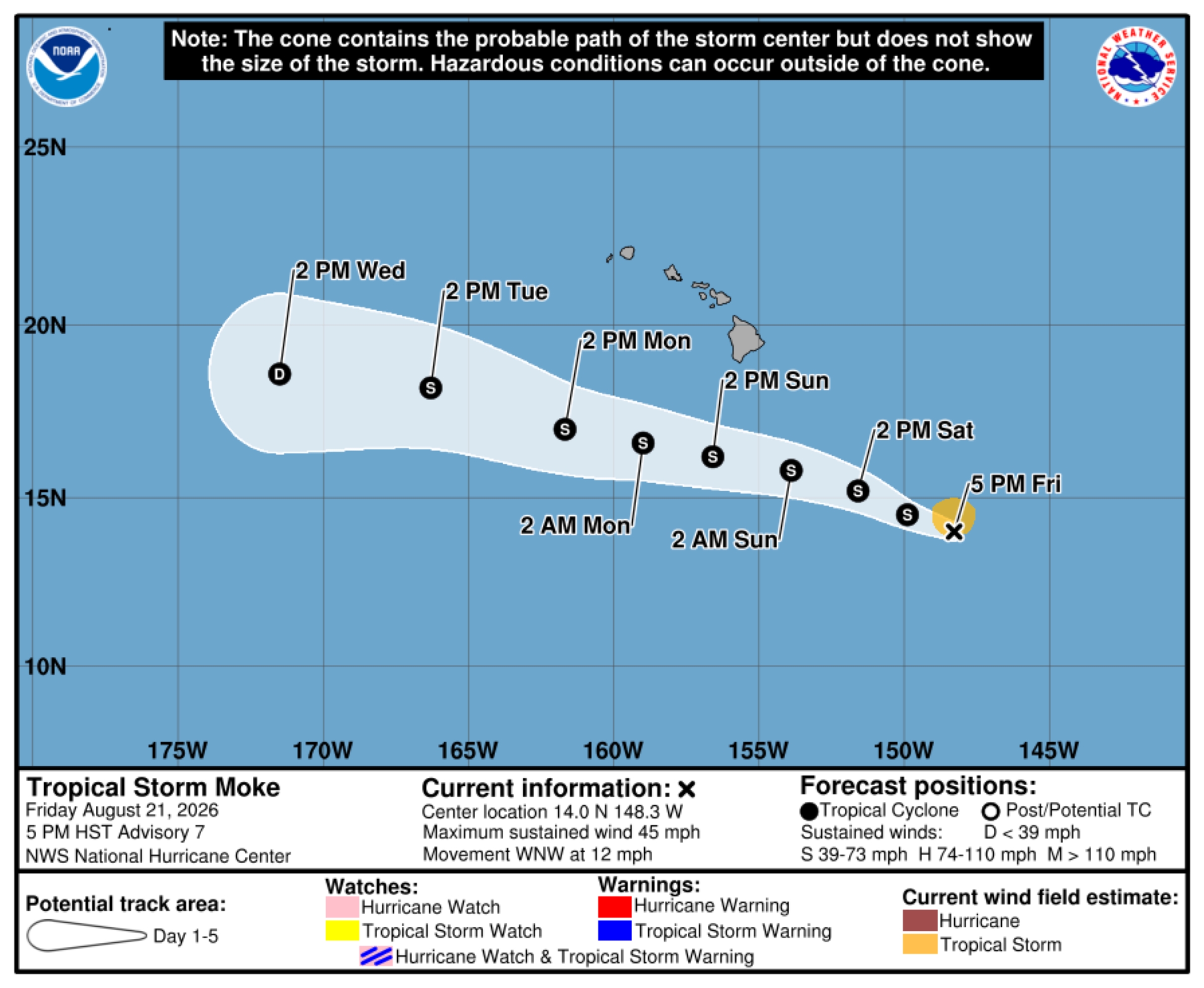
Tropical storm force winds extended up to 70 miles outward from the storm’s center, and gradual strengthening is forecast to continue during the next day or two.
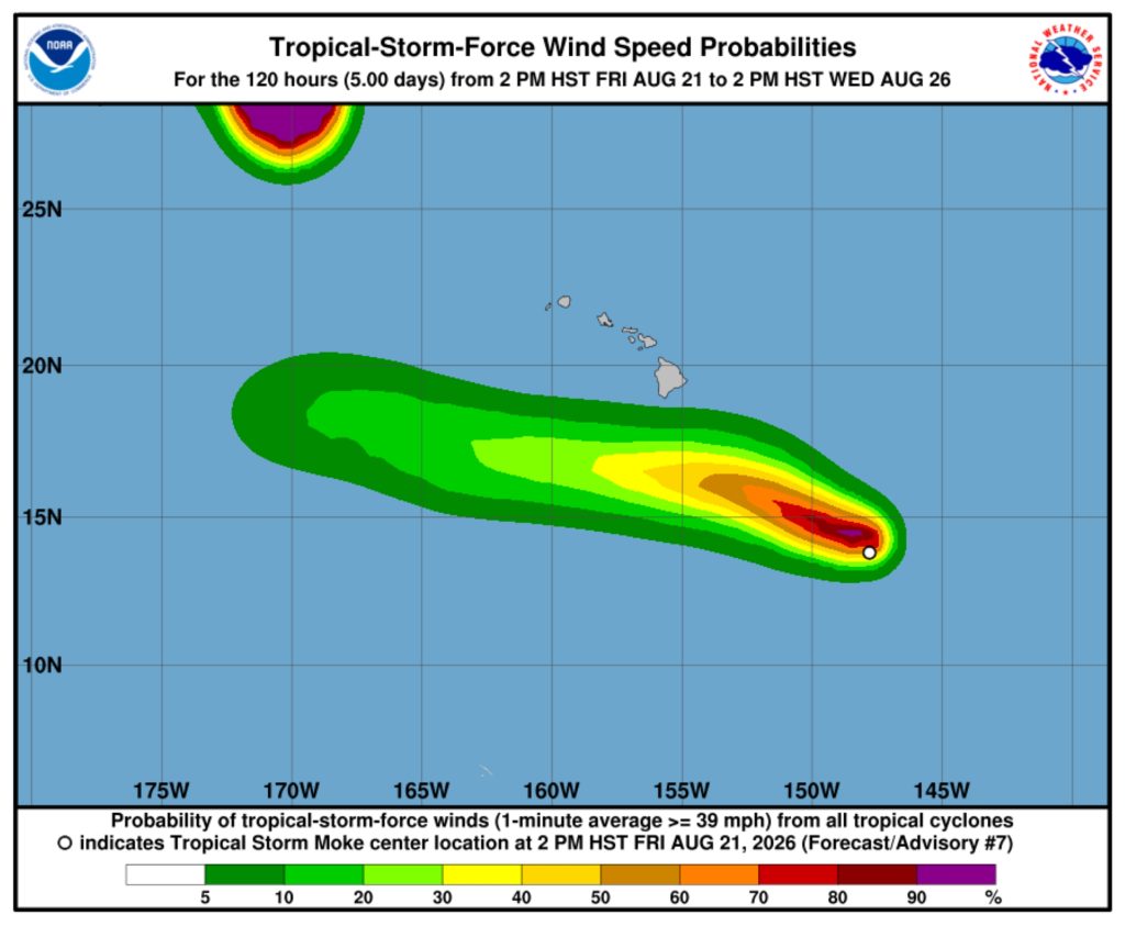
Moke’s forecast track takes the center of the storm to the south of the Big Island this weekend, then south of the main Hawaiian Islands early next week. Given that track and the compact nature of the storm, likelihood of tropical storm watches or warnings for the islands themselves remains very low.
“However, the enhanced pressure gradient north of Moke, combined with moisture associated with the cyclone interacting with the island terrain, will likely produce gusty winds and periods of heavy rainfall across portions of the state,” said the Central Pacific Hurricane Center report, adding those impacts could be heightened because of Lala’s destruction last weekend, especially where soil remains saturated.
Hurricane Lala damaged or destroyed 263 homes and 18 businesses and killed two people in the southern and southeastern portions of the island in Kaʻū. The Category 1 storm, even with no direct landfall, devastated communities including Nāʻālehu, Pāhala and Waiʻōhinu.
“This is not the same as Lala,” said National Weather Service Warning Coordination Meteorologist John Bravender during a press conference Thursday. “Looks like the track is going to be a little further south and the wind field is not as large.”
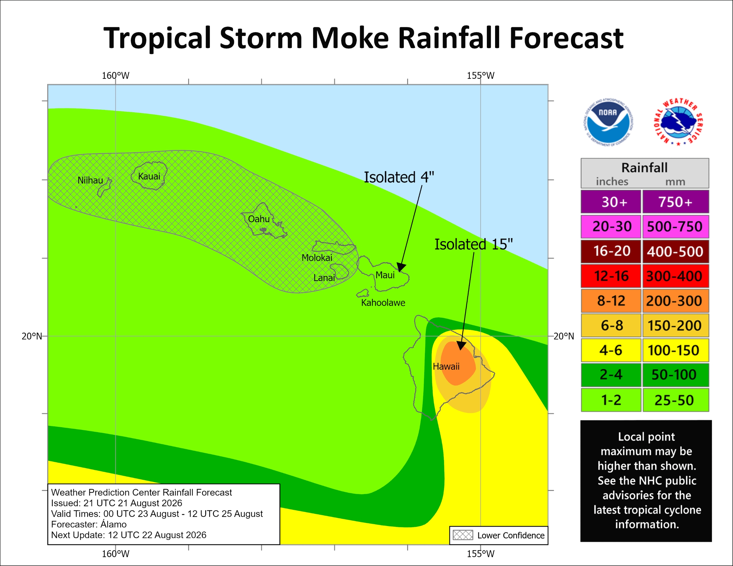
Tropical Storm Moke is expected to produce rainfall totals of 5 to 10 inches, with maximum amounts of 15 inches, in areas of the Big Island.
“This rainfall may produce life-threatening flooding and mudslides for the windward and southeast Big Island, especially in steep terrain and over areas that were affected recently by Lala,” the 5 p.m. update said.
Flood prone roads and other low-lying areas could be closed because of elevated runoff and overflowing streams. Urban areas also could receive more significant flooding and property damage because of rapid runoff.
The tropical storm is forecast to bring rainfall of 1 to 2 inches, with a maximum of 4 inches, to eastern Maui and a possible 1 to 2 inches for the remainder of the islands.
Gusty winds also are forecast, mainly for the Big Island, especially in areas of high terrain.
Swells generated by the storm are expected to affect exposed east- and south-facing shores of the state this weekend and into early next week, possibly causing life-threatening surf and rip current conditions.
Central Pacific Hurricane Center advises the public to continue monitoring the storm’s forecast closely and checking with the National Weather Service for local forecast information, including any advisories, watches or warnings issued.
Moke will remain in generally favorable environmental conditions for the next day or so before running into dry mid-level air that will become increasingly entrained into the storm’s circulation and vertical wind shear increases late this weekend and into early next week.
“These factors should cause Moke to gradually weaken as it passes south of the Hawaiian Islands,” said the 5 p.m. update.
The next complete advisory for Tropical Storm Moke will be issued at 11 a.m. today.
Hawaiʻi County emergency managers continue to closely monitor Tropical Storm Moke. Click here for what you need to know and how to prepare.
 Courtesy Graphic: National Hurricane Center and Central Pacific Hurricane Center website
- Courtesy Graphic: National Hurricane Center and Central Pacific Hurricane Center website