

Fireworks and festivities forecast for rest of Fourth of July
The rest of your Fourth of July fireworks and festivities forecast for the Big Island is pretty much what many might expect: a chance of showers in windward locations and — despite clouds in some spots — mainly dry on the leeward side.
National Weather Service forecasters in Honolulu report that high pressure just north of the state will remain the dominant weather feature, maintaining stable moderate to breezy trade winds during the next several days.
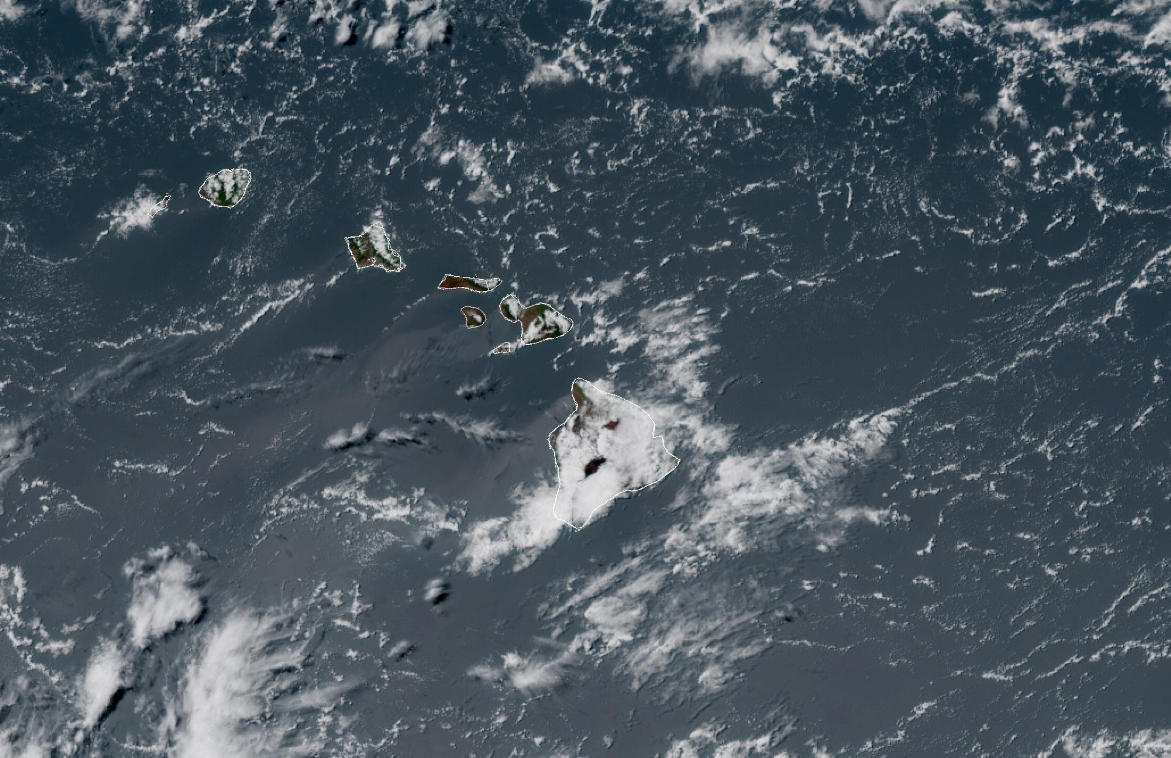
Bands of moisture continue to ride within those trades, increasing shower activity to windward and mauka areas — namely across Kaua‘i and the Big Island.
However, fire weather conditions could develop in the drier and windier spots around the island as relative humidity levels are expected to fall, even as early as Saturday afternoon.
Skies over Hilo will continue to be mostly cloudy for the rest of the Fourth of July holiday, with north-northeast winds at 6 to 8 mph. Fortunately, even though the clouds are there, a chance for showers holds off until mainly after midnight, and then it’s only at about 30%.
Isolated showers under mostly cloudy skies continue to be the story for Waimea, with strong northeast winds of 20 to 23 mph, gusting up to as high as 32 mph. Chance for rain throughout the rest of the Fourth of July is 20%, increasing slightly to 30% for scattered showers continuing after midnight and ongoing mostly cloudy skies.
New rainfall amounts of less than 1/10 of an inch are possible.
Breezy winds also are expected to continue overnight in the Waimea area, blowing from the east-northeast at 18 to 20 mph, with gusts still up to as high as 28 mph.
A 20% chance of isolated showers and cloudy conditions will persist in Pāhoa for the rest of the day, but the chance for scattered showers increases to 40% tonight. New rainfall amounts of less than 1/10 of an inch possible with continued cloudy skies.
High temperatures for windward locations will reach the upper 70s, with overnight low temps ranging from as low as 62 degrees in Waimea to 71 degrees in Hilo.
Somewhat surprisingly, the usual sun is forecast to be absent for the rest of the Fourth of July afternoon and evening, with mostly cloudy skies greeting people in Kailua-Kona. But there’s no chance for rain, at least until after midnight, with a 20% chance of isolated showers under persistent cloudy conditions.
The clouds are staying away from Waikōloa, with mostly sunny skies for the holiday, with clear skies expected to continue overnight. Like its mountain neighbor Waimea, however, breezy conditions are more of the story today in the resort village.
Winds are blowing strong from the east-northeast at 23 to 25 mph, with gusts up to 36 mph. East winds will continue overnight at 21 to 23 mph and gusts as high as 32 mph.
Partly sunny skies should continue for the rest of the day in the Nāʻālehu area. Mostly cloudy conditions develop overnight, but forecasters don’t expect any precipitation. East winds are breezy at 18 to 22 mph this afternoon, gusting up to 31 mph.
Strong winds from the northeast at 9 to 18 mph with gusts as high as 25 mph will continue overnight.
Fourth of July temperatures in leeward locations are warm — hot even — with highs in the upper 80s expected in the Kailua-Kona and Waikōloa areas. Nāʻālehu is quite a bit cooler, with a high expected in the upper 70s.
Overnight lows look to fall into the upper 60s to lower 70s for west side locations.
So, overall, it doesn’t look like too many fireworks plans or festivities should get rained out around the Big Island. It just might become a matter of timing for some locations.
With the breezy conditions in several spots — chiefly the Waimea, Waikōloa and Nāʻālehu areas — it will be important to practice your best fire safety skills if fireworks are part of your Fourth of July backyard celebrations.
Wildfires sparking in those drier and breezier areas cannot be ruled out.
National Weather Service forecasters say moderate to locally near critical fire weather conditions will persist through early next week with a slightly drier air mass in place causing relative humidity to fall to about 45% each afternoon, beginning Saturday afternoon.
The high pressure north of the state will build and meander a bit to the southeast by the turn of the week, continuing to produce locally breezy trade winds, with the strongest expected to develop Sunday or Monday.
By the end of next week, however, excess residual moisture associated with post-tropical cyclone Douglas might extend to the island chain by way of breezy trade wind flow.
This could bring increased shower activity initially over windward and mauka locations, possibly spreading farther into leeward portions of the state by the end of the forecast period.
Sponsored Content


