

Hawaiʻi County launches an accessible, online coastal zone management atlas
A new online tool aims to help the public explore the island’s coastal hazards and ecosystems.
Developed by the Planning Department and Tetra Tech Inc., the County of Hawaiʻi has launched the Coastal Zone Management Atlas to better inform the public on management plans that preserve, protect, develop, and restore the resources of the nation’s coastal zones.
The atlas is designed to:
- Provide information and resources on coastal zone management to the public.
- Summarize county Special Management Areas (SMA) requirements and provide links to key resources.
- Highlight key coastal hazards that pose risks to property owners and the public.
- Highlight key coastal ecosystems that need to be protected and restored through coastal zone management.
- Help property owners understand the information the county considers when reviewing SMA permits.
- Provide an interactive web-mapping application for users to view data layers, print maps, and use measurement and slope tools when considering development on their property.
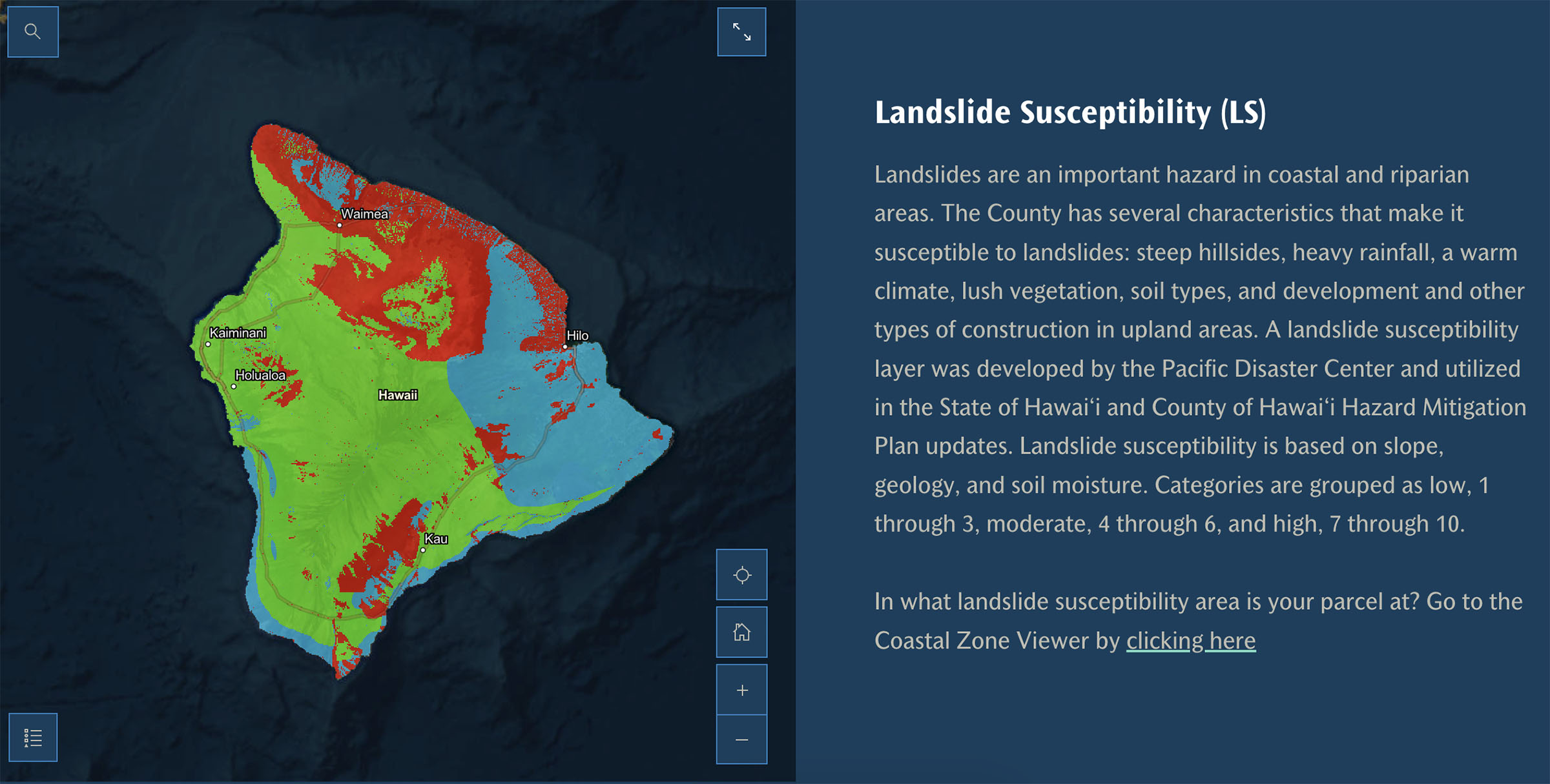
The atlas includes various data layers and measurement tools that map coastal hazards and ecosystems. For example, one data layer shows areas most susceptible to landslides and indicates when they are more likely to occur.
“The Coastal Zone Management Atlas empowers residents to make thoughtful decisions that help protect their property and our environment,” said Mayor Kimo Alameda. “We encourage everyone to explore this new online resource.”
The atlas can be accessed through the Hawaiʻi County website.
The Planning Department will host two informational webinars to introduce the atlas, provide navigation tips for using the online resources, and answer questions.
The informational webinars will cover the same content on both days. Click the links below to register for either webinar:
For more information, contact the Planning Department at 808-961-8288 or planning@hawaiicounty.gov.
Sponsored Content


