

Hawaiʻi County encourages public to prep now for impacts from incoming kona low
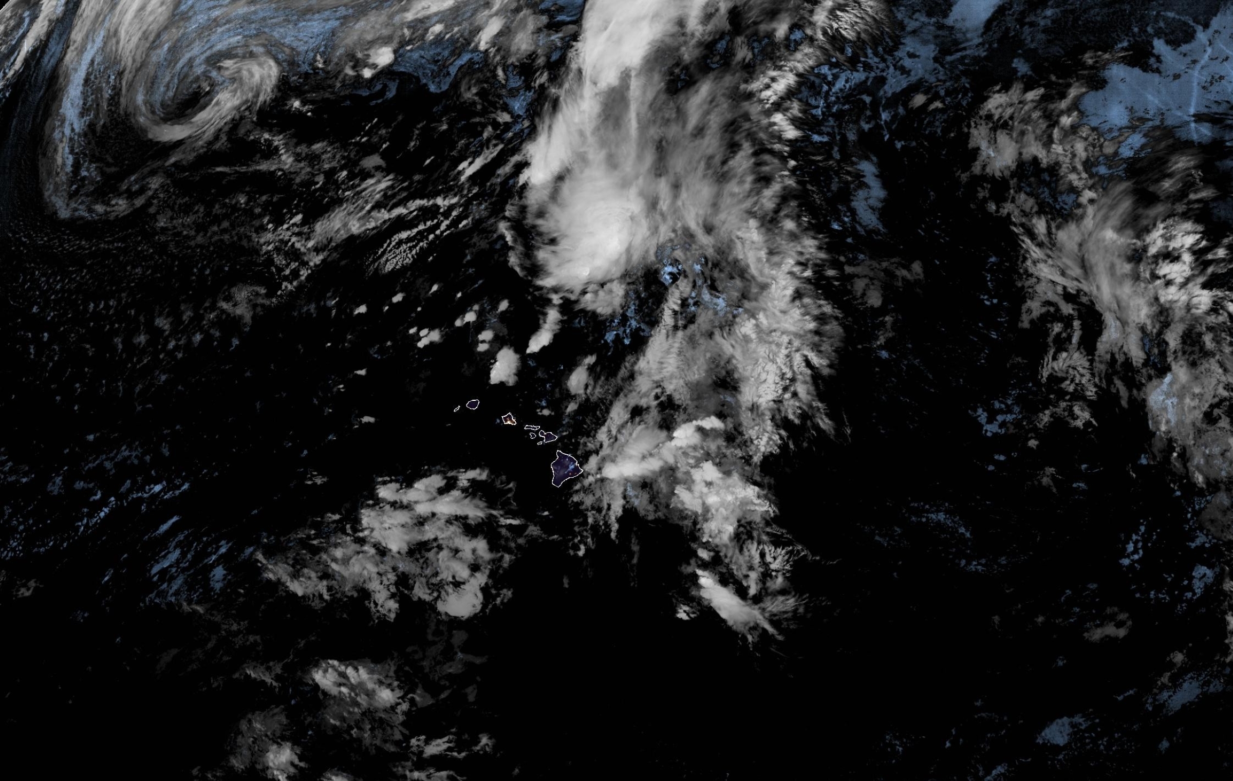
Residents and visitors should prepare for a powerful kona low that could bring strong winds, thunderstorms and heavy rainfall later this week to the Big Island.
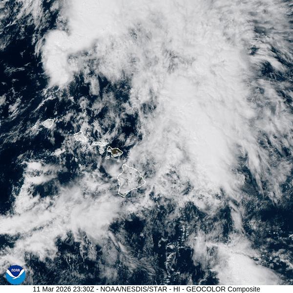
Isolated storm impacts are forecast through today (March 12), with the most severe impacts expected Friday through Sunday (March 13-15). Strong, locally damaging winds that can down trees and powerlines as well as heavy rainfall that can cause flooding are possible.
“The county is working hard to get ready for this powerful storm and keep residents safe,” said Hawaiʻi County Mayor Kimo Alameda in a release urging preparation. “A storm like this can impact the entire island, so we ask everyone to prepare for what this weather system can bring.”
National Weather Service issued a flood watch in effect through Saturday afternoon (March 14) for Hawaiʻi Island as conditions are expected to become favorable.
The storm could even produce brief and weak tornadoes in addition to isolated severe thunderstorms.
“Some of the models we’ve seen show parts of the island could receive more than 10 inches of rain,” said Hawaiʻi County Civil Defense Administrator Talmadge Magno in the release. “While some areas can handle these amounts, others will have significant flooding impacts.”
Magno said Civil Defense will share forecast updates as it receives more information as well as provide direction for actions the public needs to take.
“If you haven’t already done so, now is a great time to sign up for emergency alerts at the Hawai‘i County Civil Defense website to receive updates on your cellphone,” he added.
Preparing your property
- Check around your home and trim low-hanging branches that could be downed by strong winds and cause damage.
- Secure lānai furniture and other objects that could become airborne in strong, gusty winds.
- Check drainage areas, gutters and drains to clear any debris that could block water from flowing.
- Consider placing sandbags to protect foundations, doorways and other vulnerable areas if your property is prone to flooding. Consider moving items to a higher level if they might be damaged by flooding.
- Check emergency supplies, including food, water and necessary medications for people in your household and pets.
- Be prepared for power outages. Battery-powered light sources are safer than candles or gas lanterns and less likely to start an accidental fire. Make sure batteries are charged and you have a backup plan if you rely on an electric medical device.
- Check and refuel electrical generators and refresh your knowledge about how to safely operate them if needed. Always place a generator in a well-ventilated area where exhaust can’t blow back into areas occupied by people or pets.
General safety information
- Consider changing or delaying plans for travel or outdoor activities during inclement weather, especially routes with low-lying areas prone to flooding.
- Know the areas prone to flooding, particularly those near your home, and use extra caution around them. Heavy rain uphill from your location can cause flooding, even if it’s not raining where you are.
- Never try to cross moving water, on foot or in a vehicle: Turn around, don’t drown.
- Monitor local forecasts from reliable sources for the latest information about the storm and its potential hazards. Have a battery- or crank-powered radio to receive information during a power outage. (Don’t forget the car radio.)
- The safest place to be is indoors if lightning threatens.
- If you’re in a vehicle, stay in the vehicle, but pull off the road if rain is dangerously heavy and it is safe to pull over.
- Have a “go bag” ready in case you must evacuate, especially if your home is in an area prone to flooding. It should include food, water, necessary medication, important documents and other necessities for the members of your household — including pets — if you need to leave in a hurry.
- Check in with neighbors, especially those who might have mobility issues, to make sure they have a safe way to evacuate if flooding strikes.
Stay informed
Hawaiʻi County will provide updates as conditions evolve. Residents can receive emergency notifications by signing up for Hawaiʻi County Civil Defense alerts.
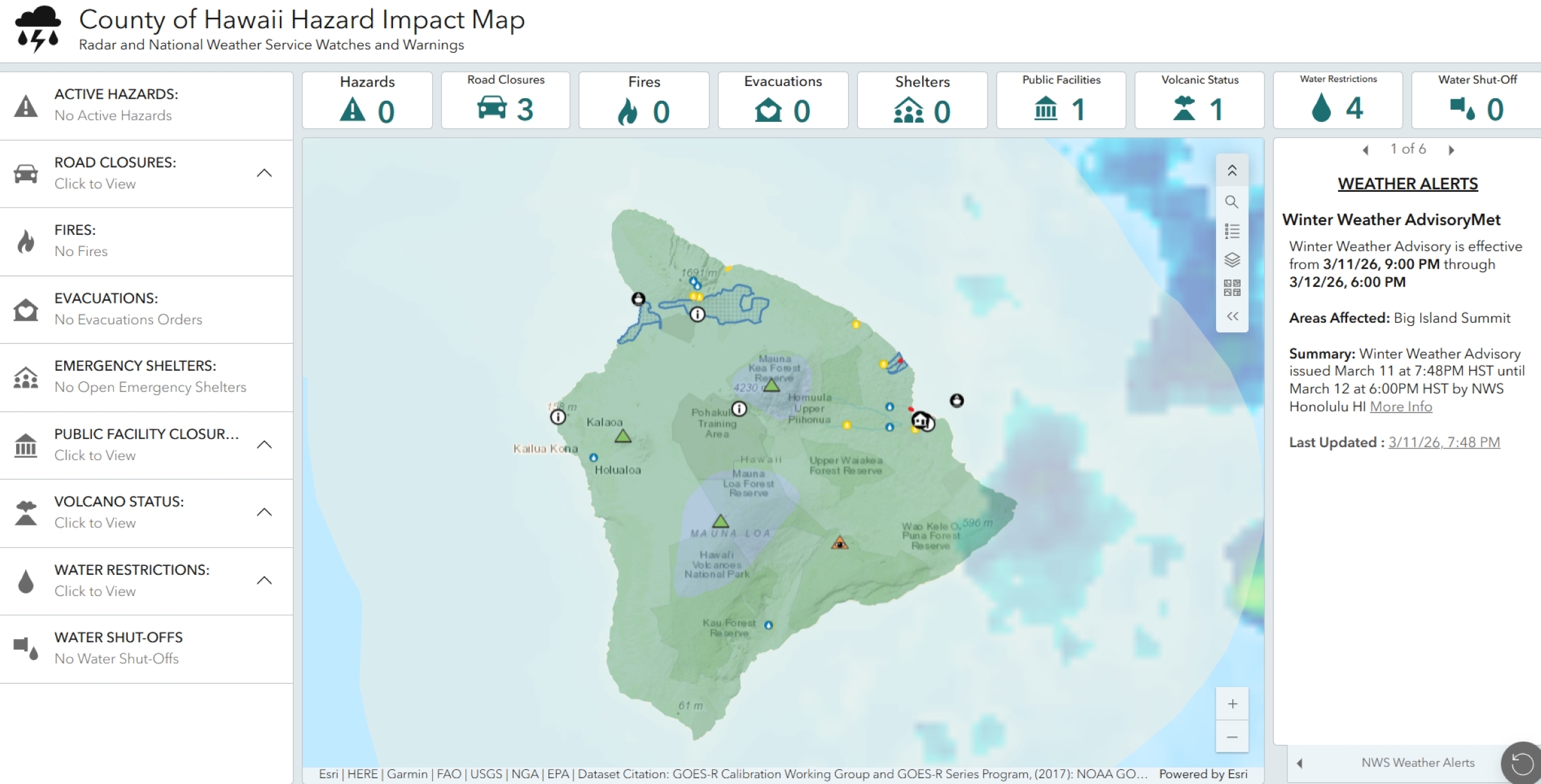
Find additional information about severe weather impacts on the Hawaiʻi County Hazard Impact Map.
Sponsored Content


