

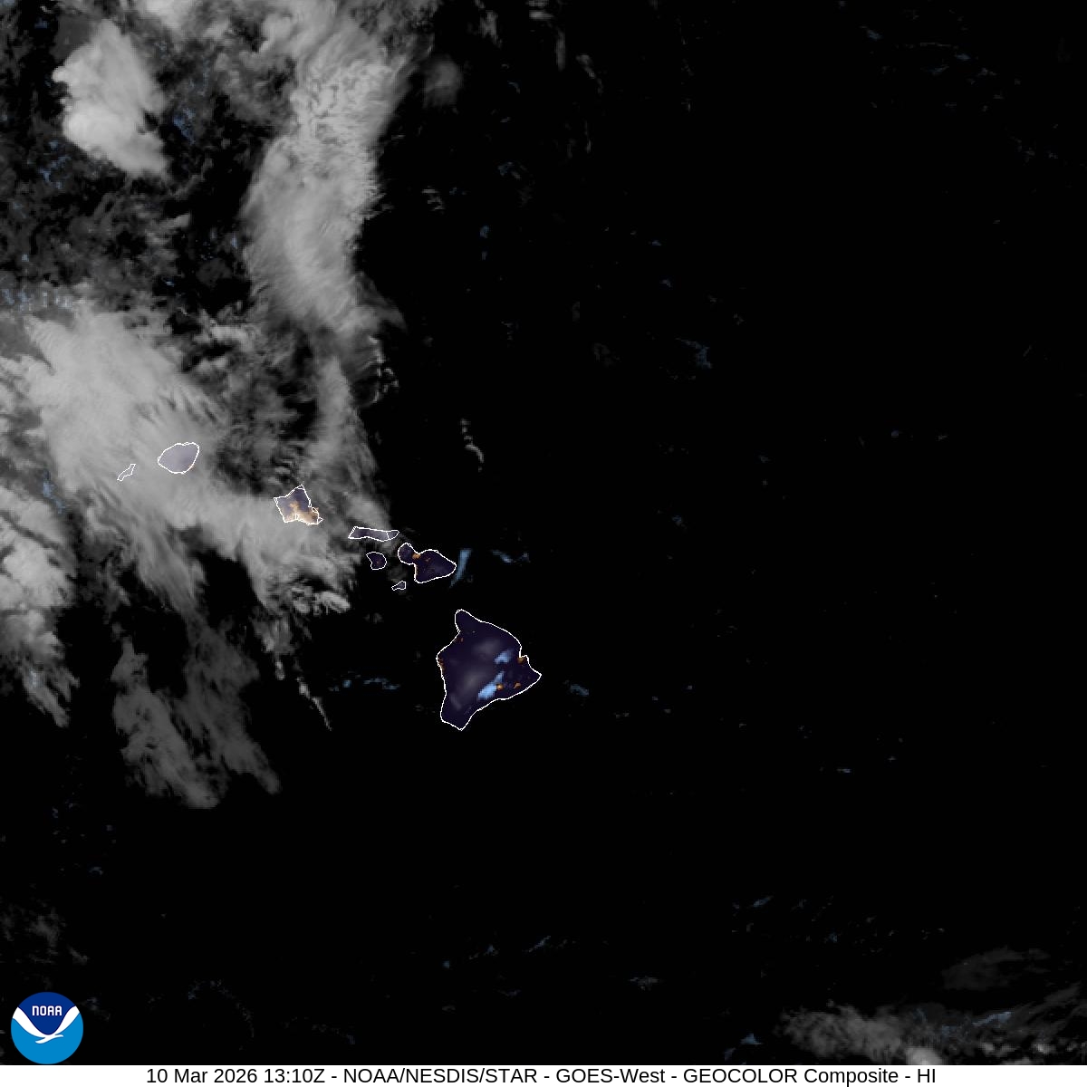
UPDATE: Flood watch extended for Big Island; special marine warning also issued for some island waters
Update at 8:54 a.m. Friday, March 13, 2026: National Weather Service forecasters in Honolulu extended through Sunday night a flood watch in effect for the Big Island as a powerful kona low continues to impact the state through the weekend and possibly into next week.
Flooding and flash flooding caused by excessive rainfall associated with the storm during the watch period.
Significant flooding could occur because of the overflow of streams and drainages. Roads in several areas might be closed, along with property damage in urban or low-lying areas because of runoff.
Landslides also could happen in locations with steep terrain.
Considerable flash flooding is possible beginning later today (March 13) as the large and powerful kona low northwest of the state draws deep tropical moisture northward across the islands.
Persistent bands of heavy rain and thunderstorms could produce intense rainfall rates, leading to rapid rises of stream waters and flooding of roads and low-lying areas.
The public is advised to monitor later forecasts and be prepared to take action should flash flood warnings be issued.
The National Weather Service in Honolulu also issued a special marine warning for southeast and windward waters of the Big Island until 10:45 a.m. today as gusty showers were seen on radar moving north.
Those showers were located by radar at 8:39 a.m. along a line extending from 6 nautical miles — or about 7 miles — southwest of South Point to near Isaac Hale Beach Park producing wind gusts of up to 40 knots — or about 46 mph — and moving north at 15 knots — or a little more than 17 mph.
Small crafts could be damaged in briefly higher winds and suddenly higher waves.
Locations impacted include Cape Kumukahi, FAD Buoy A, FAD Buoy HK, FAD Buoy E, FAD Buoy D, FAD Buoy G, FAD Buoy SS and Hilo Harbor.
Mariners and the public are advised to prepare for gusty winds, steep and fast-building seas and blinding downpours.
Remember: stay low or go below, and make sure all on board your vessel are wearing life jackets.
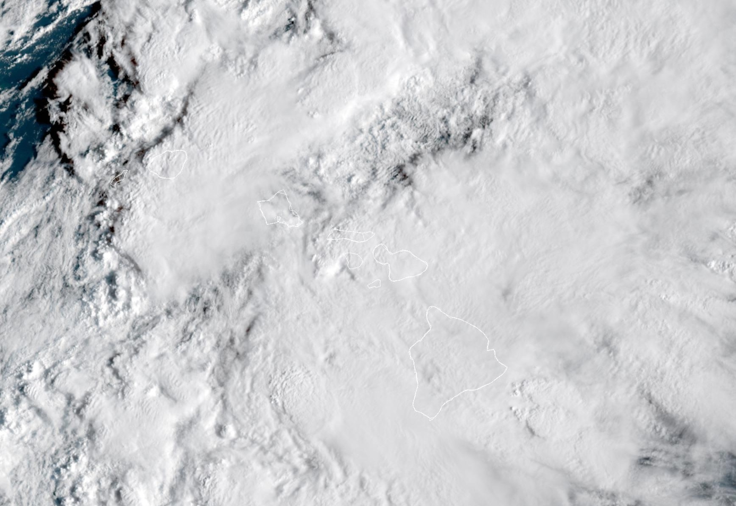
Story originally posted at 4 a.m. March 10, 2026: As a powerful kona storm begins to impact the western end of the state today, the National Weather Service issued a flood watch for the Big Island beginning Wednesday.
Kona lows refer to strong, low-pressure systems that bring stormy weather to Hawaiʻi and are responsible for most extreme weather during the winter months.
Due to the incoming weather, forecasters have issued a flood watch as well as a special weather statement for the Big Island from Wednesday evening until Saturday afternoon.
A flood watch means considerable flash flooding is possible beginning Wednesday as the storm develops northwest of the state and draws deep tropical moisture across the islands.
Persistent bands of heavy rain and thunderstorms may produce intense rainfall rates, leading to rapid rises in streams and flooding of roads and low-lying areas.
Significant flooding is expected from the overflow of streams and drainages, and roads in several areas may be closed, along with property damage in urban or low-lying spots due to runoff. Landslides may also occur in areas with steep terrain.
In addition to the heavy rainfall and severe thunderstorm threat, strong and potentially damaging kona winds are possible this week. The possibility of large hail cannot be ruled out, according to the National Weather Service.
Sponsored Content


