

Hone Sunday update #3: Hurricane weakens to tropical storm as it moves away from Hawaiian Islands
11 p.m. Sunday update: Hurricane Hone weakened to a tropical storm Sunday evening as its center passed about 175 south of Kaua‘i.
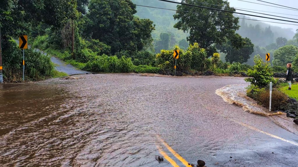
Hone is now well past the Big Island leaving trailing rain bands in its wake, according to the National Hurricane Center. The excessive rainfall brought flash flooding to Ka‘ū forcing the closure of several roads and closing two schools.
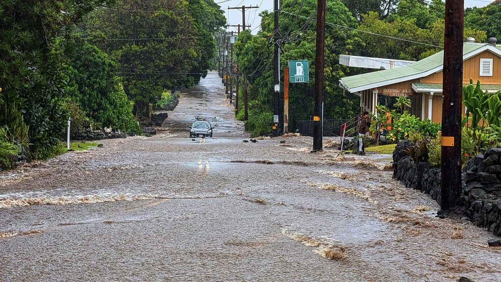
 Hurricane Hone resulted in flooding in Wai’ōhinu in Ka‘ū on Aug. 25, 2024. Portions of Highway 11 are closed. Photo credit: Bob Martin
- Hurricane Hone resulted in flooding in Wai’ōhinu in Ka‘ū on Aug. 25, 2024. Portions of Highway 11 are closed. Photo credit: Bob Martin
- Hurricane Hone resulted in flooding in Wai’ōhinu in Ka‘ū on Aug. 25, 2024. Portions of Highway 11 are closed. Photo credit: Bob Martin


The rain will continue to diminish overnight.
Hone was moving toward the west near 14 mph and this motion is expected to continue for the next few days. On the forecast track, Hone will continue moving away from the main Hawaiian Islands, and pass well north of Johnston Island Tuesday night into Wednesday.
As of 11 p.m., the storm was 180 miles southwest of Honolulu and about 185 south of Līhu‘e, Kaua‘i.
2:56 p.m. Sunday update: Hurricane Hone is gradually moving away from the Big Island, and tropical storm warnings have been discontinued.
Now about 130 miles southwest of Kona and 160 miles south-southeast of Honolulu, Hone is moving toward the west-northwest near 12 mph and this motion is expected to continue for the next few days. Hone will pass well south of the smaller Hawaiian islands through Monday morning, according to the National Hurricane Center.
Hone is expected to pass well north of Johnston Island around midweek.
Maximum sustained winds are near 80 mph with higher gusts. Some gradual weakening is forecast during the next couple of days, and Hone is expected to become a tropical storm by Monday.
Hurricane-force winds extend outward up to 15 miles from the center and tropical-storm-force winds extend outward up to 90 miles.
Hone will deliver persistent and locally widespread rainfall to portions of the Hawaiian islands through tonight. Swells generated by Hone will affect portions of the Hawaiian islands, producing life-threatening surf and rip current conditions today.
Approximately 10,000 Hawaiian Electric customers in Kohala, Volcano and Punalu‘u are without power. These outages were caused by impacts from the storm and were not related to the Public Safety Power Shutoff program.
The next storm update will be released at 5 p.m.
Original post: Hurricane Hone strengthens slightly as it continues to churn around the Big Island, according to a morning report from the National Hurricane Center.
As of 6:30 a.m., the hurricane was about 95 miles south of Kailua-Kona with maximum sustained winds of 85 mph.
According to the Hurricane Center’s 5 a.m. update, Hone was moving west near 8 mph and this motion is expected to continue through the middle of the week. Little change in strength is expected through the morning hours today before a gradual weakening trend begins this afternoon onward.
Hurricane-force winds extend outward up to 25 miles from the center and tropical-storm-force winds extend outward up to 115 miles.
Tropical Storm conditions will continue on the Big Island through the morning hours. Winds are expected to be strongest downslope of higher terrain, over headlands, and through passes.
Hone is expected to produce storm total rainfall of 6 to 12 inches over mainly windward and southeast facing slopes of the Big Island, with locally higher amounts possible. Rainfall totals of 2 to 4 inches will be possible over portions of the smaller islands, mainly windward.
Surf associated with large swells generated by Hone will continue today as Hone tracks westward. Expect dangerous conditions with life-threatening surf and rip currents.
The next update on Hurricane Hone will be released at 11 a.m.
Sponsored Content


