

UPDATE No. 4: Calvin now a post-tropical cyclone; Big Island no longer under tropical storm warning

Update at 11 a.m. July 19: According to the Central Pacific Hurricane Center at 11 a.m., Tropical Storm Calvin is no more and the tropical storm warning that was in effect for the Big Island has been canceled.
The storm is now a post-tropical cyclone. Its center is located about 255 miles west-southwest of Hilo and 240 miles south of Honolulu. The system is continuing to move west at about 20 mph.
Maximum sustained winds are near 40 mph, with higher gusts, and gradual weakening is expected until the system dissipates late Thursday. Gale-force winds still extend up to 105 miles out from the center.
Tropical storm conditions have ended in Hawaiʻi. Locally gusty winds will likely continue today before easing tonight.
As Calvin moves away from the state, additional rainfall totals of 1 to 3 inches are possible on the Big Island, with up to 2 inches possible on the other islands. Flooding continues in portions of the Big Island, where more than 6 inches of rain has already fallen over windward and southeast slopes.
The flood advisory that was in effect for eastern portions of the island was also canceled, as well as the flash flood warning for southeastern portions of the island and a high surf warning that was in effect for east-facing shores.
However, a high surf advisory for the east-facing shores of most islands is now in effect until 6 p.m. today. Surf heights from post-tropical cyclone Calvin swells have diminished, but the east-facing shores of the Big Island will likely still see surf of 7 to 10 feet for much of the day, causing strong breaking waves and strong currents that will make swimming dangerous.
Surf along all east-facing shores of the state is expected to fall below advisory thresholds by this evening.
The 11 a.m. advisory is the last the Central Pacific Hurricane Center will issue for Calvin. Additional information can be found in high seas forecasts issued by the National Weather Service forecast office in Honolulu and online.
 High winds from passing Tropical Storm Calvin down a large tree in Waimea, blocking Mana Road on July 19, 2023. (Photo courtesy: Talmadge Magno)
- Pāhala Transfer Station Road closed due to flooding from the passing Tropical Storm Calvin on July 19, 2023. (Photo courtesy: Talmadge Magno)
- Ocean View resident Savannha Lee Kalilinoeokamahina Loewe-llanes captured a rainbow on the water as Tropical Storm Calvin passed west-southwest of Hawai‘i Island on July 19, 2023. (Photo courtesy: Savannha Lee Kalilinoeokamahina Loewe-llanes)
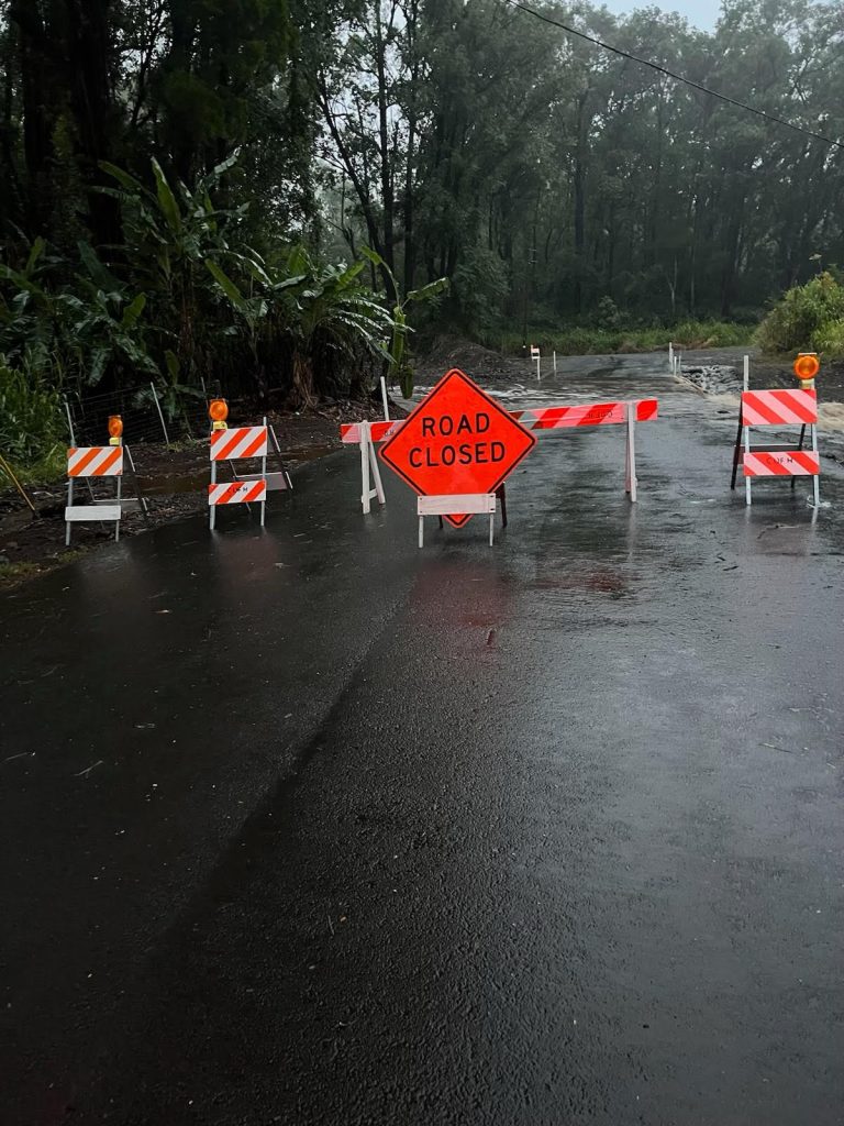
- Wood Valley Road in Ka‘ū closed due to flooding caused by the passing Tropical Storm Calvin on July 19, 2023. (Photo courtesy: Talmadge Magno)
- Ocean View resident Ricky Carstens captured a rainbow on the water as Tropical Storm Calvin passed west-southwest of Hawai‘i Island on July 19, 2023. (Photo courtesy: Ricky Carstens)
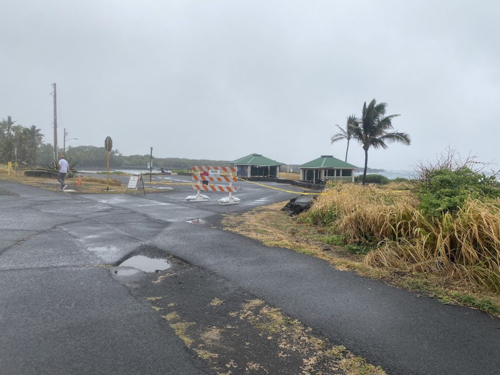
- Hawai‘i County closed all county parks, including Punalu‘u Beach Park in Ka‘ū, as a precaution as Tropical Storm Calvin passed southwest of Hawai‘i Island on July 19, 2023. (Megan Moseley/Big Island Now)
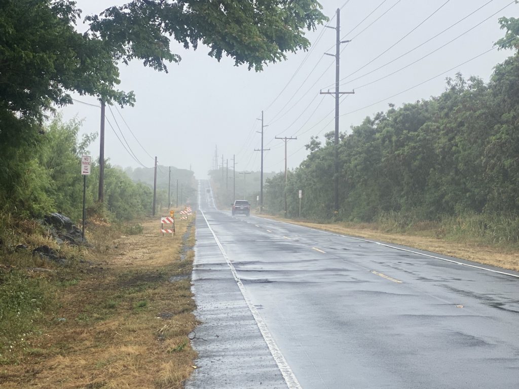
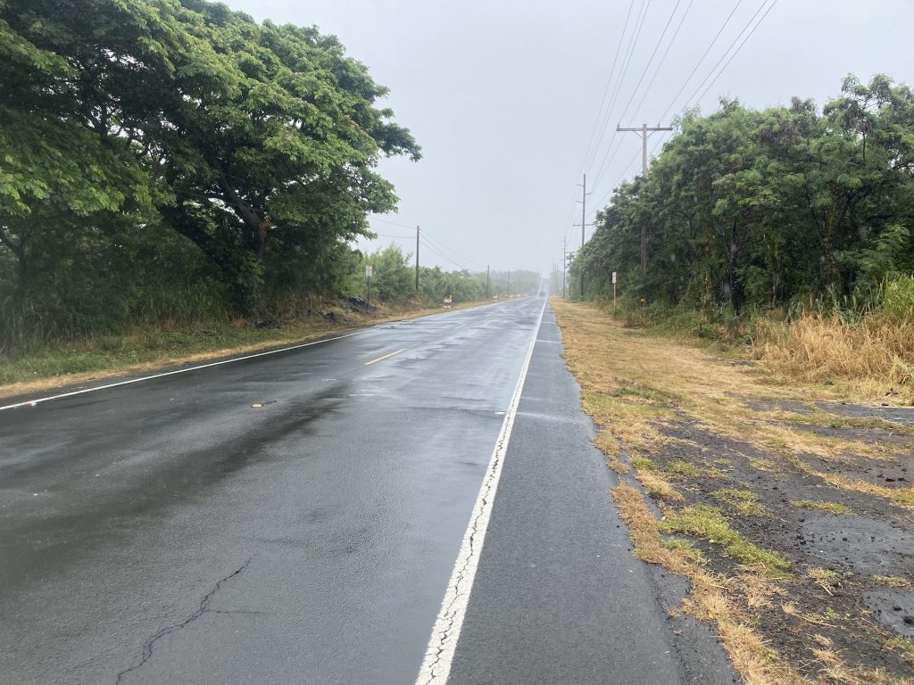
- Māmalahoa Highway between Nā‘ālehu and Pāhala was wet with rain on July 19, 2023, as Tropical Storm Calvin passed southwest of Hawai‘i Island. (Megan Moseley/Big Island Now)
- Māmalahoa Highway between Nā‘ālehu and Pāhala was wet with rain on July 19, 2023, as Tropical Storm Calvin passed southwest of Hawai‘i Island. (Megan Moseley/Big Island Now)
- Hawai‘i County closed all county parks, including Punalu‘u Beach Park in Ka‘ū, as a precaution as Tropical Storm Calvin passed southwest of Hawai‘i Island on July 19, 2023. (Megan Moseley/Big Island Now)


Hawai‘i Volcanoes National Park, including Kīlauea Visitor Center, park roads and most trails, reopened at 11 a.m. today as impacts wane from Calvin. Kulanaokuaiki Campground, backcountry areas and backcountry office also reopened.
Nāmakanipaio Campground, managed by the Volcano House, is expected to reopen at 3 p.m. The A-frame cabins remain open.
Ranger programs at the park continue to be suspended. Park staff are busy clearing trails, roads and other public facilities following the storm. Visitors should expect some areas could remain closed while being evaluated or cleared.
For a list of closures and other emergency information, click here.
Update at 9:15 a.m. July 19: The National Weather Service in Honolulu has extended the flash flood warning in effect for southeastern portions of the Big Island until 12:15 p.m.
At 9:05 a.m., rain gauges indicated that rainfall from Tropical Storm Calvin is occurring over the slopes of the Kaʻū District, but accumulations have been less than half an inch during the past hour. Hawaii County Civil Defense reports that Kaalaiki Road and Wood Valley Road near Pāhala remain closed.
Flooding in drainages, streams, rivers, roads, properties and other low-lying areas remains possible. Landslides also are possible in steep terrain.
Some locations that will experience flash flooding include Wood Valley, Pāhala, Punaluʻu Beach, Kawa Flats, Nāʻālehu, Hawaiʻi Volcanoes National Park, Waiʻōhinu, Hawaiʻi Volcanoes Park Kahuku Unit and Discovery Harbour.

Update at 8 a.m. July 19: Tropical Storm Calvin continues to move west and away from the Big Island this morning; however, the impacts from the storm are still being felt.
A tropical storm warning remains in effect for the entire island, meaning tropical storm conditions are imminent or occurring.
As Calvin moves away, additional rainfall totals of 2 to 4 inches are possible on the Big Island, with 1 to 3 inches possible on the other islands. Flooding impacts are occurring in areas of the Big Island, where more than 6 inches of rain has already fallen over windward and southeast slopes.
Seas and swells generated by Calvin will affect all of the main Hawaiian Islands today, generating life-threatening surf along exposed shorelines.
As of 8 a.m., the storm’s center was about 205 miles southwest of Hilo and 235 miles southwest of Honolulu, moving west at about 20 mph. The storm still has maximum sustained winds of near 45 mph, with tropical storm-force winds extending up to 125 miles out from the center.
Weakening is forecast through the next 48 hours, and Calvin is expected to soon become a post-tropical low pressure system.

A flash flood warning continues until 9:15 a.m. for areas in the southeastern portion of the Big Island. Some locations that will experience flash flooding include: Wood Valley, Pāhala, Punaluʻu Beach, Kawa Flats, Nāʻālehu, Hawaiʻi Volcanoes National Park, Waiʻōhinu, Hawaiʻi Volcanoes Park Kahuku Unit and Discovery Harbor.
A flood advisory for eastern portions of the island also was extended until 11:15 a.m.
At 8:01 a.m., rain gauges and the North Kohala radar indicated that rainfall continues over the windward slopes of the Big Island. Although rainfall rates have eased during the past couple of hours, water levels in the stream and river gauges along the windward slopes remain high but have been lowering.

Some locations that will continue to experience flooding include Hilo, Hawaiian Paradise Park, Waikōloa Village, Kapa’au, Honokaʻa, Pōhakuloa Camp, Pōhakuloa Training Area, Laupāhoehoe, Honomū, Nīnole, Pāpaʻikou, ʻŌʻōkala, Pepeʻekeo, Hakalau, Pa’auilo, Volcano, Glenwood, Mountain View and Keaʻau.
The Hawai‘i Department of Transportation reported that Old Māmalahoa Highway in Ō‘ōkala is closed because of a landslide. Click here for more information.
For information about closures and other emergency announcements because of Calvin, click here.
Some locations that will experience flooding include: Hilo, Hawaiian Paradise Park, Waikōloa Village, Kapaʻau, Honokaʻa, Pohakuloa Camp, Pohakuloa Training Area, Volcano, Glenwood, Mountain View, Hawaii Volcanoes National Park, Papaikou, Honomu, Pepeʻekeo, Keaʻau, Hawaiian Acres, Wood Valley, Laupahoehoe and Hakalau, according to the National Weather Service.
Update at 7:20 a.m. July 19: A Flash Flood Warning has been issued for southeast Big Island until 9:15 a.m.
At 6:23 a.m., radar indicated persistent rainfall along the slopes of the Kaʻū District. Hawaii County Civil Defense reported that Wood Valley Road has been closed due to flooding.
Flooding is also expected to close the Hawaii Belt Road in the Kawa Flats area near Punaluu, and Kaalaiki Road near Pahala. Rainfall will continue over the Kaʻū District through the morning, according to the National Weather Service.
Some locations that will experience flash flooding include: Wood Valley, Pāhala, Punaluʻu Beach, Kawa Flats, Nāʻālehu, Hawaiʻi Volcanoes National Park, Waiʻōhinu, Hawaiʻi Volcanoes Park Kahuku Unit and Discovery Harbor.
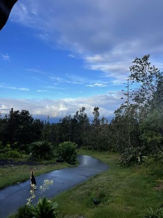
Original post: Tropical Storm Calvin passed south of the Big Island overnight, dousing the east side of Hawaiʻi County with heavy rainfall and wind but barely affecting the Kona area.
As of 5 a.m. Wednesday, the storm is now 170 miles southwest of Hilo and continuing to move west at 20 mph with sustained maximum winds of 45 mph and higher gusts. Calvin is forecast to weaken during the next 48 hours and become a post-tropical/remnant low, according to the National Weather Service.
A Flood Advisory is in effect until 8:15 a.m. for the east side of the Big Island.
Bands of heavy rainfall will continue to move ashore and impact portions of the Big Island through the early morning hours, especially for the southeast facing slopes of the Kaʻū district.
Rainfall totals overnight have reached the 4- to 6-inch range on the Big Island and an additional 2 to 4 inches remain possible as Calvin begins to move away. Similar conditions are expected across the smaller islands today as Calvin passes far to the south.
At 4:32 a.m. on Wednesday, radar indicated heavy rain over continuing over the east through southeast slopes of the Big Island. Heavy rain was falling at a rate of 1 to 2 inches per hour in
some areas as Tropical Storm Calvin passes south of the Big Island.
A Flood Watch for the entire Big Island remains in effect.

Precautions: Turn around, don’t drown when encountering flooded roads. Most flood
deaths occur in vehicles. Also stay away or be swept away. River banks and culverts can become unstable and unsafe.
Swells generated by Calvin will affect all of the main Hawaiian Islands through Wednesday, generating life-threatening surf and sea conditions along exposed shorelines.
High winds continue to affect parts of the Big Island. Take shelter when necessary.
![[Image of probabilities of 34-kt winds]](https://www.nhc.noaa.gov/storm_graphics/EP03/refresh/EP032023_wind_probs_34_F120+png/150006.png)
For information about closures on Wednesday around the Big Island, click here.
Sponsored Content


